Property Record
5780 Vaughn Rd, Montgomery, AL 36116
NEARBY LISTINGS FOR SALE OR LEASE
-
-
View all Montgomery listings for sale on LoopNet.com
Property Detail
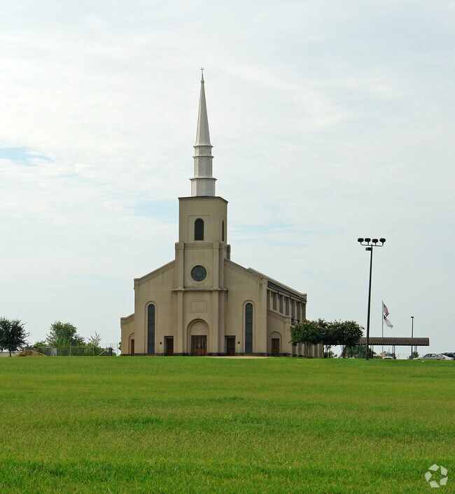
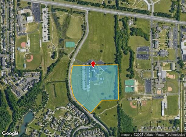
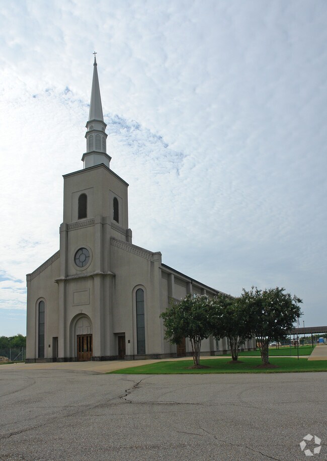
5780 Vaughn Rd
Montgomery, AL
Young Meadows Presbyterian Church 1
10-07-25-4-000-002.001
THAT PART OF LOT A LYING IN SE1/4 OF SEC 25 T16N R18E 1007254000002001
Theater
Montgomery
AE
Alabama
01101C0229H
a
0
19.30 AC
2025
North Montgomery
005605
Montgomery
35,857 SF
DEMOGRAPHICS near 5780 Vaughn Rd
1 Mile
3 Mile
5 Mile
2024 Total Population
7,612
58,828
130,384
2029 Population
7,311
56,772
126,105
Pop Growth 2024-2029
(3.95%)
(3.49%)
(3.28%)
Average Age
37
37
38
2024 Total Households
3,463
25,628
54,912
HH Growth 2024-2029
(4.07%)
(3.62%)
(3.37%)
Median Household Inc
$42,268
$51,891
$56,382
Avg Household Size
2.10
2.20
2.30
2024 Avg HH Vehicles
2.00
2.00
2.00
Median Home Value
$154,444
$169,732
$165,170
Median Year Built
1985
1986
1982
Nearby Places
Map Layers
Map Styles
 Street
 Aerial
- Restaurants
- Banks
- Shops
- Fitness
- Groceries
PUBLIC TRANSPORTATION
AIRPORT
Montgomery Regional (Dannelly Field)
DRIVE
WALK
Distance
Montgomery Regional (Dannelly Field)
30 min
16.0 mi
Nearby Properties
Address
Land Use
TOTAL SIZE
Lot Size
Zoning
Address
Land Use
TOTAL SIZE
Lot Size
Zoning
4,998 SF
27.50 AC
R-65-M
Address
Land Use
TOTAL SIZE
Lot Size
Zoning
16,400 SF
28.35 AC
R-65-M
Address
Land Use
TOTAL SIZE
Lot Size
Zoning
1,343 SF
31.75 AC
R-65-M
Address
Land Use
TOTAL SIZE
Lot Size
Zoning
4,597 SF
12.36 AC
PUD
Address
Land Use
TOTAL SIZE
Lot Size
Zoning
4,836 SF
16.25 AC
R-75-M
Address
Land Use
TOTAL SIZE
Lot Size
Zoning
15,932 SF
25.50 AC
R-60-M
Address
Land Use
TOTAL SIZE
Lot Size
Zoning
47,292 SF
63.99 AC
Address
Land Use
TOTAL SIZE
Lot Size
Zoning
38,646 SF
12.26 AC
PUD
Address
Land Use
TOTAL SIZE
Lot Size
Zoning
23,642 SF
13.70 AC
PUD
Address
Land Use
TOTAL SIZE
Lot Size
Zoning
1,554 SF
18.26 AC
R-75-M
Address
Land Use
TOTAL SIZE
Lot Size
Zoning
10,317 SF
16.70 AC
AGR-1
Address
Land Use
TOTAL SIZE
Lot Size
Zoning
2,885 SF
14 AC
R-75-M
Address
Land Use
TOTAL SIZE
Lot Size
Zoning
7,040 SF
11.70 AC
R-65-M
Address
Land Use
TOTAL SIZE
Lot Size
Zoning
24,360 SF
26.59 AC
R-65-M
Address
Land Use
TOTAL SIZE
Lot Size
Zoning
164,528 SF
5.28 AC
B-3
Address
Land Use
TOTAL SIZE
Lot Size
Zoning
30,536 SF
18.06 AC
AGR-1
Address
Land Use
TOTAL SIZE
Lot Size
Zoning
1,964 SF
13.40 AC
R-75-M
Address
Land Use
TOTAL SIZE
Lot Size
Zoning
32,902 SF
14 AC
R-75-M
Address
Land Use
TOTAL SIZE
Lot Size
Zoning
56,446 SF
18.67 AC
PUD
Address
Land Use
TOTAL SIZE
Lot Size
Zoning
5,606 SF
21 AC
R-75-M
Address
Land Use
TOTAL SIZE
Lot Size
Zoning
108,176 SF
4.27 AC
B-1-B
Address
Land Use
TOTAL SIZE
Lot Size
Zoning
154,375 SF
21.19 AC
B-3
Address
Land Use
TOTAL SIZE
Lot Size
Zoning
75,510 SF
10.97 AC
B-2
Address
Land Use
TOTAL SIZE
Lot Size
Zoning
2,679 SF
10.77 AC
R-75-M
Address
Land Use
TOTAL SIZE
Lot Size
Zoning
208,584 SF
21.10 AC
B-3
Address
Land Use
TOTAL SIZE
Lot Size
Zoning
84,764 SF
5.20 AC
B-2
Address
Land Use
TOTAL SIZE
Lot Size
Zoning
21,634 SF
6.64 AC
Address
Land Use
TOTAL SIZE
Lot Size
Zoning
65,394 SF
13 AC
B-2
Address
Land Use
TOTAL SIZE
Lot Size
Zoning
105,816 SF
4.34 AC
B-2
Address
Land Use
TOTAL SIZE
Lot Size
Zoning
3,312 SF
15.73 AC
R-65-M
The World's #1 Commercial Real Estate Marketplace
Connect with us
© 2026 CoStar Group
The information above has been obtained from sources believed reliable. While we do not doubt its accuracy we have not verified it and make no guarantee, warranty or representation about it. It is your responsibility to independently confirm its accuracy and completeness. Any projections, opinions, assumptions, or estimates used are for example only and do not represent the current or future performance of the property. The value of this transaction to you depends on tax and other factors which should be evaluated by your tax, financial, and legal advisors. You and your advisors should conduct a careful, independent investigation of the property to determine to your satisfaction the suitability of the property for your needs.