Property Record
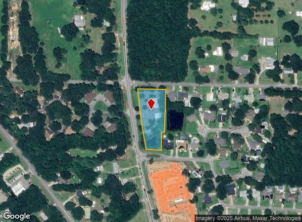
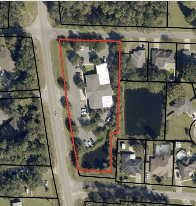
5784 Chumuckla Hwy, Milton, FL 32571
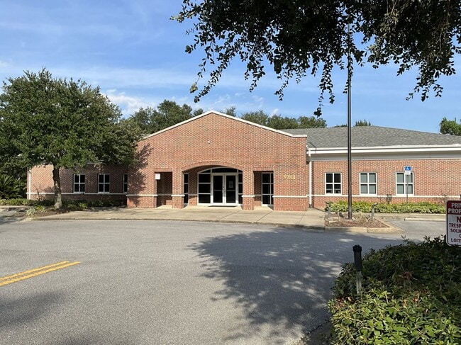
This Property Is For Sale
NEARBY LISTINGS FOR SALE OR LEASE
Property Detail
5784 Chumuckla Hwy
32-2N-29-0000-01425-0000
COM NW CORN THN S88*08 E ON N LN 284.94 FT THN S1*31W 27.01 FT TO S R/W OF GARDENVIEW RD FOR POB THN CONT 289.94 FT THN N88*28W 20 FT THN S1*31W 123 .97 FT THN N86*1232W 104.18 FT TO E R/W OF CHUMUCKLA HWY THN NW ON CURV 415.78 FT (R= 5679.63 ANG=4*1
Officebuilding
Santa Rosa
X
Florida
12113C0293H
1.42 AC
2023
Avalon Beach/Milton
2024
Pensacola
010303
Pensacola-Ferry Pass-Brent, FL
8,703 SF
DEMOGRAPHICS near 5784 Chumuckla Hwy
1 Mile
3 Mile
5 Mile
2024 Total Population
4,042
20,883
37,176
2029 Population
4,652
23,932
42,537
Pop Growth 2024-2029
+ 15.09%
+ 14.60%
+ 14.42%
Average Age
40
39
39
2024 Total Households
1,421
7,333
13,326
HH Growth 2024-2029
+ 15.27%
+ 14.85%
+ 14.70%
Median Household Inc
$93,515
$89,482
$83,784
Avg Household Size
2.90
2.90
2.80
2024 Avg HH Vehicles
2.00
2.00
2.00
Median Home Value
$317,683
$293,891
$274,992
Median Year Built
2004
2002
1999
Nearby Places
- Restaurants
- Banks
- Shops
- Fitness
- Groceries
PUBLIC TRANSPORTATION
AIRPORT
Pensacola International
DRIVE
WALK
Distance
Pensacola International
28 min
15.3 mi
Freight Ports
Port of Mobile
DRIVE
WALK
Distance
Port of Mobile
78 min
64.2 mi
Nearby Properties
Address
Land Use
TOTAL SIZE
Lot Size
Zoning
Address
Land Use
TOTAL SIZE
Lot Size
Zoning
164,185 SF
31.45 AC
AG-RR
Address
Land Use
TOTAL SIZE
Lot Size
Zoning
47.05 AC
AG-RR
Address
Land Use
TOTAL SIZE
Lot Size
Zoning
52,875 SF
5.24 AC
HCD
Address
Land Use
TOTAL SIZE
Lot Size
Zoning
51,329 SF
5.65 AC
HCD
Address
Land Use
TOTAL SIZE
Lot Size
Zoning
23.33 AC
AG-RR
Address
Land Use
TOTAL SIZE
Lot Size
Zoning
93,476 SF
7.43 AC
HCD
Address
Land Use
TOTAL SIZE
Lot Size
Zoning
94,231 SF
14.72 AC
HCD
Address
Land Use
TOTAL SIZE
Lot Size
Zoning
35,878 SF
10 AC
HCD
Address
Land Use
TOTAL SIZE
Lot Size
Zoning
45,825 SF
3.26 AC
HCD
Address
Land Use
TOTAL SIZE
Lot Size
Zoning
641.44 AC
AG-RR
Address
Land Use
TOTAL SIZE
Lot Size
Zoning
27,839 SF
4 AC
AG-RR
Address
Land Use
TOTAL SIZE
Lot Size
Zoning
14,765 SF
173.09 AC
R1
Address
Land Use
TOTAL SIZE
Lot Size
Zoning
34,880 SF
2.42 AC
HCD
Address
Land Use
TOTAL SIZE
Lot Size
Zoning
19,054 SF
25 AC
AG-RR
Address
Land Use
TOTAL SIZE
Lot Size
Zoning
25,700 SF
4.34 AC
HCD
Address
Land Use
TOTAL SIZE
Lot Size
Zoning
24,567 SF
2.82 AC
HCD
Address
Land Use
TOTAL SIZE
Lot Size
Zoning
2,324 SF
19.68 AC
HCD
Address
Land Use
TOTAL SIZE
Lot Size
Zoning
8,574 SF
1.64 AC
HCD
Address
Land Use
TOTAL SIZE
Lot Size
Zoning
15,943 SF
1.89 AC
HCD
Address
Land Use
TOTAL SIZE
Lot Size
Zoning
15,643 SF
1.58 AC
HCD
Address
Land Use
TOTAL SIZE
Lot Size
Zoning
22,876 SF
4.05 AC
AG-RR
Address
Land Use
TOTAL SIZE
Lot Size
Zoning
11,589 SF
36.81 AC
AG-RR
Address
Land Use
TOTAL SIZE
Lot Size
Zoning
10,997 SF
2 AC
NC
Address
Land Use
TOTAL SIZE
Lot Size
Zoning
16,983 SF
5 AC
HCD
Address
Land Use
TOTAL SIZE
Lot Size
Zoning
19,788 SF
2.92 AC
AG-RR
Address
Land Use
TOTAL SIZE
Lot Size
Zoning
9,270 SF
1.01 AC
HCD
Address
Land Use
TOTAL SIZE
Lot Size
Zoning
5,746 SF
1.61 AC
HCD
The World's #1 Commercial Real Estate Marketplace
Connect with us
© 2025 CoStar Group
The information above has been obtained from sources believed reliable. While we do not doubt its accuracy we have not verified it and make no guarantee, warranty or representation about it. It is your responsibility to independently confirm its accuracy and completeness. Any projections, opinions, assumptions, or estimates used are for example only and do not represent the current or future performance of the property. The value of this transaction to you depends on tax and other factors which should be evaluated by your tax, financial, and legal advisors. You and your advisors should conduct a careful, independent investigation of the property to determine to your satisfaction the suitability of the property for your needs.