Property Record
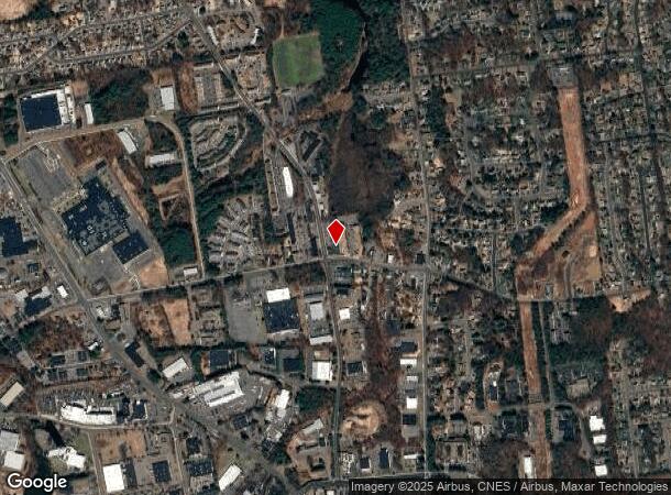
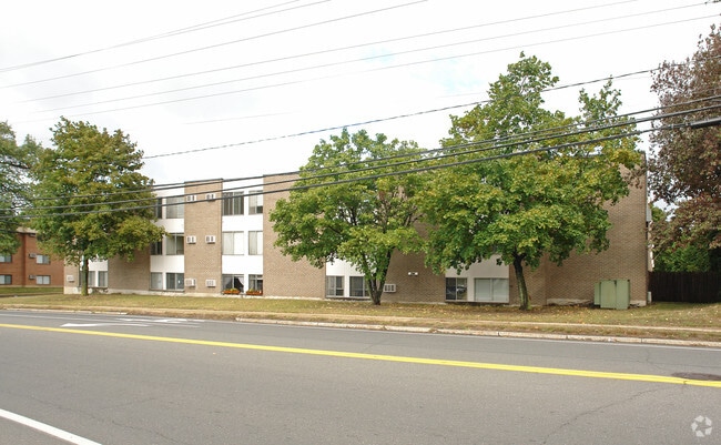
579 Emmett St, Bristol, CT 06010

NEARBY LISTINGS FOR SALE OR LEASE
Property Detail
579 Emmett St
BRIS-000003-000000-000012-096326
Hartford
Apartmenthouse5plusunits
Connecticut
X
12
09009C0045H
1.49 AC
2025
Bristol/Plainville
2025
Hartford
405402
Hartford-West Hartford-East Hartford, CT
44,328 SF
DEMOGRAPHICS near 579 Emmett St
1 mile
3 mile
5 mile
2024 Total Population
10,206
65,359
116,548
2029 Population
10,240
65,383
116,560
Pop Growth 2024-2029
+ 0.33%
+ 0.04%
+ 0.01%
Average Age
41
42
43
2024 Total Households
4,632
28,213
48,659
HH Growth 2024-2029
+ 0.37%
+ 0.01%
(0.01%)
Median Household Inc
$56,633
$69,509
$79,235
Avg Household Size
2.10
2.20
2.30
2024 Avg HH Vehicles
2.00
2.00
2.00
Median Home Value
$176,046
$223,824
$255,680
Median Year Built
1972
1965
1969
Nearby Places
Map Layers
Map Styles
 Street
 Aerial
Transit
 Traffic
 Biking
Places
Listings with unknown addresses are not visible on the map
- Restaurants
- Banks
- Shops
- Fitness
- Groceries
PUBLIC TRANSPORTATION
COMMUTER RAIL
Berlin (Hartford Line - CONN DOT)
Drive
Walk
Distance
Berlin (Hartford Line - CONN DOT)
16 min
9.6 mi
Berlin Amtrak (Amtrak Hartford Line - Amtrak, Hartford Line - Amtrak, Northeast Regional - Amtrak, Valley Flyer - Amtrak)
Drive
Walk
Distance
Berlin Amtrak (Amtrak Hartford Line - Amtrak, Hartford Line - Amtrak, Northeast Regional - Amtrak, Valley Flyer - Amtrak)
16 min
9.6 mi
AIRPORT
Bradley International
Drive
Walk
Distance
Bradley International
55 min
30.4 mi
Tweed/New Haven
Drive
Walk
Distance
Tweed/New Haven
46 min
30.8 mi
Freight Ports
Port of New Haven
Drive
Walk
Distance
Port of New Haven
42 min
28.5 mi
Nearby Properties
Address
Land Use
TOTAL SIZE
Lot Size
Zoning
Address
Land Use
TOTAL SIZE
Lot Size
Zoning
77,001 SF
54.59 AC
IP-1
Address
Land Use
TOTAL SIZE
Lot Size
Zoning
349,054 SF
12.03 AC
R-15
Address
Land Use
TOTAL SIZE
Lot Size
Zoning
100,304 SF
28.80 AC
IP-1
Address
Land Use
TOTAL SIZE
Lot Size
Zoning
58,473 SF
18.20 AC
IP-1
Address
Land Use
TOTAL SIZE
Lot Size
Zoning
145,719 SF
17.90 AC
R-15
Address
Land Use
TOTAL SIZE
Lot Size
Zoning
114,375 SF
12.72 AC
IP-1
Address
Land Use
TOTAL SIZE
Lot Size
Zoning
330,400 SF
36.90 AC
IP-1
Address
Land Use
TOTAL SIZE
Lot Size
Zoning
28.47 AC
R-10
Address
Land Use
TOTAL SIZE
Lot Size
Zoning
12,892 SF
20.91 AC
A
Address
Land Use
TOTAL SIZE
Lot Size
Zoning
56,184 SF
19.42 AC
BG
Address
Land Use
TOTAL SIZE
Lot Size
Zoning
171,826 SF
36.60 AC
R-15
Address
Land Use
TOTAL SIZE
Lot Size
Zoning
199,744 SF
44.70 AC
R-15
Address
Land Use
TOTAL SIZE
Lot Size
Zoning
62,232 SF
0.90 AC
BD-1
Address
Land Use
TOTAL SIZE
Lot Size
Zoning
54,904 SF
7.01 AC
A
Address
Land Use
TOTAL SIZE
Lot Size
Zoning
502,440 SF
27.87 AC
I-2
Address
Land Use
TOTAL SIZE
Lot Size
Zoning
4,000 SF
13.78 AC
BG
Address
Land Use
TOTAL SIZE
Lot Size
Zoning
17.62 AC
B
Address
Land Use
TOTAL SIZE
Lot Size
Zoning
1,700 SF
38.81 AC
A
Address
Land Use
TOTAL SIZE
Lot Size
Zoning
120,801 SF
8.35 AC
R-40
Address
Land Use
TOTAL SIZE
Lot Size
Zoning
29.05 AC
R-20
Address
Land Use
TOTAL SIZE
Lot Size
Zoning
149,912 SF
13.66 AC
B
Address
Land Use
TOTAL SIZE
Lot Size
Zoning
143,315 SF
4.50 AC
A
Address
Land Use
TOTAL SIZE
Lot Size
Zoning
3,084 SF
14.90 AC
BG
Address
Land Use
TOTAL SIZE
Lot Size
Zoning
133,720 SF
7.34 AC
IP-1
Address
Land Use
TOTAL SIZE
Lot Size
Zoning
19 AC
GI
Address
Land Use
TOTAL SIZE
Lot Size
Zoning
42,516 SF
10.40 AC
BG
Address
Land Use
TOTAL SIZE
Lot Size
Zoning
41,011 SF
8.50 AC
BG
Address
Land Use
TOTAL SIZE
Lot Size
Zoning
118,573 SF
9.75 AC
BG
Address
Land Use
TOTAL SIZE
Lot Size
Zoning
51,851 SF
1.32 AC
BD-1
Address
Land Use
TOTAL SIZE
Lot Size
Zoning
147,132 SF
12.50 AC
BG
The World's #1 Commercial Real Estate Marketplace
Connect with us
© 2026 CoStar Group
The information above has been obtained from sources believed reliable. While we do not doubt its accuracy we have not verified it and make no guarantee, warranty or representation about it. It is your responsibility to independently confirm its accuracy and completeness. Any projections, opinions, assumptions, or estimates used are for example only and do not represent the current or future performance of the property. The value of this transaction to you depends on tax and other factors which should be evaluated by your tax, financial, and legal advisors. You and your advisors should conduct a careful, independent investigation of the property to determine to your satisfaction the suitability of the property for your needs.