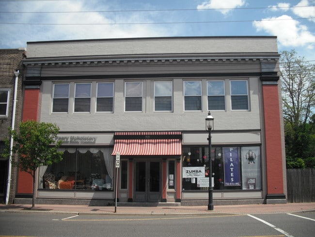
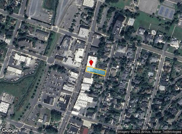
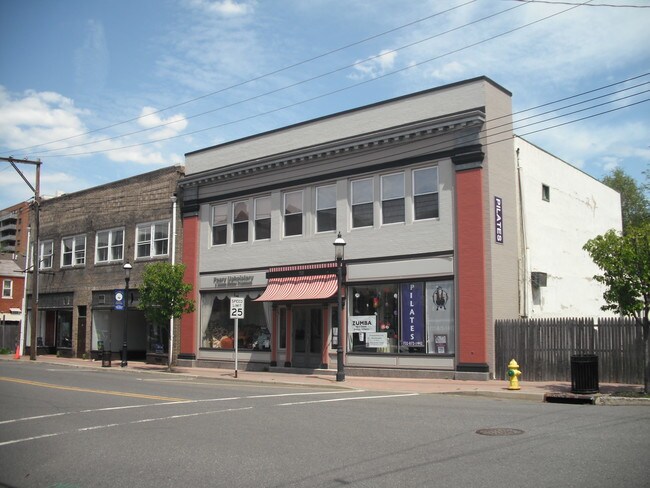
Property Record
58 1St Ave, Atlantic Highlands, NJ 07716

NEARBY LISTINGS FOR SALE OR LEASE
Property Detail
58 1St Ave
05-00097-0000-00015
NO MTG AMOUNT ON DOC
Commercialnec
Monmouth
X
New Jersey
34025C0066F
15
2024
0.22 AC
2025
Eastern Monmouth
800200
Northern New Jersey
6,202 SF
New York-Jersey City-White Plains, NY-NJ
DEMOGRAPHICS near 58 1St Ave
1 Mile
3 Mile
5 Mile
2024 Total Population
6,382
24,283
79,772
2029 Population
6,339
24,273
79,388
Pop Growth 2024-2029
(0.67%)
(0.04%)
(0.48%)
Average Age
44
44
42
2024 Total Households
2,652
10,044
30,783
HH Growth 2024-2029
(0.87%)
+ 0.06%
(0.49%)
Median Household Inc
$119,340
$118,853
$126,060
Avg Household Size
2.40
2.40
2.50
2024 Avg HH Vehicles
2.00
2.00
2.00
Median Home Value
$573,021
$468,356
$512,004
Median Year Built
1963
1963
1963
Nearby Places
Map Layers
Map Styles
 Street
 Aerial
- Restaurants
- Banks
- Shops
- Fitness
- Groceries
PUBLIC TRANSPORTATION
COMMUTER RAIL
DRIVE
WALK
Distance
12 min
6.1 mi
Red Bank (North Jersey Coast Line - NJ Transit Commuter Rail (NJ Transit))
DRIVE
WALK
Distance
Red Bank (North Jersey Coast Line - NJ Transit Commuter Rail (NJ Transit))
14 min
7.3 mi
AIRPORT
Newark Liberty International
DRIVE
WALK
Distance
Newark Liberty International
52 min
36.9 mi
Freight Ports
New York Container Terminal
DRIVE
WALK
Distance
New York Container Terminal
45 min
32.2 mi
Nearby Properties
Address
Land Use
TOTAL SIZE
Lot Size
Zoning
Address
Land Use
TOTAL SIZE
Lot Size
Zoning
596.51 AC
FL
Address
Land Use
TOTAL SIZE
Lot Size
Zoning
35.84 AC
R-22
Address
Land Use
TOTAL SIZE
Lot Size
Zoning
77,396 SF
11.47 AC
R-22
Address
Land Use
TOTAL SIZE
Lot Size
Zoning
1,800 SF
504.53 AC
R220
Address
Land Use
TOTAL SIZE
Lot Size
Zoning
3,864 SF
260 AC
M-1
Address
Land Use
TOTAL SIZE
Lot Size
Zoning
96.54 AC
FL
Address
Land Use
TOTAL SIZE
Lot Size
Zoning
163,312 SF
16.21 AC
PRH
Address
Land Use
TOTAL SIZE
Lot Size
Zoning
50,339 SF
10.50 AC
B-3
Address
Land Use
TOTAL SIZE
Lot Size
Zoning
162.89 AC
R220
Address
Land Use
TOTAL SIZE
Lot Size
Zoning
1.77 AC
MF-2
Address
Land Use
TOTAL SIZE
Lot Size
Zoning
23,090 SF
11.21 AC
MR
Address
Land Use
TOTAL SIZE
Lot Size
Zoning
74,620 SF
0.87 AC
MF
Address
Land Use
TOTAL SIZE
Lot Size
Zoning
17,200 SF
8.37 AC
SF80
Address
Land Use
TOTAL SIZE
Lot Size
Zoning
2,161 SF
95.96 AC
R220
Address
Land Use
TOTAL SIZE
Lot Size
Zoning
6,168 SF
13.09 AC
Address
Land Use
TOTAL SIZE
Lot Size
Zoning
21,208 SF
1.14 AC
R110
Address
Land Use
TOTAL SIZE
Lot Size
Zoning
1,980 SF
10.20 AC
MR
Address
Land Use
TOTAL SIZE
Lot Size
Zoning
48,256 SF
87 SF
R-1
Address
Land Use
TOTAL SIZE
Lot Size
Zoning
44,755 SF
0.01 AC
B-3
Address
Land Use
TOTAL SIZE
Lot Size
Zoning
33,784 SF
6.55 AC
R203
Address
Land Use
TOTAL SIZE
Lot Size
Zoning
25,043 SF
54.66 AC
R-22
Address
Land Use
TOTAL SIZE
Lot Size
Zoning
5.32 AC
RTH9
Address
Land Use
TOTAL SIZE
Lot Size
Zoning
10,164 SF
1.47 AC
R-1
Address
Land Use
TOTAL SIZE
Lot Size
Zoning
42,744 SF
17.24 AC
R-10
Address
Land Use
TOTAL SIZE
Lot Size
Zoning
43,588 SF
2.82 AC
HB
Address
Land Use
TOTAL SIZE
Lot Size
Zoning
7.48 AC
WC-2
Address
Land Use
TOTAL SIZE
Lot Size
Zoning
228 SF
3.55 AC
POS
Address
Land Use
TOTAL SIZE
Lot Size
Zoning
1,905 SF
59.88 AC
R220
Address
Land Use
TOTAL SIZE
Lot Size
Zoning
44,039 SF
5.78 AC
SF10
Address
Land Use
TOTAL SIZE
Lot Size
Zoning
4,980 SF
3.67 AC
R-1
The World's #1 Commercial Real Estate Marketplace
Connect with us
© 2025 CoStar Group
The information above has been obtained from sources believed reliable. While we do not doubt its accuracy we have not verified it and make no guarantee, warranty or representation about it. It is your responsibility to independently confirm its accuracy and completeness. Any projections, opinions, assumptions, or estimates used are for example only and do not represent the current or future performance of the property. The value of this transaction to you depends on tax and other factors which should be evaluated by your tax, financial, and legal advisors. You and your advisors should conduct a careful, independent investigation of the property to determine to your satisfaction the suitability of the property for your needs.