Property Record
58 Delaware Rd, Blairstown, NJ 07825

NEARBY LISTINGS FOR SALE OR LEASE
-
-
View all Blairstown listings for sale on LoopNet.com
Property Detail
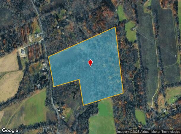
58 Delaware Rd
Allentown-Bethlehem-Easton, PA-NJ
FACILITY NAME: VACANT LAND
13-00047-0000-00019
Warren
Governmentalpublicusegeneral
New Jersey
X
19
34041C0116E
32.90 AC
0
Warren County
2025
Northern New Jersey
031101
DEMOGRAPHICS near 58 Delaware Rd
1 Mile
3 Mile
5 Mile
2024 Total Population
145
3,896
10,130
2029 Population
144
3,880
10,099
Pop Growth 2024-2029
(0.69%)
(0.41%)
(0.31%)
Average Age
47
46
46
2024 Total Households
58
1,536
4,043
HH Growth 2024-2029
0.00%
(0.39%)
(0.30%)
Median Household Inc
$89,285
$89,781
$89,999
Avg Household Size
2.50
2.50
2.50
2024 Avg HH Vehicles
3.00
2.00
2.00
Median Home Value
$379,999
$298,761
$321,428
Median Year Built
1977
1974
1974
Nearby Places
Map Layers
Map Styles
 Street
 Aerial
- Restaurants
- Banks
- Shops
- Fitness
- Groceries
PUBLIC TRANSPORTATION
AIRPORT
Lehigh Valley International
DRIVE
WALK
Distance
Lehigh Valley International
56 min
32.9 mi
Freight Ports
Maher Terminal
DRIVE
WALK
Distance
Maher Terminal
82 min
64.2 mi
Nearby Properties
Address
Land Use
TOTAL SIZE
Lot Size
Zoning
Address
Land Use
TOTAL SIZE
Lot Size
Zoning
265,682 SF
46.27 AC
I2
Address
Land Use
TOTAL SIZE
Lot Size
Zoning
164,000 SF
35.88 AC
I2
Address
Land Use
TOTAL SIZE
Lot Size
Zoning
13,250 SF
11.41 AC
R2
Address
Land Use
TOTAL SIZE
Lot Size
Zoning
1,092 SF
20.83 AC
C
Address
Land Use
TOTAL SIZE
Lot Size
Zoning
153,705 SF
15.49 AC
IND
Address
Land Use
TOTAL SIZE
Lot Size
Zoning
2.70 AC
C
Address
Land Use
TOTAL SIZE
Lot Size
Zoning
463.70 AC
I2
Address
Land Use
TOTAL SIZE
Lot Size
Zoning
2,765 SF
6.20 AC
Address
Land Use
TOTAL SIZE
Lot Size
Zoning
118,224 SF
11.58 AC
IND
Address
Land Use
TOTAL SIZE
Lot Size
Zoning
64.40 AC
A-1
Address
Land Use
TOTAL SIZE
Lot Size
Zoning
218.16 AC
FPD
Address
Land Use
TOTAL SIZE
Lot Size
Zoning
5,000 SF
80.32 AC
FPD
Address
Land Use
TOTAL SIZE
Lot Size
Zoning
Address
Land Use
TOTAL SIZE
Lot Size
Zoning
2,803 SF
30.24 AC
C
Address
Land Use
TOTAL SIZE
Lot Size
Zoning
229.07 AC
I2
Address
Land Use
TOTAL SIZE
Lot Size
Zoning
64,184 SF
151.90 AC
I2
Address
Land Use
TOTAL SIZE
Lot Size
Zoning
194.09 AC
FPD
Address
Land Use
TOTAL SIZE
Lot Size
Zoning
6,795 SF
6.16 AC
LDAR
Address
Land Use
TOTAL SIZE
Lot Size
Zoning
Address
Land Use
TOTAL SIZE
Lot Size
Zoning
14,580 SF
27.75 AC
I2
Address
Land Use
TOTAL SIZE
Lot Size
Zoning
2.40 AC
C
Address
Land Use
TOTAL SIZE
Lot Size
Zoning
6,078 SF
38.46 AC
C
Address
Land Use
TOTAL SIZE
Lot Size
Zoning
57.28 AC
A-1
Address
Land Use
TOTAL SIZE
Lot Size
Zoning
1,880 SF
8.43 AC
C
Address
Land Use
TOTAL SIZE
Lot Size
Zoning
Address
Land Use
TOTAL SIZE
Lot Size
Zoning
2,790 SF
34.20 AC
GFP
Address
Land Use
TOTAL SIZE
Lot Size
Zoning
5,664 SF
1 AC
LDAR
Address
Land Use
TOTAL SIZE
Lot Size
Zoning
129.02 AC
FPD
Address
Land Use
TOTAL SIZE
Lot Size
Zoning
11.89 AC
AR1
Address
Land Use
TOTAL SIZE
Lot Size
Zoning
The World's #1 Commercial Real Estate Marketplace
Connect with us
© 2025 CoStar Group
The information above has been obtained from sources believed reliable. While we do not doubt its accuracy we have not verified it and make no guarantee, warranty or representation about it. It is your responsibility to independently confirm its accuracy and completeness. Any projections, opinions, assumptions, or estimates used are for example only and do not represent the current or future performance of the property. The value of this transaction to you depends on tax and other factors which should be evaluated by your tax, financial, and legal advisors. You and your advisors should conduct a careful, independent investigation of the property to determine to your satisfaction the suitability of the property for your needs.