Property Record
58 N Main St, Assonet, MA 02702


Save to a Folder
{{folder.Name}}
{{folder.ListingIds.length}} Properties
{{folder.ListingIds.length}} Property
Create a New Folder
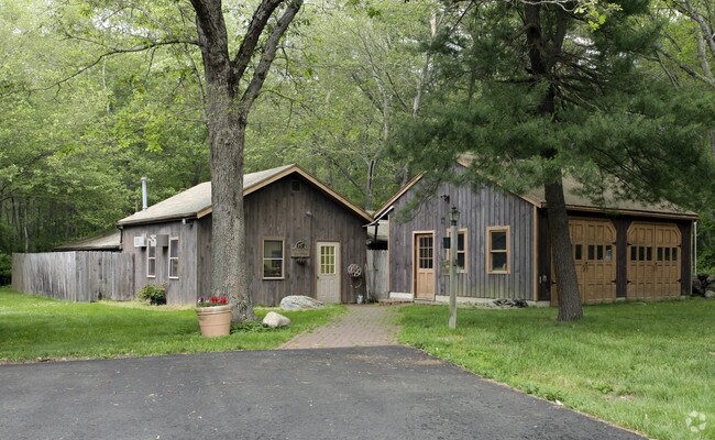
Property Detail
58 N Main St
Commercialofficeresidentialmixeduse
Bristol
G
Massachusetts
B and X Area of moderate flood hazard, usually the area between the limits of the 100-year and 500-year floods.
3.24 AC
0
Attleboro/New Bedford
2025
Boston
617101
Providence-Warwick, RI-MA
2,958 SF
FREE-000206-000000-000026
NEARBY LISTINGS FOR SALE OR LEASE
-
-
View all Assonet listings for sale on LoopNet.com
DEMOGRAPHICS near 58 N Main St
1 mile
3 mile
5 mile
2025 Total Population
1,567
9,150
35,108
2030 Population
1,579
9,283
35,747
Pop Growth 2025-2030
+ 0.77%
+ 1.45%
+ 1.82%
Average Age
42
42
42
2025 Total Households
561
3,205
12,999
HH Growth 2025-2030
+ 0.71%
+ 1.53%
+ 1.95%
Median Household Inc
$143,972
$139,033
$112,697
Avg Household Size
2.70
2.80
2.70
2025 Avg HH Vehicles
2.00
2.00
2.00
Median Home Value
$555,350
$558,795
$489,963
Median Year Built
1978
1981
1979
Nearby Places
Map Layers
Map Styles
 Street
 Aerial
Layers
 Traffic
 Biking
Places
Listings with unknown addresses are not visible on the map
- Restaurants
- Banks
- Shops
- Fitness
- Groceries
PUBLIC TRANSPORTATION
AIRPORT
Rhode Island Tf Green International
Drive
Walk
Distance
Rhode Island Tf Green International
47 min
30.3 mi
Freight Ports
Port of New Bedford Harbor
Drive
Walk
Distance
Port of New Bedford Harbor
28 min
21.8 mi
Nearby Properties
Address
Land Use
TOTAL SIZE
Lot Size
Zoning
Address
Land Use
TOTAL SIZE
Lot Size
Zoning
174.51 AC
I
Address
Land Use
TOTAL SIZE
Lot Size
Zoning
387.83 AC
I
Address
Land Use
TOTAL SIZE
Lot Size
Zoning
65.74 AC
B
Address
Land Use
TOTAL SIZE
Lot Size
Zoning
108,692 SF
10.80 AC
R1
Address
Land Use
TOTAL SIZE
Lot Size
Zoning
39,944 SF
47.07 AC
I2
Address
Land Use
TOTAL SIZE
Lot Size
Zoning
34.88 AC
G
Address
Land Use
TOTAL SIZE
Lot Size
Zoning
2,295.68 AC
OSR
Address
Land Use
TOTAL SIZE
Lot Size
Zoning
65,800 SF
24.31 AC
I2
Address
Land Use
TOTAL SIZE
Lot Size
Zoning
649 AC
OSR
Address
Land Use
TOTAL SIZE
Lot Size
Zoning
7,867 SF
27 AC
R1
Address
Land Use
TOTAL SIZE
Lot Size
Zoning
3.99 AC
G
Address
Land Use
TOTAL SIZE
Lot Size
Zoning
2.50 AC
B
Address
Land Use
TOTAL SIZE
Lot Size
Zoning
90 AC
G
Address
Land Use
TOTAL SIZE
Lot Size
Zoning
5.70 AC
R
Address
Land Use
TOTAL SIZE
Lot Size
Zoning
74.50 AC
R1
Address
Land Use
TOTAL SIZE
Lot Size
Zoning
6,553 SF
4.46 AC
G
Address
Land Use
TOTAL SIZE
Lot Size
Zoning
39 AC
G
Address
Land Use
TOTAL SIZE
Lot Size
Zoning
4.96 AC
I
Address
Land Use
TOTAL SIZE
Lot Size
Zoning
2,520 SF
3.13 AC
B
Address
Land Use
TOTAL SIZE
Lot Size
Zoning
4,000 SF
26 AC
OSR
Address
Land Use
TOTAL SIZE
Lot Size
Zoning
57,900 SF
10.20 AC
I
Address
Land Use
TOTAL SIZE
Lot Size
Zoning
134.03 AC
G
Address
Land Use
TOTAL SIZE
Lot Size
Zoning
16,851 SF
2.59 AC
B
Address
Land Use
TOTAL SIZE
Lot Size
Zoning
4.26 AC
G
Address
Land Use
TOTAL SIZE
Lot Size
Zoning
9,022 SF
16.75 AC
G
Address
Land Use
TOTAL SIZE
Lot Size
Zoning
4.93 AC
I
Address
Land Use
TOTAL SIZE
Lot Size
Zoning
11.40 AC
G
Address
Land Use
TOTAL SIZE
Lot Size
Zoning
4.18 AC
I
Address
Land Use
TOTAL SIZE
Lot Size
Zoning
24,000 SF
7.62 AC
I
Address
Land Use
TOTAL SIZE
Lot Size
Zoning
8,729 SF
1.10 AC
R
The World's #1 Commercial Real Estate Marketplace
Connect with us
© 2026 CoStar Group
The information above has been obtained from sources believed reliable. While we do not doubt its accuracy we have not verified it and make no guarantee, warranty or representation about it. It is your responsibility to independently confirm its accuracy and completeness. Any projections, opinions, assumptions, or estimates used are for example only and do not represent the current or future performance of the property. The value of this transaction to you depends on tax and other factors which should be evaluated by your tax, financial, and legal advisors. You and your advisors should conduct a careful, independent investigation of the property to determine to your satisfaction the suitability of the property for your needs.