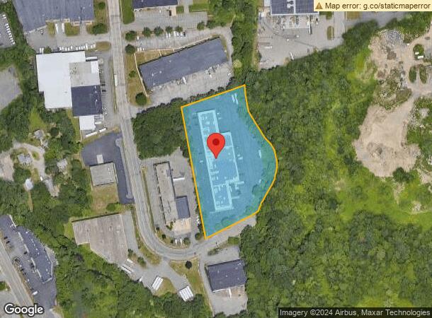
Property Record
58 Norfolk Ave, South Easton, MA 02375


Current Lease Availabilities
NEARBY LISTINGS FOR SALE OR LEASE
Property Detail
58 Norfolk Ave
Warehouse
Bristol
AE
Massachusetts
25023C0162J
3.70 AC
2025
Attleboro/New Bedford
2025
Boston
600202
Providence-Warwick, RI-MA
38,328 SF
EAST-000037U-000085
DEMOGRAPHICS near 58 Norfolk Ave
1 Mile
3 Mile
5 Mile
2024 Total Population
2,953
35,862
120,414
2029 Population
2,942
35,614
119,079
Pop Growth 2024-2029
(0.37%)
(0.69%)
(1.11%)
Average Age
42
41
39
2024 Total Households
1,192
12,223
41,440
HH Growth 2024-2029
(0.42%)
(0.61%)
(1.12%)
Median Household Inc
$100,229
$111,344
$83,041
Avg Household Size
2.40
2.70
2.70
2024 Avg HH Vehicles
2.00
2.00
2.00
Median Home Value
$450,704
$452,978
$430,108
Median Year Built
1968
1968
1964
Nearby Places
Map Layers
Map Styles
 Street
 Aerial
- Restaurants
- Banks
- Shops
- Fitness
- Groceries
PUBLIC TRANSPORTATION
COMMUTER RAIL
Brockton (Middleborough/Lakeville Line - Massachusetts Bay Transportation Authority Commuter Rail (Purple Line))
DRIVE
WALK
Distance
Brockton (Middleborough/Lakeville Line - Massachusetts Bay Transportation Authority Commuter Rail (Purple Line))
12 min
5.3 mi
Campello (Middleborough/Lakeville Line - Massachusetts Bay Transportation Authority Commuter Rail (Purple Line))
DRIVE
WALK
Distance
Campello (Middleborough/Lakeville Line - Massachusetts Bay Transportation Authority Commuter Rail (Purple Line))
14 min
5.8 mi
AIRPORT
General Edward Lawrence Logan International
DRIVE
WALK
Distance
General Edward Lawrence Logan International
43 min
28.2 mi
Rhode Island Tf Green International
DRIVE
WALK
Distance
Rhode Island Tf Green International
63 min
38.4 mi
Freight Ports
Port of Boston
DRIVE
WALK
Distance
Port of Boston
41 min
26.0 mi
Nearby Properties
Address
Land Use
TOTAL SIZE
Lot Size
Zoning
Address
Land Use
TOTAL SIZE
Lot Size
Zoning
Address
Land Use
TOTAL SIZE
Lot Size
Zoning
1,352 SF
66.81 AC
R1B
Address
Land Use
TOTAL SIZE
Lot Size
Zoning
216,489 SF
49.60 AC
Address
Land Use
TOTAL SIZE
Lot Size
Zoning
22.56 AC
Address
Land Use
TOTAL SIZE
Lot Size
Zoning
270,179 SF
51 AC
Address
Land Use
TOTAL SIZE
Lot Size
Zoning
1,660 SF
31.95 AC
R1B
Address
Land Use
TOTAL SIZE
Lot Size
Zoning
97,262 SF
6.46 AC
Address
Land Use
TOTAL SIZE
Lot Size
Zoning
6,110 SF
14.03 AC
R1A
Address
Land Use
TOTAL SIZE
Lot Size
Zoning
558,011 SF
82.11 AC
Address
Land Use
TOTAL SIZE
Lot Size
Zoning
254,946 SF
11.22 AC
R2
Address
Land Use
TOTAL SIZE
Lot Size
Zoning
210,600 SF
19.86 AC
Address
Land Use
TOTAL SIZE
Lot Size
Zoning
1,576 SF
5.83 AC
C5
Address
Land Use
TOTAL SIZE
Lot Size
Zoning
312,000 SF
30.61 AC
Address
Land Use
TOTAL SIZE
Lot Size
Zoning
2,574 SF
7.96 AC
I1
Address
Land Use
TOTAL SIZE
Lot Size
Zoning
Address
Land Use
TOTAL SIZE
Lot Size
Zoning
211,030 SF
19.27 AC
Address
Land Use
TOTAL SIZE
Lot Size
Zoning
103,765 SF
19.83 AC
Address
Land Use
TOTAL SIZE
Lot Size
Zoning
1,844 SF
14 AC
R1C
Address
Land Use
TOTAL SIZE
Lot Size
Zoning
101,871 SF
82.25 AC
Address
Land Use
TOTAL SIZE
Lot Size
Zoning
1,374 SF
7.82 AC
C2
Address
Land Use
TOTAL SIZE
Lot Size
Zoning
79,958 SF
2.90 AC
Address
Land Use
TOTAL SIZE
Lot Size
Zoning
7.50 AC
Address
Land Use
TOTAL SIZE
Lot Size
Zoning
44,138 SF
27.41 AC
Address
Land Use
TOTAL SIZE
Lot Size
Zoning
45.45 AC
C2
Address
Land Use
TOTAL SIZE
Lot Size
Zoning
3,891 SF
7.19 AC
I1
Address
Land Use
TOTAL SIZE
Lot Size
Zoning
13.80 AC
I1
Address
Land Use
TOTAL SIZE
Lot Size
Zoning
103.60 AC
R1B
Address
Land Use
TOTAL SIZE
Lot Size
Zoning
40,755 SF
2.62 AC
Address
Land Use
TOTAL SIZE
Lot Size
Zoning
88,200 SF
8.98 AC
Address
Land Use
TOTAL SIZE
Lot Size
Zoning
1,666 SF
22.18 AC
I1
The World's #1 Commercial Real Estate Marketplace
Connect with us
© 2026 CoStar Group
The information above has been obtained from sources believed reliable. While we do not doubt its accuracy we have not verified it and make no guarantee, warranty or representation about it. It is your responsibility to independently confirm its accuracy and completeness. Any projections, opinions, assumptions, or estimates used are for example only and do not represent the current or future performance of the property. The value of this transaction to you depends on tax and other factors which should be evaluated by your tax, financial, and legal advisors. You and your advisors should conduct a careful, independent investigation of the property to determine to your satisfaction the suitability of the property for your needs.