Property Record
580 Dewdrop Cir, Cincinnati, OH 45240

Property Detail
580 Dewdrop Cir
Cincinnati, OH-KY-IN
DEWDROP CR LTS 5,6,9 TH 11 CAMERON PARK SUB BLK A&B SEC 9 PT 1 & 2 PRS 30-40TH44&PG5PR271 CONS
591-0002-0030
Hamilton
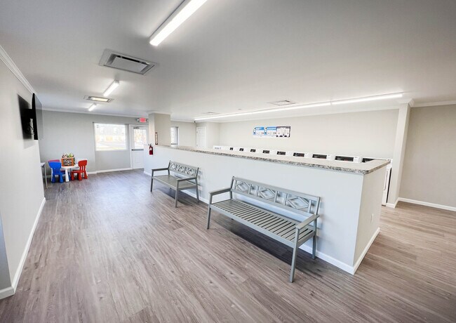
Apartment
Ohio
B and X Area of moderate flood hazard, usually the area between the limits of the 100-year and 500-year floods.
5,6,9
2025
14.20 AC
2025
Forest Park
021504
Cincinnati/Dayton
10,824 SF
NEARBY LISTINGS FOR SALE OR LEASE
-
-
View all Cincinnati listings for sale on LoopNet.com
DEMOGRAPHICS near 580 Dewdrop Cir
1 mile
3 mile
5 mile
2025 Total Population
10,107
58,308
172,875
2030 Population
10,132
58,966
174,966
Pop Growth 2025-2030
+ 0.25%
+ 1.13%
+ 1.21%
Average Age
41
41
40
2025 Total Households
3,986
23,526
69,163
HH Growth 2025-2030
+ 0.38%
+ 1.28%
+ 1.30%
Median Household Inc
$80,155
$73,329
$69,922
Avg Household Size
2.40
2.40
2.40
2025 Avg HH Vehicles
2.00
2.00
2.00
Median Home Value
$172,956
$212,125
$205,357
Median Year Built
1967
1970
1969
Nearby Places
Map Layers
Map Styles
 Street
 Aerial
Transit
 Traffic
 Biking
Places
Listings with unknown addresses are not visible on the map
- Restaurants
- Banks
- Shops
- Fitness
- Groceries
PUBLIC TRANSPORTATION
AIRPORT
Cincinnati/Northern Kentucky International
Drive
Walk
Distance
Cincinnati/Northern Kentucky International
53 min
29.1 mi
Nearby Properties
Address
Land Use
TOTAL SIZE
Lot Size
Zoning
Address
Land Use
TOTAL SIZE
Lot Size
Zoning
47.52 AC
Address
Land Use
TOTAL SIZE
Lot Size
Zoning
61.62 AC
Address
Land Use
TOTAL SIZE
Lot Size
Zoning
38,880 SF
20.93 AC
Address
Land Use
TOTAL SIZE
Lot Size
Zoning
34.60 AC
Address
Land Use
TOTAL SIZE
Lot Size
Zoning
15.33 AC
Address
Land Use
TOTAL SIZE
Lot Size
Zoning
87,612 SF
16.29 AC
R3
Address
Land Use
TOTAL SIZE
Lot Size
Zoning
1,363,493 SF
75.28 AC
Address
Land Use
TOTAL SIZE
Lot Size
Zoning
10.85 AC
Address
Land Use
TOTAL SIZE
Lot Size
Zoning
Address
Land Use
TOTAL SIZE
Lot Size
Zoning
26.63 AC
Address
Land Use
TOTAL SIZE
Lot Size
Zoning
115,446 SF
20.08 AC
Address
Land Use
TOTAL SIZE
Lot Size
Zoning
2.24 AC
Address
Land Use
TOTAL SIZE
Lot Size
Zoning
25,098 SF
21.31 AC
Address
Land Use
TOTAL SIZE
Lot Size
Zoning
25.89 AC
Address
Land Use
TOTAL SIZE
Lot Size
Zoning
4,849 SF
19.98 AC
Address
Land Use
TOTAL SIZE
Lot Size
Zoning
1,700 SF
35.39 AC
Address
Land Use
TOTAL SIZE
Lot Size
Zoning
5,085 SF
15.17 AC
Address
Land Use
TOTAL SIZE
Lot Size
Zoning
111,993 SF
17.34 AC
Address
Land Use
TOTAL SIZE
Lot Size
Zoning
279,161 SF
28.02 AC
Address
Land Use
TOTAL SIZE
Lot Size
Zoning
9,744 SF
8.15 AC
Address
Land Use
TOTAL SIZE
Lot Size
Zoning
15.83 AC
Address
Land Use
TOTAL SIZE
Lot Size
Zoning
113,400 SF
53.19 AC
Address
Land Use
TOTAL SIZE
Lot Size
Zoning
6,652 SF
15.45 AC
R1
Address
Land Use
TOTAL SIZE
Lot Size
Zoning
11.25 AC
Address
Land Use
TOTAL SIZE
Lot Size
Zoning
2,940 SF
22.12 AC
Address
Land Use
TOTAL SIZE
Lot Size
Zoning
5,073 SF
14.07 AC
Address
Land Use
TOTAL SIZE
Lot Size
Zoning
16.45 AC
Address
Land Use
TOTAL SIZE
Lot Size
Zoning
76.09 AC
Address
Land Use
TOTAL SIZE
Lot Size
Zoning
103.18 AC
R1A
Address
Land Use
TOTAL SIZE
Lot Size
Zoning
95,700 SF
18.40 AC
The World's #1 Commercial Real Estate Marketplace
Connect with us
© 2026 CoStar Group
The information above has been obtained from sources believed reliable. While we do not doubt its accuracy we have not verified it and make no guarantee, warranty or representation about it. It is your responsibility to independently confirm its accuracy and completeness. Any projections, opinions, assumptions, or estimates used are for example only and do not represent the current or future performance of the property. The value of this transaction to you depends on tax and other factors which should be evaluated by your tax, financial, and legal advisors. You and your advisors should conduct a careful, independent investigation of the property to determine to your satisfaction the suitability of the property for your needs.