Property Record
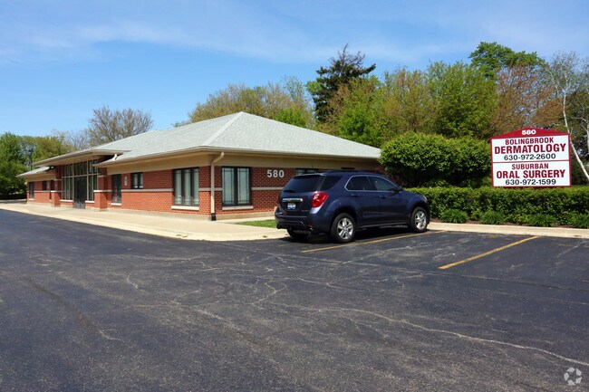
580 E Boughton Rd, Bolingbrook, IL 60440


Property Detail
580 E Boughton Rd
Chicago-Naperville-Elgin, IL-IN
LOT 4 IN COSLETTS ASSESSMENT PLAT, OF PRT OF THE W1/2 SW1/4 SEC 1, T37N-R10E., TOGETHER WITH THT PRT OF VAC RD LYG N OF ADJ
12-02-01-300-004
Will
Commercialnec
Illinois
B and X Area of moderate flood hazard, usually the area between the limits of the 100-year and 500-year floods.
4
2024
0.99 AC
2024
Joliet/Central Will
880109
Chicago
4,141 SF
NEARBY LISTINGS FOR SALE OR LEASE
DEMOGRAPHICS near 580 E Boughton Rd
1 mile
3 mile
5 mile
2025 Total Population
11,569
78,567
213,338
2030 Population
11,677
79,343
216,014
Pop Growth 2025-2030
+ 0.93%
+ 0.99%
+ 1.25%
Average Age
42
40
41
2025 Total Households
4,303
28,248
80,106
HH Growth 2025-2030
+ 0.88%
+ 1.02%
+ 1.30%
Median Household Inc
$96,686
$96,167
$106,292
Avg Household Size
2.60
2.70
2.60
2025 Avg HH Vehicles
2.00
2.00
2.00
Median Home Value
$314,237
$326,568
$371,255
Median Year Built
1978
1978
1979
Nearby Places
Map Layers
Map Styles
 Street
 Aerial
Layers
 Traffic
 Biking
Places
Listings with unknown addresses are not visible on the map
- Restaurants
- Banks
- Shops
- Fitness
- Groceries
PUBLIC TRANSPORTATION
COMMUTER RAIL
Lemont Station (Heritage Corridor Line - Northeast Illinois Regional Commuter Railroad (Metra))
Drive
Walk
Distance
Lemont Station (Heritage Corridor Line - Northeast Illinois Regional Commuter Railroad (Metra))
12 min
6.3 mi
Belmont Station (Burlington Northern-Santa Fe Railway Line - Northeast Illinois Regional Commuter Railroad (Metra))
Drive
Walk
Distance
Belmont Station (Burlington Northern-Santa Fe Railway Line - Northeast Illinois Regional Commuter Railroad (Metra))
15 min
6.4 mi
AIRPORT
Chicago Midway International
Drive
Walk
Distance
Chicago Midway International
28 min
18.4 mi
Chicago O'Hare International
Drive
Walk
Distance
Chicago O'Hare International
45 min
29.8 mi
Nearby Properties
Address
Land Use
TOTAL SIZE
Lot Size
Zoning
Address
Land Use
TOTAL SIZE
Lot Size
Zoning
22.17 AC
M
Address
Land Use
TOTAL SIZE
Lot Size
Zoning
16.28 AC
M
Address
Land Use
TOTAL SIZE
Lot Size
Zoning
21,520 SF
32.67 AC
Address
Land Use
TOTAL SIZE
Lot Size
Zoning
373,827 SF
21.30 AC
Address
Land Use
TOTAL SIZE
Lot Size
Zoning
759,709 SF
41.75 AC
Address
Land Use
TOTAL SIZE
Lot Size
Zoning
21.12 AC
Address
Land Use
TOTAL SIZE
Lot Size
Zoning
18.23 AC
M
Address
Land Use
TOTAL SIZE
Lot Size
Zoning
315,708 SF
21.95 AC
M
Address
Land Use
TOTAL SIZE
Lot Size
Zoning
48.48 AC
Address
Land Use
TOTAL SIZE
Lot Size
Zoning
22.75 AC
Address
Land Use
TOTAL SIZE
Lot Size
Zoning
14.98 AC
M
Address
Land Use
TOTAL SIZE
Lot Size
Zoning
308,196 SF
17.65 AC
M
Address
Land Use
TOTAL SIZE
Lot Size
Zoning
334,656 SF
17.72 AC
I
Address
Land Use
TOTAL SIZE
Lot Size
Zoning
9.58 AC
M
Address
Land Use
TOTAL SIZE
Lot Size
Zoning
353,286 SF
19.84 AC
Address
Land Use
TOTAL SIZE
Lot Size
Zoning
28.89 AC
Address
Land Use
TOTAL SIZE
Lot Size
Zoning
264,310 SF
12.21 AC
I
Address
Land Use
TOTAL SIZE
Lot Size
Zoning
581,000 SF
28.56 AC
Address
Land Use
TOTAL SIZE
Lot Size
Zoning
513,805 SF
23.84 AC
Address
Land Use
TOTAL SIZE
Lot Size
Zoning
143,024 SF
21.50 AC
Address
Land Use
TOTAL SIZE
Lot Size
Zoning
9.97 AC
M
Address
Land Use
TOTAL SIZE
Lot Size
Zoning
13.42 AC
Address
Land Use
TOTAL SIZE
Lot Size
Zoning
351,257 SF
16.39 AC
I
Address
Land Use
TOTAL SIZE
Lot Size
Zoning
432,522 SF
20.38 AC
Address
Land Use
TOTAL SIZE
Lot Size
Zoning
396,546 SF
20.33 AC
I
Address
Land Use
TOTAL SIZE
Lot Size
Zoning
15.54 AC
Address
Land Use
TOTAL SIZE
Lot Size
Zoning
13.46 AC
M
Address
Land Use
TOTAL SIZE
Lot Size
Zoning
367,990 SF
17.32 AC
I
Address
Land Use
TOTAL SIZE
Lot Size
Zoning
Address
Land Use
TOTAL SIZE
Lot Size
Zoning
314,196 SF
21.08 AC
The World's #1 Commercial Real Estate Marketplace
Connect with us
© 2026 CoStar Group
The information above has been obtained from sources believed reliable. While we do not doubt its accuracy we have not verified it and make no guarantee, warranty or representation about it. It is your responsibility to independently confirm its accuracy and completeness. Any projections, opinions, assumptions, or estimates used are for example only and do not represent the current or future performance of the property. The value of this transaction to you depends on tax and other factors which should be evaluated by your tax, financial, and legal advisors. You and your advisors should conduct a careful, independent investigation of the property to determine to your satisfaction the suitability of the property for your needs.