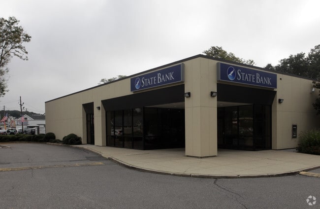
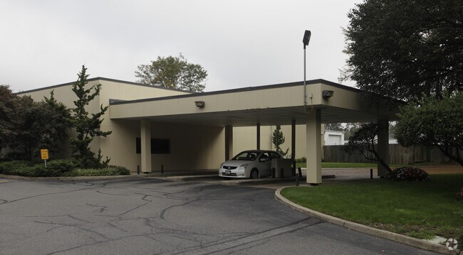
Property Record
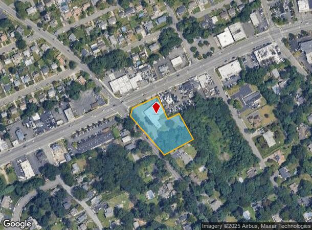
580 E Jericho Tpke, Huntington Station, NY 11746
NEARBY LISTINGS FOR SALE OR LEASE
Property Detail
580 E Jericho Tpke
Nassau County-Suffolk County, NY
Locust Pk
0400-204-00-01-00-086-001
FILED LOT 1-4 &,REAR LOT
Financialbuilding
Suffolk
X
New York
36103C0610H
86
2024
1.40 AC
2024
Western Suffolk
112002
Long Island (New York)
DEMOGRAPHICS near 580 E Jericho Tpke
1 Mile
3 Mile
5 Mile
2024 Total Population
11,771
80,705
177,913
2029 Population
11,441
78,863
174,721
Pop Growth 2024-2029
(2.80%)
(2.28%)
(1.79%)
Average Age
42
42
43
2024 Total Households
3,900
26,200
59,841
HH Growth 2024-2029
(3.15%)
(2.44%)
(1.99%)
Median Household Inc
$128,759
$130,647
$145,949
Avg Household Size
2.90
2.90
2.80
2024 Avg HH Vehicles
2.00
2.00
2.00
Median Home Value
$527,761
$634,047
$704,397
Median Year Built
1958
1960
1962
Nearby Places
- Restaurants
- Banks
- Shops
- Fitness
- Groceries
PUBLIC TRANSPORTATION
COMMUTER RAIL
Huntington Station (Port Jefferson Branch - Long Island Rail Road)
DRIVE
WALK
Distance
Huntington Station (Port Jefferson Branch - Long Island Rail Road)
6 min
2.1 mi
Greenlawn Station (Port Jefferson Branch - Long Island Rail Road)
DRIVE
WALK
Distance
Greenlawn Station (Port Jefferson Branch - Long Island Rail Road)
9 min
3.5 mi
AIRPORT
Long Island MacArthur
DRIVE
WALK
Distance
Long Island MacArthur
30 min
17.2 mi
John F Kennedy International
DRIVE
WALK
Distance
John F Kennedy International
49 min
33.0 mi
Freight Ports
NY - Red Hook Container Terminal
DRIVE
WALK
Distance
NY - Red Hook Container Terminal
60 min
37.7 mi
Nearby Properties
Address
Land Use
TOTAL SIZE
Lot Size
Zoning
Address
Land Use
TOTAL SIZE
Lot Size
Zoning
0.41 AC
VILLA
Address
Land Use
TOTAL SIZE
Lot Size
Zoning
65 AC
C6
Address
Land Use
TOTAL SIZE
Lot Size
Zoning
0.06 AC
VILLA
Address
Land Use
TOTAL SIZE
Lot Size
Zoning
1.50 AC
CR80
Address
Land Use
TOTAL SIZE
Lot Size
Zoning
0.06 AC
VILLA
Address
Land Use
TOTAL SIZE
Lot Size
Zoning
0.02 AC
VILLA
Address
Land Use
TOTAL SIZE
Lot Size
Zoning
0.04 AC
VILLA
Address
Land Use
TOTAL SIZE
Lot Size
Zoning
0.05 AC
VILLA
Address
Land Use
TOTAL SIZE
Lot Size
Zoning
0.05 AC
VILLA
Address
Land Use
TOTAL SIZE
Lot Size
Zoning
0.05 AC
VILLA
Address
Land Use
TOTAL SIZE
Lot Size
Zoning
0.05 AC
VILLA
Address
Land Use
TOTAL SIZE
Lot Size
Zoning
0.03 AC
VILLA
Address
Land Use
TOTAL SIZE
Lot Size
Zoning
0.04 AC
VILLA
Address
Land Use
TOTAL SIZE
Lot Size
Zoning
0.04 AC
VILLA
Address
Land Use
TOTAL SIZE
Lot Size
Zoning
0.03 AC
VILLA
Address
Land Use
TOTAL SIZE
Lot Size
Zoning
0.02 AC
VILLA
Address
Land Use
TOTAL SIZE
Lot Size
Zoning
0.04 AC
VILLA
Address
Land Use
TOTAL SIZE
Lot Size
Zoning
0.04 AC
VILLA
Address
Land Use
TOTAL SIZE
Lot Size
Zoning
0.04 AC
VILLA
Address
Land Use
TOTAL SIZE
Lot Size
Zoning
0.04 AC
VILLA
Address
Land Use
TOTAL SIZE
Lot Size
Zoning
0.04 AC
VILLA
Address
Land Use
TOTAL SIZE
Lot Size
Zoning
0.23 AC
VILLA
Address
Land Use
TOTAL SIZE
Lot Size
Zoning
0.03 AC
VILLA
Address
Land Use
TOTAL SIZE
Lot Size
Zoning
0.03 AC
VILLA
Address
Land Use
TOTAL SIZE
Lot Size
Zoning
0.03 AC
VILLA
Address
Land Use
TOTAL SIZE
Lot Size
Zoning
32.67 AC
R80
Address
Land Use
TOTAL SIZE
Lot Size
Zoning
36 AC
R20
Address
Land Use
TOTAL SIZE
Lot Size
Zoning
82 AC
R40
Address
Land Use
TOTAL SIZE
Lot Size
Zoning
0.03 AC
VILLA
Address
Land Use
TOTAL SIZE
Lot Size
Zoning
0.03 AC
VILLA
The World's #1 Commercial Real Estate Marketplace
Connect with us
© 2025 CoStar Group
The information above has been obtained from sources believed reliable. While we do not doubt its accuracy we have not verified it and make no guarantee, warranty or representation about it. It is your responsibility to independently confirm its accuracy and completeness. Any projections, opinions, assumptions, or estimates used are for example only and do not represent the current or future performance of the property. The value of this transaction to you depends on tax and other factors which should be evaluated by your tax, financial, and legal advisors. You and your advisors should conduct a careful, independent investigation of the property to determine to your satisfaction the suitability of the property for your needs.