Property Record
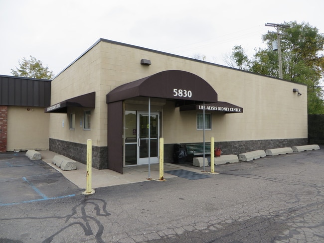
5830 Conner St, Detroit, MI 48213


NEARBY LISTINGS FOR SALE OR LEASE
Property Detail
5830 Conner St
21-0363835
Warren Park No 2
Dentalbldg
E CONNER 572 THRU 583 WARREN PARK NO 2 SUB L37 P52 PLATS, W C R 21/458 183 IRREG
X
Wayne
26163C0140F
Michigan
2025
0.60 AC
2025
Detroit E of Woodward
502600
Detroit
5,976 SF
Detroit-Warren-Dearborn, MI
DEMOGRAPHICS near 5830 Conner St
1 Mile
3 Mile
5 Mile
2024 Total Population
10,736
127,663
326,241
2029 Population
11,090
130,035
324,466
Pop Growth 2024-2029
+ 3.30%
+ 1.86%
(0.54%)
Average Age
39
39
38
2024 Total Households
4,137
49,750
127,017
HH Growth 2024-2029
+ 3.46%
+ 1.81%
(0.61%)
Median Household Inc
$27,182
$37,491
$41,535
Avg Household Size
2.40
2.50
2.50
2024 Avg HH Vehicles
1.00
1.00
1.00
Median Home Value
$64,717
$80,621
$96,083
Median Year Built
1950
1948
1950
Nearby Places
Map Layers
Map Styles
 Street
 Aerial
- Restaurants
- Banks
- Shops
- Fitness
- Groceries
PUBLIC TRANSPORTATION
AIRPORT
Detroit City
DRIVE
WALK
Distance
Detroit City
9 min
4.3 mi
Detroit Metro Wayne County
DRIVE
WALK
Distance
Detroit Metro Wayne County
33 min
28.7 mi
Freight Ports
Port of Baltimore
DRIVE
WALK
Distance
Port of Baltimore
1 min
397.7 mi
SALE & LEASE HISTORY
LISTING DATE
SALE/LEASE

Sep 24, 2016
For Sale
Nearby Properties
Address
Land Use
TOTAL SIZE
Lot Size
Zoning
Address
Land Use
TOTAL SIZE
Lot Size
Zoning
2,958,207 SF
277.38 AC
M4
Address
Land Use
TOTAL SIZE
Lot Size
Zoning
2,005,073 SF
108.66 AC
M4
Address
Land Use
TOTAL SIZE
Lot Size
Zoning
461,840 SF
4.78 AC
R6
Address
Land Use
TOTAL SIZE
Lot Size
Zoning
929,400 SF
52.48 AC
M4
Address
Land Use
TOTAL SIZE
Lot Size
Zoning
996,200 SF
2.14 AC
Address
Land Use
TOTAL SIZE
Lot Size
Zoning
482,649 SF
M4
Address
Land Use
TOTAL SIZE
Lot Size
Zoning
648,928 SF
5.46 AC
R6
Address
Land Use
TOTAL SIZE
Lot Size
Zoning
506,404 SF
198 AC
M4
Address
Land Use
TOTAL SIZE
Lot Size
Zoning
298,117 SF
15.97 AC
PD
Address
Land Use
TOTAL SIZE
Lot Size
Zoning
144,578 SF
7.10 AC
PD
Address
Land Use
TOTAL SIZE
Lot Size
Zoning
300,000 SF
0.29 AC
M4
Address
Land Use
TOTAL SIZE
Lot Size
Zoning
405,004 SF
28.13 AC
M4
Address
Land Use
TOTAL SIZE
Lot Size
Zoning
57.16 AC
M4
Address
Land Use
TOTAL SIZE
Lot Size
Zoning
358,327 SF
M4
Address
Land Use
TOTAL SIZE
Lot Size
Zoning
161,250 SF
0.50 AC
R2
Address
Land Use
TOTAL SIZE
Lot Size
Zoning
302,305 SF
M4
Address
Land Use
TOTAL SIZE
Lot Size
Zoning
122,600 SF
0.07 AC
B4
Address
Land Use
TOTAL SIZE
Lot Size
Zoning
286,023 SF
M4
Address
Land Use
TOTAL SIZE
Lot Size
Zoning
89,897 SF
2.23 AC
Address
Land Use
TOTAL SIZE
Lot Size
Zoning
129,260 SF
3 AC
B4
Address
Land Use
TOTAL SIZE
Lot Size
Zoning
88,592 SF
0.46 AC
R2
Address
Land Use
TOTAL SIZE
Lot Size
Zoning
307,262 SF
M4
Address
Land Use
TOTAL SIZE
Lot Size
Zoning
72,940 SF
83.37 AC
M4
Address
Land Use
TOTAL SIZE
Lot Size
Zoning
93,850 SF
6.56 AC
Address
Land Use
TOTAL SIZE
Lot Size
Zoning
88,695 SF
6.53 AC
PD
Address
Land Use
TOTAL SIZE
Lot Size
Zoning
115,839 SF
8.54 AC
M4
Address
Land Use
TOTAL SIZE
Lot Size
Zoning
105,847 SF
2.28 AC
R5
Address
Land Use
TOTAL SIZE
Lot Size
Zoning
62,402 SF
0.28 AC
B4
Address
Land Use
TOTAL SIZE
Lot Size
Zoning
73,398 SF
1.27 AC
R5
Address
Land Use
TOTAL SIZE
Lot Size
Zoning
192,452 SF
10.89 AC
M4
The World's #1 Commercial Real Estate Marketplace
Connect with us
© 2026 CoStar Group
The information above has been obtained from sources believed reliable. While we do not doubt its accuracy we have not verified it and make no guarantee, warranty or representation about it. It is your responsibility to independently confirm its accuracy and completeness. Any projections, opinions, assumptions, or estimates used are for example only and do not represent the current or future performance of the property. The value of this transaction to you depends on tax and other factors which should be evaluated by your tax, financial, and legal advisors. You and your advisors should conduct a careful, independent investigation of the property to determine to your satisfaction the suitability of the property for your needs.