Property Record
5800 Centennial Blvd, Nashville, TN 37209


NEARBY LISTINGS FOR SALE OR LEASE
Property Detail
5800 Centennial Blvd
091-00-0-057
St Ave
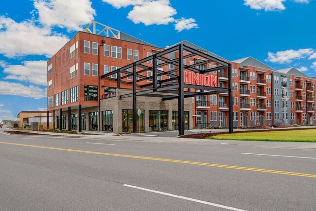
Highriseapartments
N/S CENTENNIAL BV W OF 51ST AVE N
X
Davidson
47037C0236H
Tennessee
2025
3.90 AC
2025
The Nations
013001
Nashville
89,821 SF
Nashville-Davidson--Murfreesboro--Franklin, TN
DEMOGRAPHICS near 5800 Centennial Blvd
1 Mile
3 Mile
5 Mile
2024 Total Population
7,244
63,765
176,871
2029 Population
7,350
64,365
179,917
Pop Growth 2024-2029
+ 1.46%
+ 0.94%
+ 1.72%
Average Age
33
36
37
2024 Total Households
3,291
27,888
81,475
HH Growth 2024-2029
+ 1.09%
+ 0.79%
+ 2.11%
Median Household Inc
$84,596
$59,482
$67,832
Avg Household Size
2.10
2.10
1.90
2024 Avg HH Vehicles
2.00
2.00
1.00
Median Home Value
$440,785
$437,663
$483,404
Median Year Built
2010
1983
2000
Nearby Places
Map Layers
Map Styles
 Street
 Aerial
- Restaurants
- Banks
- Shops
- Fitness
- Groceries
PUBLIC TRANSPORTATION
COMMUTER RAIL
Riverfront (East Corridor Line - Tennessee Regional Transportation Authority Music City Star (Music City Star))
DRIVE
WALK
Distance
Riverfront (East Corridor Line - Tennessee Regional Transportation Authority Music City Star (Music City Star))
11 min
6.0 mi
AIRPORT
Nashville International
DRIVE
WALK
Distance
Nashville International
23 min
15.6 mi
Freight Ports
Port of Mobile
DRIVE
WALK
Distance
Port of Mobile
490 min
449.4 mi
Nearby Properties
Address
Land Use
TOTAL SIZE
Lot Size
Zoning
Address
Land Use
TOTAL SIZE
Lot Size
Zoning
148,222 SF
25.86 AC
MULTI-ZONE
Address
Land Use
TOTAL SIZE
Lot Size
Zoning
208,992 SF
6.09 AC
MUG
Address
Land Use
TOTAL SIZE
Lot Size
Zoning
17.03 AC
ORI
Address
Land Use
TOTAL SIZE
Lot Size
Zoning
184,700 SF
14.20 AC
RM40
Address
Land Use
TOTAL SIZE
Lot Size
Zoning
301.19 AC
MULTI-ZONE
Address
Land Use
TOTAL SIZE
Lot Size
Zoning
80,280 SF
2.20 AC
OVUDO
Address
Land Use
TOTAL SIZE
Lot Size
Zoning
984,601 SF
3.74 AC
MULTIZONE
Address
Land Use
TOTAL SIZE
Lot Size
Zoning
133,157 SF
1.05 AC
ORI
Address
Land Use
TOTAL SIZE
Lot Size
Zoning
121,769 SF
4.64 AC
MULTI-ZONE
Address
Land Use
TOTAL SIZE
Lot Size
Zoning
55,073 SF
11.42 AC
IWD
Address
Land Use
TOTAL SIZE
Lot Size
Zoning
226,728 SF
10.15 AC
MUG-A
Address
Land Use
TOTAL SIZE
Lot Size
Zoning
91.99 AC
R8
Address
Land Use
TOTAL SIZE
Lot Size
Zoning
352,170 SF
3.11 AC
ORIA
Address
Land Use
TOTAL SIZE
Lot Size
Zoning
213,556 SF
123.31 AC
IR
Address
Land Use
TOTAL SIZE
Lot Size
Zoning
174,635 SF
1.54 AC
MUG
Address
Land Use
TOTAL SIZE
Lot Size
Zoning
121,340 SF
1.33 AC
MUG
Address
Land Use
TOTAL SIZE
Lot Size
Zoning
180,982 SF
14.71 AC
MUIA
Address
Land Use
TOTAL SIZE
Lot Size
Zoning
154,530 SF
6.18 AC
SP
Address
Land Use
TOTAL SIZE
Lot Size
Zoning
80.71 AC
R6
Address
Land Use
TOTAL SIZE
Lot Size
Zoning
346,977 SF
3.57 AC
SP
Address
Land Use
TOTAL SIZE
Lot Size
Zoning
75,265 SF
4.31 AC
MULTIZONE
Address
Land Use
TOTAL SIZE
Lot Size
Zoning
257,836 SF
0.41 AC
SP
Address
Land Use
TOTAL SIZE
Lot Size
Zoning
33,664 SF
18.98 AC
IWD
Address
Land Use
TOTAL SIZE
Lot Size
Zoning
289,766 SF
3.51 AC
SP
Address
Land Use
TOTAL SIZE
Lot Size
Zoning
295,832 SF
3.61 AC
MUG-A
Address
Land Use
TOTAL SIZE
Lot Size
Zoning
291,740 SF
2.59 AC
ORI
Address
Land Use
TOTAL SIZE
Lot Size
Zoning
146.13 AC
IR
Address
Land Use
TOTAL SIZE
Lot Size
Zoning
234,840 SF
3.25 AC
MULTIZONE
Address
Land Use
TOTAL SIZE
Lot Size
Zoning
4.35 AC
MUI-A
The World's #1 Commercial Real Estate Marketplace
Connect with us
© 2026 CoStar Group
The information above has been obtained from sources believed reliable. While we do not doubt its accuracy we have not verified it and make no guarantee, warranty or representation about it. It is your responsibility to independently confirm its accuracy and completeness. Any projections, opinions, assumptions, or estimates used are for example only and do not represent the current or future performance of the property. The value of this transaction to you depends on tax and other factors which should be evaluated by your tax, financial, and legal advisors. You and your advisors should conduct a careful, independent investigation of the property to determine to your satisfaction the suitability of the property for your needs.