Property Record
5800 Monroe St, Sylvania, OH 43560
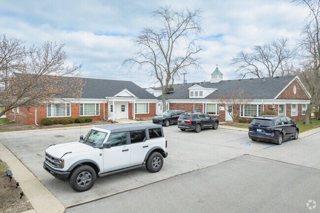

Property Detail
5800 Monroe St
82-14077
COUNTRY SQUARE CONDOMINIUM UNIT 14
Commercialcondominium
Lucas
31-B4
Ohio
B and X Area of moderate flood hazard, usually the area between the limits of the 100-year and 500-year floods.
9.51 AC
0
West/Sylvania
2025
Toledo
008100
Toledo, OH
NEARBY LISTINGS FOR SALE OR LEASE
DEMOGRAPHICS near 5800 Monroe St
1 mile
3 mile
5 mile
2025 Total Population
5,768
50,052
145,314
2030 Population
5,669
48,848
143,298
Pop Growth 2025-2030
(1.72%)
(2.41%)
(1.39%)
Average Age
42
43
41
2025 Total Households
2,415
21,330
61,611
HH Growth 2025-2030
(1.78%)
(2.41%)
(1.34%)
Median Household Inc
$86,245
$84,971
$77,676
Avg Household Size
2.30
2.30
2.30
2025 Avg HH Vehicles
2.00
2.00
2.00
Median Home Value
$216,243
$223,250
$203,117
Median Year Built
1970
1970
1968
Nearby Places
Map Layers
Map Styles
 Street
 Aerial
Layers
 Traffic
 Biking
Places
Listings with unknown addresses are not visible on the map
- Restaurants
- Banks
- Shops
- Fitness
- Groceries
PUBLIC TRANSPORTATION
COMMUTER RAIL
Toledo (Capitol Limited - Amtrak, Lake Shore Limited - Amtrak)
Drive
Walk
Distance
Toledo (Capitol Limited - Amtrak, Lake Shore Limited - Amtrak)
18 min
9.7 mi
AIRPORT
Eugene F Kranz Toledo Express
Drive
Walk
Distance
Eugene F Kranz Toledo Express
34 min
18.8 mi
Freight Ports
Port of Toledo
Drive
Walk
Distance
Port of Toledo
30 min
14.8 mi
SALE & LEASE HISTORY
LISTING DATE
SALE/LEASE

Sep 05, 2022
For Sale
Oct 13, 2022
For Lease
Nov 03, 2025
For Lease
Nov 03, 2025
For Sale
Mar 13, 2020
For Lease
Nearby Properties
Address
Land Use
TOTAL SIZE
Lot Size
Zoning
Address
Land Use
TOTAL SIZE
Lot Size
Zoning
607,717 SF
7.39 AC
31-R3
Address
Land Use
TOTAL SIZE
Lot Size
Zoning
460,266 SF
85.36 AC
31-R1
Address
Land Use
TOTAL SIZE
Lot Size
Zoning
15.79 AC
31-B4
Address
Land Use
TOTAL SIZE
Lot Size
Zoning
312,089 SF
6.34 AC
31-B5
Address
Land Use
TOTAL SIZE
Lot Size
Zoning
7.71 AC
10-CRSO
Address
Land Use
TOTAL SIZE
Lot Size
Zoning
238,200 SF
32.90 AC
31-R1
Address
Land Use
TOTAL SIZE
Lot Size
Zoning
12.52 AC
10-CRSO
Address
Land Use
TOTAL SIZE
Lot Size
Zoning
209,351 SF
49.06 AC
31-R1
Address
Land Use
TOTAL SIZE
Lot Size
Zoning
260,875 SF
9.91 AC
20-R5
Address
Land Use
TOTAL SIZE
Lot Size
Zoning
166,837 SF
23.82 AC
10-MX
Address
Land Use
TOTAL SIZE
Lot Size
Zoning
78,678 SF
10.20 AC
31-R1
Address
Land Use
TOTAL SIZE
Lot Size
Zoning
49,960 SF
8.33 AC
10-CO
Address
Land Use
TOTAL SIZE
Lot Size
Zoning
51,129 SF
460.05 AC
20-S1
Address
Land Use
TOTAL SIZE
Lot Size
Zoning
169,580 SF
8.98 AC
20-C2
Address
Land Use
TOTAL SIZE
Lot Size
Zoning
67,713 SF
10.24 AC
20-C2
Address
Land Use
TOTAL SIZE
Lot Size
Zoning
130,387 SF
8.50 AC
20-R5
Address
Land Use
TOTAL SIZE
Lot Size
Zoning
174,890 SF
19.86 AC
31-R3
Address
Land Use
TOTAL SIZE
Lot Size
Zoning
52,429 SF
3.79 AC
10-CO
Address
Land Use
TOTAL SIZE
Lot Size
Zoning
135,978 SF
14.01 AC
31-B2
Address
Land Use
TOTAL SIZE
Lot Size
Zoning
123,985 SF
9.74 AC
10-MX
Address
Land Use
TOTAL SIZE
Lot Size
Zoning
84,485 SF
8.41 AC
20-C2
Address
Land Use
TOTAL SIZE
Lot Size
Zoning
214,400 SF
13.07 AC
20-C2
Address
Land Use
TOTAL SIZE
Lot Size
Zoning
119,804 SF
5.02 AC
31-R4
Address
Land Use
TOTAL SIZE
Lot Size
Zoning
63,445 SF
5.72 AC
20-C4
Address
Land Use
TOTAL SIZE
Lot Size
Zoning
243,247 SF
11.66 AC
20-R5PUD
Address
Land Use
TOTAL SIZE
Lot Size
Zoning
70,550 SF
8.25 AC
31-B1
Address
Land Use
TOTAL SIZE
Lot Size
Zoning
78,266 SF
13.57 AC
20-S1
Address
Land Use
TOTAL SIZE
Lot Size
Zoning
132,204 SF
1 AC
20-R5
Address
Land Use
TOTAL SIZE
Lot Size
Zoning
70,483 SF
8.53 AC
31-R1
Address
Land Use
TOTAL SIZE
Lot Size
Zoning
44,028 SF
3.92 AC
10-MX
The World's #1 Commercial Real Estate Marketplace
Connect with us
© 2026 CoStar Group
The information above has been obtained from sources believed reliable. While we do not doubt its accuracy we have not verified it and make no guarantee, warranty or representation about it. It is your responsibility to independently confirm its accuracy and completeness. Any projections, opinions, assumptions, or estimates used are for example only and do not represent the current or future performance of the property. The value of this transaction to you depends on tax and other factors which should be evaluated by your tax, financial, and legal advisors. You and your advisors should conduct a careful, independent investigation of the property to determine to your satisfaction the suitability of the property for your needs.