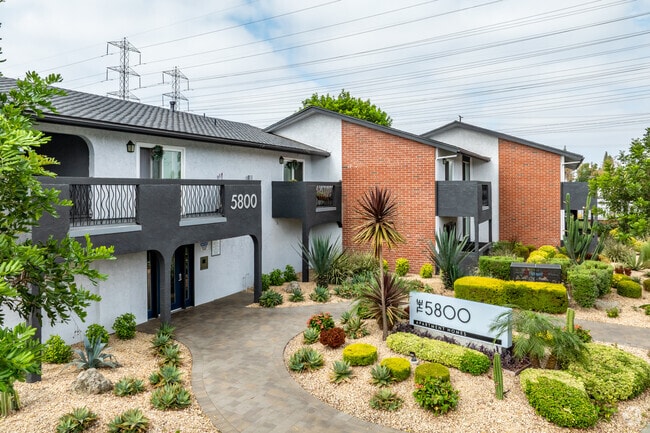
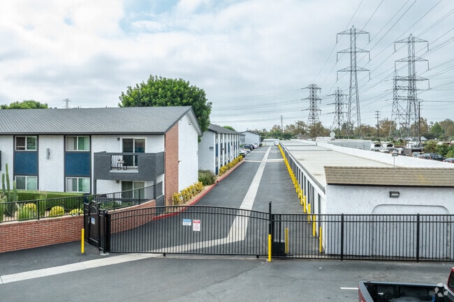
Property Record
5800 South St, Lakewood, CA 90713

NEARBY LISTINGS FOR SALE OR LEASE
Property Detail
5800 South St
Los Angeles-Long Beach-Glendale, CA
Parcel Map 2381
7171-001-010
PARCEL MAP AS PER BK 34 P 67 OF PM*LOTS 1 AND LOT 2
Multifamilydwelling
Los Angeles
X
California
06037C1980F
1,2
2024
5.22 AC
2025
Bellflower
570902
Los Angeles
132,019 SF
DEMOGRAPHICS near 5800 South St
1 Mile
3 Mile
5 Mile
2024 Total Population
26,425
242,548
641,808
2029 Population
25,523
234,433
620,123
Pop Growth 2024-2029
(3.41%)
(3.35%)
(3.38%)
Average Age
41
40
39
2024 Total Households
8,809
76,406
198,178
HH Growth 2024-2029
(3.71%)
(3.61%)
(3.61%)
Median Household Inc
$103,810
$87,585
$86,231
Avg Household Size
2.90
3.10
3.10
2024 Avg HH Vehicles
2.00
2.00
2.00
Median Home Value
$740,629
$724,784
$710,936
Median Year Built
1956
1959
1960
Nearby Places
Map Layers
Map Styles
 Street
 Aerial
- Restaurants
- Banks
- Shops
- Fitness
- Groceries
PUBLIC TRANSPORTATION
COMMUTER RAIL
Norwalk/Santa Fe Springs (91 Line - Southern California Regional Rail Authority (Metrolink), Orange County Line - Southern California Regional Rail Authority (Metrolink))
DRIVE
WALK
Distance
Norwalk/Santa Fe Springs (91 Line - Southern California Regional Rail Authority (Metrolink), Orange County Line - Southern California Regional Rail Authority (Metrolink))
13 min
8.4 mi
Buena Park (91 Line - Southern California Regional Rail Authority (Metrolink), Orange County Line - Southern California Regional Rail Authority (Metrolink))
DRIVE
WALK
Distance
Buena Park (91 Line - Southern California Regional Rail Authority (Metrolink), Orange County Line - Southern California Regional Rail Authority (Metrolink))
17 min
9.1 mi
AIRPORT
Long Beach (Daugherty Field)
DRIVE
WALK
Distance
Long Beach (Daugherty Field)
12 min
6.4 mi
Los Angeles International
DRIVE
WALK
Distance
Los Angeles International
31 min
22.1 mi
John Wayne/Orange County
DRIVE
WALK
Distance
John Wayne/Orange County
29 min
22.6 mi
Freight Ports
Port of Long Beach
DRIVE
WALK
Distance
Port of Long Beach
20 min
9.5 mi
Nearby Properties
Address
Land Use
TOTAL SIZE
Lot Size
Zoning
Address
Land Use
TOTAL SIZE
Lot Size
Zoning
324,400 SF
55.03 AC
CECR
Address
Land Use
TOTAL SIZE
Lot Size
Zoning
202,924 SF
99.50 AC
LKC4*
Address
Land Use
TOTAL SIZE
Lot Size
Zoning
235,971 SF
10.58 AC
HGC4*
Address
Land Use
TOTAL SIZE
Lot Size
Zoning
353,001 SF
4.81 AC
CEM
Address
Land Use
TOTAL SIZE
Lot Size
Zoning
395,436 SF
17.22 AC
LBMG
Address
Land Use
TOTAL SIZE
Lot Size
Zoning
160,112 SF
3.94 AC
LBPPD1
Address
Land Use
TOTAL SIZE
Lot Size
Zoning
108,931 SF
5.76 AC
LBPPD1
Address
Land Use
TOTAL SIZE
Lot Size
Zoning
203,371 SF
0.14 AC
HGC4*
Address
Land Use
TOTAL SIZE
Lot Size
Zoning
97,250 SF
4.86 AC
LBPPD1
Address
Land Use
TOTAL SIZE
Lot Size
Zoning
1,097,606 SF
52.50 AC
LBPD
Address
Land Use
TOTAL SIZE
Lot Size
Zoning
247,536 SF
5.79 AC
CECR
Address
Land Use
TOTAL SIZE
Lot Size
Zoning
91,545 SF
2.86 AC
LBPPD1
Address
Land Use
TOTAL SIZE
Lot Size
Zoning
292,696 SF
11.48 AC
LBR4
Address
Land Use
TOTAL SIZE
Lot Size
Zoning
132,404 SF
4.84 AC
LBIG
Address
Land Use
TOTAL SIZE
Lot Size
Zoning
233,030 SF
10.95 AC
LBR4
Address
Land Use
TOTAL SIZE
Lot Size
Zoning
108,564 SF
2.48 AC
LBR4N
Address
Land Use
TOTAL SIZE
Lot Size
Zoning
140,624 SF
4.35 AC
ATMRV1200*
Address
Land Use
TOTAL SIZE
Lot Size
Zoning
80,114 SF
1.27 AC
LKC4*
Address
Land Use
TOTAL SIZE
Lot Size
Zoning
299,406 SF
1.72 AC
LKC4*
Address
Land Use
TOTAL SIZE
Lot Size
Zoning
76,570 SF
6.46 AC
LBPPD1
Address
Land Use
TOTAL SIZE
Lot Size
Zoning
1,004,620 SF
19.73 AC
CECR
Address
Land Use
TOTAL SIZE
Lot Size
Zoning
141,332 SF
7.13 AC
LBPPD1
Address
Land Use
TOTAL SIZE
Lot Size
Zoning
80,339 SF
5.88 AC
ATCPD*
Address
Land Use
TOTAL SIZE
Lot Size
Zoning
266,036 SF
6.13 AC
ATCS
Address
Land Use
TOTAL SIZE
Lot Size
Zoning
96,849 SF
7.56 AC
LKC3YY
Address
Land Use
TOTAL SIZE
Lot Size
Zoning
193,300 SF
4.22 AC
CECR
Address
Land Use
TOTAL SIZE
Lot Size
Zoning
131,914 SF
10.15 AC
CECR
The World's #1 Commercial Real Estate Marketplace
Connect with us
© 2025 CoStar Group
The information above has been obtained from sources believed reliable. While we do not doubt its accuracy we have not verified it and make no guarantee, warranty or representation about it. It is your responsibility to independently confirm its accuracy and completeness. Any projections, opinions, assumptions, or estimates used are for example only and do not represent the current or future performance of the property. The value of this transaction to you depends on tax and other factors which should be evaluated by your tax, financial, and legal advisors. You and your advisors should conduct a careful, independent investigation of the property to determine to your satisfaction the suitability of the property for your needs.