Property Record
5801 Morning Dr, Bakersfield, CA
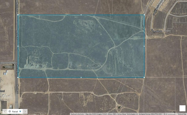


This Property Is For Sale
Property Detail
5801 Morning Dr
Bakersfield-Delano, CA
SECTION 18 , TOWNSHIP 29 , RANGE 29 , QUARTER
531-011-02-02-5
KERN
Vacantlandnec
California
B and X Area of moderate flood hazard, usually the area between the limits of the 100-year and 500-year floods.
77.45 AC
2024
NE Outlying Kern County
2025
Bakersfield
000913
NEARBY LISTINGS FOR SALE OR LEASE
DEMOGRAPHICS near 5801 Morning Dr
1 mile
3 mile
5 mile
2025 Total Population
4,522
50,111
128,278
2030 Population
4,681
50,926
129,904
Pop Growth 2025-2030
+ 3.52%
+ 1.63%
+ 1.27%
Average Age
37
36
35
2025 Total Households
1,585
15,568
38,100
HH Growth 2025-2030
+ 2.97%
+ 1.56%
+ 1.28%
Median Household Inc
$86,922
$75,049
$61,813
Avg Household Size
2.80
3.10
3.30
2025 Avg HH Vehicles
2.00
2.00
2.00
Median Home Value
$403,086
$345,272
$317,790
Median Year Built
2006
1982
1975
Nearby Places
Map Layers
Map Styles
 Street
 Aerial
Layers
 Traffic
 Biking
Places
Listings with unknown addresses are not visible on the map
- Restaurants
- Banks
- Shops
- Fitness
- Groceries
PUBLIC TRANSPORTATION
COMMUTER RAIL
Bakersfield (San Joaquins - Amtrak)
Drive
Walk
Distance
Bakersfield (San Joaquins - Amtrak)
14 min
8.6 mi
AIRPORT
Meadows Field
Drive
Walk
Distance
Meadows Field
24 min
13.7 mi
Freight Ports
The Port of Hueneme
Drive
Walk
Distance
The Port of Hueneme
165 min
132.3 mi
Nearby Properties
Address
Land Use
TOTAL SIZE
Lot Size
Zoning
Address
Land Use
TOTAL SIZE
Lot Size
Zoning
1.38 AC
C-2
Address
Land Use
TOTAL SIZE
Lot Size
Zoning
11,267 SF
40 AC
Address
Land Use
TOTAL SIZE
Lot Size
Zoning
66,139 SF
4.48 AC
CO
Address
Land Use
TOTAL SIZE
Lot Size
Zoning
Address
Land Use
TOTAL SIZE
Lot Size
Zoning
66,139 SF
4.48 AC
CO
Address
Land Use
TOTAL SIZE
Lot Size
Zoning
103,536 SF
6.31 AC
R-3
Address
Land Use
TOTAL SIZE
Lot Size
Zoning
102,262 SF
3.93 AC
Address
Land Use
TOTAL SIZE
Lot Size
Zoning
10.31 AC
Address
Land Use
TOTAL SIZE
Lot Size
Zoning
127,224 SF
7 AC
R-2/PUD
Address
Land Use
TOTAL SIZE
Lot Size
Zoning
66,582 SF
3.36 AC
R-2
Address
Land Use
TOTAL SIZE
Lot Size
Zoning
179,460 SF
10.20 AC
R3
Address
Land Use
TOTAL SIZE
Lot Size
Zoning
68,264 SF
6.56 AC
C2
Address
Land Use
TOTAL SIZE
Lot Size
Zoning
4.94 AC
R-3
Address
Land Use
TOTAL SIZE
Lot Size
Zoning
34,733 SF
7.25 AC
C2
Address
Land Use
TOTAL SIZE
Lot Size
Zoning
101,437 SF
9.05 AC
PCD
Address
Land Use
TOTAL SIZE
Lot Size
Zoning
96,952 SF
2.56 AC
R-2
Address
Land Use
TOTAL SIZE
Lot Size
Zoning
11.05 AC
C2/PCD
Address
Land Use
TOTAL SIZE
Lot Size
Zoning
95,258 SF
5.34 AC
PUD
Address
Land Use
TOTAL SIZE
Lot Size
Zoning
93,070 SF
7.98 AC
PUD
Address
Land Use
TOTAL SIZE
Lot Size
Zoning
Address
Land Use
TOTAL SIZE
Lot Size
Zoning
94,456 SF
4 AC
R-4
Address
Land Use
TOTAL SIZE
Lot Size
Zoning
18,660 SF
4.01 AC
PCD
Address
Land Use
TOTAL SIZE
Lot Size
Zoning
38,904 SF
5.78 AC
C-2
Address
Land Use
TOTAL SIZE
Lot Size
Zoning
85,718 SF
4.72 AC
R-3
Address
Land Use
TOTAL SIZE
Lot Size
Zoning
5,809 SF
3.86 AC
R-3
Address
Land Use
TOTAL SIZE
Lot Size
Zoning
149.22 AC
Address
Land Use
TOTAL SIZE
Lot Size
Zoning
20,803 SF
5.33 AC
C2
Address
Land Use
TOTAL SIZE
Lot Size
Zoning
26,295 SF
1.25 AC
R2
Address
Land Use
TOTAL SIZE
Lot Size
Zoning
36,618 SF
3.35 AC
C1
Address
Land Use
TOTAL SIZE
Lot Size
Zoning
The World's #1 Commercial Real Estate Marketplace
Connect with us
© 2026 CoStar Group
The information above has been obtained from sources believed reliable. While we do not doubt its accuracy we have not verified it and make no guarantee, warranty or representation about it. It is your responsibility to independently confirm its accuracy and completeness. Any projections, opinions, assumptions, or estimates used are for example only and do not represent the current or future performance of the property. The value of this transaction to you depends on tax and other factors which should be evaluated by your tax, financial, and legal advisors. You and your advisors should conduct a careful, independent investigation of the property to determine to your satisfaction the suitability of the property for your needs.