Property Record
5801 Riverdale Rd, Atlanta, GA 30349


NEARBY LISTINGS FOR SALE OR LEASE
-
-
View all Atlanta listings for sale on LoopNet.com
Property Detail
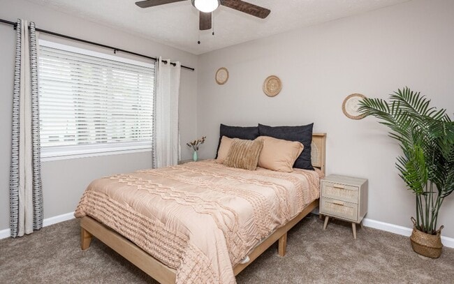
5801 Riverdale Rd
13-0104B-00A-005
Clayton
Gardenaptcourtapt5plusunits
Georgia
X
104
13063C0056F
18.67 AC
2025
Clayton County
2025
Atlanta
040510
Atlanta-Sandy Springs-Roswell, GA
193 SF
DEMOGRAPHICS near 5801 Riverdale Rd
1 Mile
3 Mile
5 Mile
2024 Total Population
15,837
65,819
179,450
2029 Population
15,751
66,223
181,752
Pop Growth 2024-2029
(0.54%)
+ 0.61%
+ 1.28%
Average Age
33
36
36
2024 Total Households
6,722
25,655
67,338
HH Growth 2024-2029
(0.65%)
+ 0.52%
+ 1.32%
Median Household Inc
$41,729
$44,197
$47,748
Avg Household Size
2.30
2.50
2.60
2024 Avg HH Vehicles
1.00
2.00
2.00
Median Home Value
$160,049
$157,464
$162,291
Median Year Built
1987
1983
1980
Nearby Places
Map Layers
Map Styles
 Street
 Aerial
- Restaurants
- Banks
- Shops
- Fitness
- Groceries
PUBLIC TRANSPORTATION
AIRPORT
Hartsfield - Jackson Atlanta International
DRIVE
WALK
Distance
Hartsfield - Jackson Atlanta International
12 min
5.6 mi
Freight Ports
Georgia Ports - Savannah
DRIVE
WALK
Distance
Georgia Ports - Savannah
271 min
240.7 mi
Nearby Properties
Address
Land Use
TOTAL SIZE
Lot Size
Zoning
Address
Land Use
TOTAL SIZE
Lot Size
Zoning
518,648 SF
31.03 AC
MCD
Address
Land Use
TOTAL SIZE
Lot Size
Zoning
274.75 AC
HI
Address
Land Use
TOTAL SIZE
Lot Size
Zoning
28,000 SF
246.83 AC
I
Address
Land Use
TOTAL SIZE
Lot Size
Zoning
229.84 AC
HI
Address
Land Use
TOTAL SIZE
Lot Size
Zoning
115.30 AC
I
Address
Land Use
TOTAL SIZE
Lot Size
Zoning
596 SF
57.40 AC
RM
Address
Land Use
TOTAL SIZE
Lot Size
Zoning
699 SF
44.34 AC
RM
Address
Land Use
TOTAL SIZE
Lot Size
Zoning
1,231,833 SF
15.51 AC
C2
Address
Land Use
TOTAL SIZE
Lot Size
Zoning
4,381,104 SF
26.70 AC
AG1
Address
Land Use
TOTAL SIZE
Lot Size
Zoning
32,000 SF
8.86 AC
C
Address
Land Use
TOTAL SIZE
Lot Size
Zoning
352 SF
32.69 AC
RM
Address
Land Use
TOTAL SIZE
Lot Size
Zoning
71.46 AC
C
Address
Land Use
TOTAL SIZE
Lot Size
Zoning
370 SF
36.20 AC
RM
Address
Land Use
TOTAL SIZE
Lot Size
Zoning
264 SF
24.92 AC
RM
Address
Land Use
TOTAL SIZE
Lot Size
Zoning
3,259,200 SF
17.69 AC
MF
Address
Land Use
TOTAL SIZE
Lot Size
Zoning
4,461,259 SF
18.79 AC
MF
Address
Land Use
TOTAL SIZE
Lot Size
Zoning
212,048 SF
110.06 AC
HI
Address
Land Use
TOTAL SIZE
Lot Size
Zoning
387 SF
32.53 AC
RM
Address
Land Use
TOTAL SIZE
Lot Size
Zoning
96,028 SF
21.02 AC
I
Address
Land Use
TOTAL SIZE
Lot Size
Zoning
216 SF
24.45 AC
RM
Address
Land Use
TOTAL SIZE
Lot Size
Zoning
200 SF
20.71 AC
RM
Address
Land Use
TOTAL SIZE
Lot Size
Zoning
167,008 SF
36.21 AC
HI
Address
Land Use
TOTAL SIZE
Lot Size
Zoning
166,955 SF
5.03 AC
C2
Address
Land Use
TOTAL SIZE
Lot Size
Zoning
178,002 SF
39.88 AC
OI
Address
Land Use
TOTAL SIZE
Lot Size
Zoning
240 SF
28.43 AC
RM
Address
Land Use
TOTAL SIZE
Lot Size
Zoning
45.64 AC
HI
Address
Land Use
TOTAL SIZE
Lot Size
Zoning
422,480 SF
19.42 AC
HI
Address
Land Use
TOTAL SIZE
Lot Size
Zoning
240 SF
27 AC
HI
Address
Land Use
TOTAL SIZE
Lot Size
Zoning
296 SF
27.93 AC
RM
Address
Land Use
TOTAL SIZE
Lot Size
Zoning
9.05 AC
C
The World's #1 Commercial Real Estate Marketplace
Connect with us
© 2026 CoStar Group
The information above has been obtained from sources believed reliable. While we do not doubt its accuracy we have not verified it and make no guarantee, warranty or representation about it. It is your responsibility to independently confirm its accuracy and completeness. Any projections, opinions, assumptions, or estimates used are for example only and do not represent the current or future performance of the property. The value of this transaction to you depends on tax and other factors which should be evaluated by your tax, financial, and legal advisors. You and your advisors should conduct a careful, independent investigation of the property to determine to your satisfaction the suitability of the property for your needs.