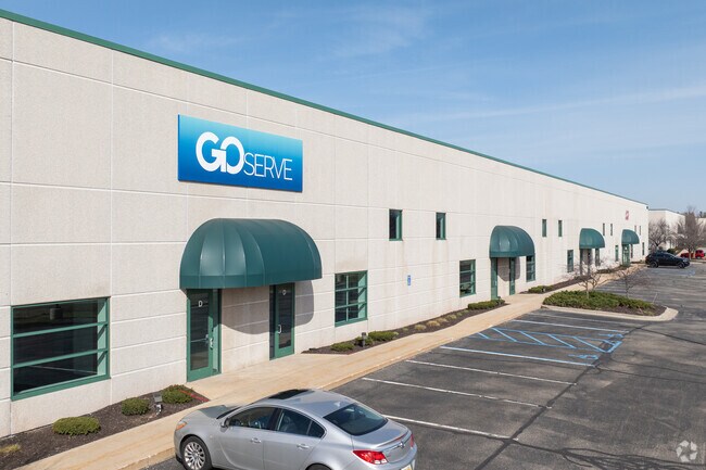
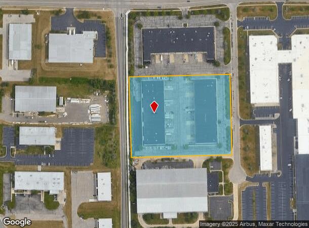
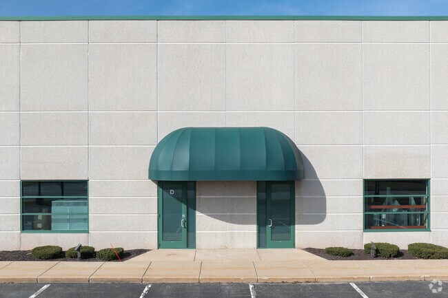
Property Record
5801 Weller Ct Sw, Wyoming, MI 49509
NEARBY LISTINGS FOR SALE OR LEASE
Property Detail
5801 Weller Ct Sw
41-17-35-300-043
411735300043 PART OF SW 1/4 COM AT SW COR OF SEC TH N 1D 27M 58S W ALONG W SEC LINE 1533.43 FT TH N 88D 32M 02S E 40.0 FT E
Commercialnec
Kent
X
Michigan
26005C0125G
5.82 AC
2024
Southwestern Grand Rapids
2025
West Michigan
014505
Grand Rapids-Wyoming, MI
86,400 SF
DEMOGRAPHICS near 5801 Weller Ct Sw
1 Mile
3 Mile
5 Mile
2024 Total Population
3,454
73,406
186,626
2029 Population
3,500
74,406
188,479
Pop Growth 2024-2029
+ 1.33%
+ 1.36%
+ 0.99%
Average Age
40
38
38
2024 Total Households
1,306
28,218
69,659
HH Growth 2024-2029
+ 1.30%
+ 1.36%
+ 1.02%
Median Household Inc
$69,255
$67,609
$67,541
Avg Household Size
2.60
2.50
2.60
2024 Avg HH Vehicles
2.00
2.00
2.00
Median Home Value
$245,137
$212,592
$216,592
Median Year Built
1994
1984
1977
Nearby Places
Map Layers
Map Styles
 Street
 Aerial
- Restaurants
- Banks
- Shops
- Fitness
- Groceries
PUBLIC TRANSPORTATION
COMMUTER RAIL
DRIVE
WALK
Distance
13 min
8.6 mi
AIRPORT
Gerald R Ford International
DRIVE
WALK
Distance
Gerald R Ford International
21 min
10.0 mi
SALE & LEASE HISTORY
LISTING DATE
SALE/LEASE

Nov 16, 2020
For Lease
Jan 16, 2021
For Lease
Feb 23, 2024
For Lease
Apr 24, 2020
For Lease
Nearby Properties
Address
Land Use
TOTAL SIZE
Lot Size
Zoning
Address
Land Use
TOTAL SIZE
Lot Size
Zoning
290,627 SF
Address
Land Use
TOTAL SIZE
Lot Size
Zoning
899,034 SF
78.93 AC
B1
Address
Land Use
TOTAL SIZE
Lot Size
Zoning
17,165 SF
33.12 AC
PUD3
Address
Land Use
TOTAL SIZE
Lot Size
Zoning
560,062 SF
55.39 AC
R4
Address
Land Use
TOTAL SIZE
Lot Size
Zoning
295,027 SF
51.42 AC
I3
Address
Land Use
TOTAL SIZE
Lot Size
Zoning
63,788 SF
124.62 AC
D1
Address
Land Use
TOTAL SIZE
Lot Size
Zoning
307,361 SF
16.60 AC
R1-A
Address
Land Use
TOTAL SIZE
Lot Size
Zoning
487,739 SF
73.87 AC
RR
Address
Land Use
TOTAL SIZE
Lot Size
Zoning
26.94 AC
Address
Land Use
TOTAL SIZE
Lot Size
Zoning
Address
Land Use
TOTAL SIZE
Lot Size
Zoning
38.98 AC
PUD-PL UNI
Address
Land Use
TOTAL SIZE
Lot Size
Zoning
112,040 SF
9.69 AC
PUD3
Address
Land Use
TOTAL SIZE
Lot Size
Zoning
Address
Land Use
TOTAL SIZE
Lot Size
Zoning
13.53 AC
R1-A
Address
Land Use
TOTAL SIZE
Lot Size
Zoning
386,450 SF
29.10 AC
Address
Land Use
TOTAL SIZE
Lot Size
Zoning
264,739 SF
26.56 AC
I2
Address
Land Use
TOTAL SIZE
Lot Size
Zoning
465,772 SF
61.95 AC
I1
Address
Land Use
TOTAL SIZE
Lot Size
Zoning
206,562 SF
15.12 AC
R1
Address
Land Use
TOTAL SIZE
Lot Size
Zoning
22.35 AC
Address
Land Use
TOTAL SIZE
Lot Size
Zoning
191,331 SF
9.20 AC
PUD1
Address
Land Use
TOTAL SIZE
Lot Size
Zoning
179,436 SF
24.94 AC
I2
Address
Land Use
TOTAL SIZE
Lot Size
Zoning
212,353 SF
16.52 AC
R4
Address
Land Use
TOTAL SIZE
Lot Size
Zoning
20.30 AC
Address
Land Use
TOTAL SIZE
Lot Size
Zoning
128,872 SF
7.32 AC
PUD3
Address
Land Use
TOTAL SIZE
Lot Size
Zoning
20.50 AC
RR
Address
Land Use
TOTAL SIZE
Lot Size
Zoning
Address
Land Use
TOTAL SIZE
Lot Size
Zoning
Address
Land Use
TOTAL SIZE
Lot Size
Zoning
179,056 SF
17.75 AC
PUD1
Address
Land Use
TOTAL SIZE
Lot Size
Zoning
349,885 SF
8.92 AC
I1
Address
Land Use
TOTAL SIZE
Lot Size
Zoning
31,658 SF
2.47 AC
PUD3
The World's #1 Commercial Real Estate Marketplace
Connect with us
© 2025 CoStar Group
The information above has been obtained from sources believed reliable. While we do not doubt its accuracy we have not verified it and make no guarantee, warranty or representation about it. It is your responsibility to independently confirm its accuracy and completeness. Any projections, opinions, assumptions, or estimates used are for example only and do not represent the current or future performance of the property. The value of this transaction to you depends on tax and other factors which should be evaluated by your tax, financial, and legal advisors. You and your advisors should conduct a careful, independent investigation of the property to determine to your satisfaction the suitability of the property for your needs.