Property Record
5802 1 Ave N, Brooklyn, NY 11220

NEARBY LISTINGS FOR SALE OR LEASE
-
-
-
-
-
-
-
No Photo
-
-
-
-
-
-
-
View all Brooklyn listings for sale on LoopNet.com
Property Detail
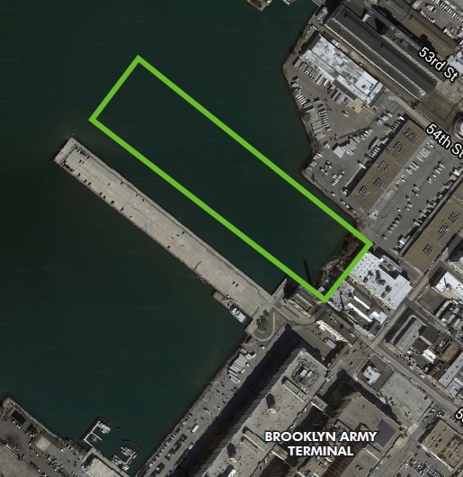
5802 1 Ave N
00827-0020
DOCID-2021110101089001
Commercialnec
Kings
VE
New York
3604970194F
20
2024
9.88 AC
2025
South Brooklyn
010200
Long Island (New York)
95,600 SF
New York-Jersey City-White Plains, NY-NJ
DEMOGRAPHICS near 5802 1 Ave N
1 mile
3 mile
5 mile
2024 Total Population
70,654
525,401
1,752,246
2029 Population
63,890
483,878
1,651,869
Pop Growth 2024-2029
(9.57%)
(7.90%)
(5.73%)
Average Age
39
38
39
2024 Total Households
22,516
178,598
653,185
HH Growth 2024-2029
(9.73%)
(8.16%)
(5.93%)
Median Household Inc
$62,552
$73,364
$79,154
Avg Household Size
3.00
2.80
2.60
2024 Avg HH Vehicles
.00
1.00
1.00
Median Home Value
$818,697
$1,003,611
$869,759
Median Year Built
1947
1947
1948
Nearby Places
Map Layers
Map Styles
 Street
 Aerial
Transit
 Traffic
 Biking
Places
Listings with unknown addresses are not visible on the map
- Restaurants
- Banks
- Shops
- Fitness
- Groceries
PUBLIC TRANSPORTATION
TRANSIT/SUBWAY
59 Street (N,R Line) (N - New York MTA Subway (The Subway), R - New York MTA Subway (The Subway))
Drive
Walk
Distance
59 Street (N,R Line) (N - New York MTA Subway (The Subway), R - New York MTA Subway (The Subway))
6 min
15 min
0.8 mi
53 Street (N - New York MTA Subway (The Subway), R - New York MTA Subway (The Subway))
Drive
Walk
Distance
53 Street (N - New York MTA Subway (The Subway), R - New York MTA Subway (The Subway))
6 min
19 min
1.0 mi
COMMUTER RAIL
Tompkinsville (Staten Island Railway - New York MTA Subway (The Subway))
Drive
Walk
Distance
Tompkinsville (Staten Island Railway - New York MTA Subway (The Subway))
21 min
8.4 mi
St George (Staten Island Railway - New York MTA Subway (The Subway))
Drive
Walk
Distance
St George (Staten Island Railway - New York MTA Subway (The Subway))
23 min
9.0 mi
AIRPORT
LaGuardia
Drive
Walk
Distance
LaGuardia
32 min
15.9 mi
John F Kennedy International
Drive
Walk
Distance
John F Kennedy International
34 min
16.2 mi
Newark Liberty International
Drive
Walk
Distance
Newark Liberty International
36 min
19.4 mi
Freight Ports
NY - Red Hook Container Terminal
Drive
Walk
Distance
NY - Red Hook Container Terminal
12 min
4.8 mi
SALE & LEASE HISTORY
LISTING DATE
SALE/LEASE

Sep 24, 2016
For Sale
Nearby Properties
Address
Land Use
TOTAL SIZE
Lot Size
Zoning
Address
Land Use
TOTAL SIZE
Lot Size
Zoning
92,440 SF
466.23 AC
R5
Address
Land Use
TOTAL SIZE
Lot Size
Zoning
2,542,066 SF
174.49 AC
R3-2
Address
Land Use
TOTAL SIZE
Lot Size
Zoning
1,524,659 SF
170.96 AC
R4
Address
Land Use
TOTAL SIZE
Lot Size
Zoning
577,381 SF
3.19 AC
R6
Address
Land Use
TOTAL SIZE
Lot Size
Zoning
902,000 SF
6.44 AC
M3-1
Address
Land Use
TOTAL SIZE
Lot Size
Zoning
63.35 AC
Address
Land Use
TOTAL SIZE
Lot Size
Zoning
460,000 SF
3.21 AC
R6
Address
Land Use
TOTAL SIZE
Lot Size
Zoning
305,093 SF
0.60 AC
C1-9
Address
Land Use
TOTAL SIZE
Lot Size
Zoning
335,800 SF
1.51 AC
R6
Address
Land Use
TOTAL SIZE
Lot Size
Zoning
340,837 SF
0.61 AC
C1-9
Address
Land Use
TOTAL SIZE
Lot Size
Zoning
1,324,592 SF
5.13 AC
M3-1
Address
Land Use
TOTAL SIZE
Lot Size
Zoning
30.92 AC
Address
Land Use
TOTAL SIZE
Lot Size
Zoning
397,354 SF
0.61 AC
C5-2
Address
Land Use
TOTAL SIZE
Lot Size
Zoning
340,068 SF
0.58 AC
C2-8
Address
Land Use
TOTAL SIZE
Lot Size
Zoning
340,068 SF
0.58 AC
C2-8
Address
Land Use
TOTAL SIZE
Lot Size
Zoning
427,208 SF
1.30 AC
R6
Address
Land Use
TOTAL SIZE
Lot Size
Zoning
Address
Land Use
TOTAL SIZE
Lot Size
Zoning
537,885 SF
2.98 AC
R8
Address
Land Use
TOTAL SIZE
Lot Size
Zoning
393,092 SF
1.07 AC
R8A
Address
Land Use
TOTAL SIZE
Lot Size
Zoning
450,503 SF
1.85 AC
R8
Address
Land Use
TOTAL SIZE
Lot Size
Zoning
371,139 SF
3.22 AC
R5
Address
Land Use
TOTAL SIZE
Lot Size
Zoning
5,359,400 SF
59.07 AC
M2-1
Address
Land Use
TOTAL SIZE
Lot Size
Zoning
25.67 AC
Address
Land Use
TOTAL SIZE
Lot Size
Zoning
286,000 SF
12.63 AC
PARK
Address
Land Use
TOTAL SIZE
Lot Size
Zoning
1,785,288 SF
22.38 AC
M2-1
Address
Land Use
TOTAL SIZE
Lot Size
Zoning
370,248 SF
0.52 AC
C1-9
Address
Land Use
TOTAL SIZE
Lot Size
Zoning
418,000 SF
0.78 AC
R10A
Address
Land Use
TOTAL SIZE
Lot Size
Zoning
3,970,000 SF
91.14 AC
M3-1
Address
Land Use
TOTAL SIZE
Lot Size
Zoning
1,466,751 SF
24.79 AC
R5
Address
Land Use
TOTAL SIZE
Lot Size
Zoning
689,850 SF
3.08 AC
M3-1
The World's #1 Commercial Real Estate Marketplace
Connect with us
© 2026 CoStar Group
The information above has been obtained from sources believed reliable. While we do not doubt its accuracy we have not verified it and make no guarantee, warranty or representation about it. It is your responsibility to independently confirm its accuracy and completeness. Any projections, opinions, assumptions, or estimates used are for example only and do not represent the current or future performance of the property. The value of this transaction to you depends on tax and other factors which should be evaluated by your tax, financial, and legal advisors. You and your advisors should conduct a careful, independent investigation of the property to determine to your satisfaction the suitability of the property for your needs.