Property Record
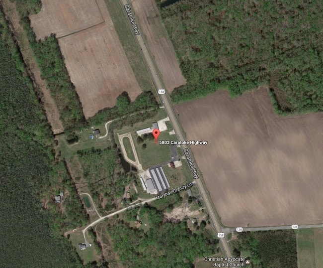
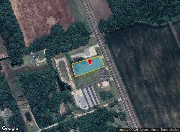
5802 Caratoke Hwy, Poplar Branch, NC 27965
NEARBY LISTINGS FOR SALE OR LEASE
-
-
View all Poplar Branch listings for sale on LoopNet.com
Property Detail
5802 Caratoke Hwy
Virginia Beach-Norfolk-Newport News, VA-NC
BERTHA COMMERCIAL LOT 2
0084-000-016D-0000
Currituck
Commercialacreage
North Carolina
X
2
3720990200K
1 AC
2025
Currituck County
2025
Hampton Roads
110404
DEMOGRAPHICS near 5802 Caratoke Hwy
1 Mile
3 Mile
5 Mile
2024 Total Population
105
1,976
4,581
2029 Population
133
2,506
5,841
Pop Growth 2024-2029
+ 26.67%
+ 26.82%
+ 27.50%
Average Age
42
43
44
2024 Total Households
40
783
1,862
HH Growth 2024-2029
+ 27.50%
+ 26.82%
+ 27.60%
Median Household Inc
$71,249
$66,104
$67,748
Avg Household Size
2.60
2.50
2.50
2024 Avg HH Vehicles
2.00
2.00
2.00
Median Home Value
$279,166
$260,351
$248,855
Median Year Built
1994
1991
1991
Nearby Places
Map Layers
Map Styles
 Street
 Aerial
- Restaurants
- Banks
- Shops
- Fitness
- Groceries
SALE & LEASE HISTORY
LISTING DATE
SALE/LEASE

Sep 24, 2016
For Sale
Nearby Properties
Address
Land Use
TOTAL SIZE
Lot Size
Zoning
Address
Land Use
TOTAL SIZE
Lot Size
Zoning
81,355 SF
12 AC
SFM
Address
Land Use
TOTAL SIZE
Lot Size
Zoning
616.40 AC
Address
Land Use
TOTAL SIZE
Lot Size
Zoning
743.18 AC
GB
Address
Land Use
TOTAL SIZE
Lot Size
Zoning
5,530 SF
27.23 AC
SFM
Address
Land Use
TOTAL SIZE
Lot Size
Zoning
394 AC
GB
Address
Land Use
TOTAL SIZE
Lot Size
Zoning
3,352 SF
76.23 AC
SFM
Address
Land Use
TOTAL SIZE
Lot Size
Zoning
3,080 SF
92.03 AC
AG
Address
Land Use
TOTAL SIZE
Lot Size
Zoning
1,600 SF
4.19 AC
GB
Address
Land Use
TOTAL SIZE
Lot Size
Zoning
1,542 SF
12.14 AC
GB
Address
Land Use
TOTAL SIZE
Lot Size
Zoning
11,064 SF
3.30 AC
SFM
Address
Land Use
TOTAL SIZE
Lot Size
Zoning
321.76 AC
AG
Address
Land Use
TOTAL SIZE
Lot Size
Zoning
9,831 SF
1.85 AC
GB
Address
Land Use
TOTAL SIZE
Lot Size
Zoning
8,450 SF
9.09 AC
GB
Address
Land Use
TOTAL SIZE
Lot Size
Zoning
2,268 SF
4.15 AC
GB
Address
Land Use
TOTAL SIZE
Lot Size
Zoning
3,087 SF
0.92 AC
SFM
Address
Land Use
TOTAL SIZE
Lot Size
Zoning
1,758 SF
1.89 AC
GB
Address
Land Use
TOTAL SIZE
Lot Size
Zoning
51.26 AC
SFM
Address
Land Use
TOTAL SIZE
Lot Size
Zoning
3,253 SF
0.93 AC
SFM
Address
Land Use
TOTAL SIZE
Lot Size
Zoning
24.75 AC
GB
Address
Land Use
TOTAL SIZE
Lot Size
Zoning
3,363 SF
0.92 AC
SFM
Address
Land Use
TOTAL SIZE
Lot Size
Zoning
3,690 SF
3 AC
SFM
Address
Land Use
TOTAL SIZE
Lot Size
Zoning
4,758 SF
1.31 AC
GB
Address
Land Use
TOTAL SIZE
Lot Size
Zoning
4,245 SF
0.47 AC
AG
Address
Land Use
TOTAL SIZE
Lot Size
Zoning
13,500 SF
7.20 AC
GB
Address
Land Use
TOTAL SIZE
Lot Size
Zoning
3,586 SF
0.53 AC
SFM
Address
Land Use
TOTAL SIZE
Lot Size
Zoning
6,141 SF
1.91 AC
GB
Address
Land Use
TOTAL SIZE
Lot Size
Zoning
600 SF
24.87 AC
GB
Address
Land Use
TOTAL SIZE
Lot Size
Zoning
3,848 SF
0.92 AC
SFM
Address
Land Use
TOTAL SIZE
Lot Size
Zoning
148.71 AC
AG
Address
Land Use
TOTAL SIZE
Lot Size
Zoning
2,688 SF
22.95 AC
GB
The World's #1 Commercial Real Estate Marketplace
Connect with us
© 2025 CoStar Group
The information above has been obtained from sources believed reliable. While we do not doubt its accuracy we have not verified it and make no guarantee, warranty or representation about it. It is your responsibility to independently confirm its accuracy and completeness. Any projections, opinions, assumptions, or estimates used are for example only and do not represent the current or future performance of the property. The value of this transaction to you depends on tax and other factors which should be evaluated by your tax, financial, and legal advisors. You and your advisors should conduct a careful, independent investigation of the property to determine to your satisfaction the suitability of the property for your needs.