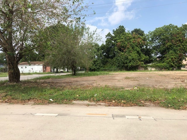
Property Record
5804 Hardy St, Houston, TX 77009

NEARBY LISTINGS FOR SALE OR LEASE
Property Detail
5804 Hardy St
0641370060008
Pinewood Court
Vacantlandnec
TRS 7 & 8 BLK 206 PINEWOOD COURT
X
Harris
48201C0690N
Texas
2024
0.12 AC
2025
I-10 East
210500
Houston
1,012 SF
Houston-Pasadena-The Woodlands, TX
DEMOGRAPHICS near 5804 Hardy St
1 mile
3 mile
5 mile
2024 Total Population
13,168
136,334
398,148
2029 Population
13,537
141,048
412,175
Pop Growth 2024-2029
+ 2.80%
+ 3.46%
+ 3.52%
Average Age
39
37
37
2024 Total Households
4,622
50,716
158,129
HH Growth 2024-2029
+ 2.75%
+ 3.55%
+ 3.84%
Median Household Inc
$42,580
$45,205
$62,649
Avg Household Size
2.80
2.60
2.40
2024 Avg HH Vehicles
2.00
2.00
2.00
Median Home Value
$212,784
$240,542
$303,026
Median Year Built
1952
1961
1979
Nearby Places
Map Layers
Map Styles
 Street
 Aerial
Transit
 Traffic
 Biking
Places
Listings with unknown addresses are not visible on the map
- Restaurants
- Banks
- Shops
- Fitness
- Groceries
PUBLIC TRANSPORTATION
COMMUTER RAIL
Drive
Walk
Distance
9 min
4.5 mi
AIRPORT
George Bush Intcntl/Houston
Drive
Walk
Distance
George Bush Intcntl/Houston
19 min
15.5 mi
William P Hobby
Drive
Walk
Distance
William P Hobby
30 min
16.6 mi
Freight Ports
Port of Houston
Drive
Walk
Distance
Port of Houston
18 min
11.0 mi
SALE & LEASE HISTORY
LISTING DATE
SALE/LEASE

May 07, 2024
For Sale
Mar 01, 2022
For Sale
Dec 09, 2020
For Sale
Aug 28, 2019
For Sale
Nearby Properties
Address
Land Use
TOTAL SIZE
Lot Size
Zoning
Address
Land Use
TOTAL SIZE
Lot Size
Zoning
474,326 SF
43.16 AC
Address
Land Use
TOTAL SIZE
Lot Size
Zoning
314,489 SF
1.84 AC
Address
Land Use
TOTAL SIZE
Lot Size
Zoning
587,156 SF
4.40 AC
Address
Land Use
TOTAL SIZE
Lot Size
Zoning
263,475 SF
7.90 AC
Address
Land Use
TOTAL SIZE
Lot Size
Zoning
186,808 SF
4.73 AC
Address
Land Use
TOTAL SIZE
Lot Size
Zoning
198,770 SF
2.10 AC
Address
Land Use
TOTAL SIZE
Lot Size
Zoning
276,332 SF
6.05 AC
Address
Land Use
TOTAL SIZE
Lot Size
Zoning
498,726 SF
4.97 AC
Address
Land Use
TOTAL SIZE
Lot Size
Zoning
302,826 SF
2.87 AC
Address
Land Use
TOTAL SIZE
Lot Size
Zoning
545,628 SF
19.41 AC
Address
Land Use
TOTAL SIZE
Lot Size
Zoning
224,741 SF
10.75 AC
Address
Land Use
TOTAL SIZE
Lot Size
Zoning
213,548 SF
16.98 AC
Address
Land Use
TOTAL SIZE
Lot Size
Zoning
200,902 SF
4.36 AC
Address
Land Use
TOTAL SIZE
Lot Size
Zoning
188,582 SF
17.94 AC
Address
Land Use
TOTAL SIZE
Lot Size
Zoning
64,521 SF
3.91 AC
Address
Land Use
TOTAL SIZE
Lot Size
Zoning
110,721 SF
0.94 AC
Address
Land Use
TOTAL SIZE
Lot Size
Zoning
171,166 SF
6.87 AC
Address
Land Use
TOTAL SIZE
Lot Size
Zoning
304,925 SF
10.91 AC
Address
Land Use
TOTAL SIZE
Lot Size
Zoning
66,588 SF
3.95 AC
Address
Land Use
TOTAL SIZE
Lot Size
Zoning
10.70 AC
Address
Land Use
TOTAL SIZE
Lot Size
Zoning
257,748 SF
10.70 AC
Address
Land Use
TOTAL SIZE
Lot Size
Zoning
177,720 SF
14.96 AC
Address
Land Use
TOTAL SIZE
Lot Size
Zoning
234,016 SF
7.75 AC
Address
Land Use
TOTAL SIZE
Lot Size
Zoning
81,552 SF
1.75 AC
Address
Land Use
TOTAL SIZE
Lot Size
Zoning
96,091 SF
5.41 AC
Address
Land Use
TOTAL SIZE
Lot Size
Zoning
89,184 SF
6.89 AC
Address
Land Use
TOTAL SIZE
Lot Size
Zoning
55,517 SF
13 AC
Address
Land Use
TOTAL SIZE
Lot Size
Zoning
113,014 SF
3.50 AC
Address
Land Use
TOTAL SIZE
Lot Size
Zoning
15,917 SF
15.07 AC
Address
Land Use
TOTAL SIZE
Lot Size
Zoning
82,951 SF
21.32 AC
The World's #1 Commercial Real Estate Marketplace
Connect with us
© 2026 CoStar Group
The information above has been obtained from sources believed reliable. While we do not doubt its accuracy we have not verified it and make no guarantee, warranty or representation about it. It is your responsibility to independently confirm its accuracy and completeness. Any projections, opinions, assumptions, or estimates used are for example only and do not represent the current or future performance of the property. The value of this transaction to you depends on tax and other factors which should be evaluated by your tax, financial, and legal advisors. You and your advisors should conduct a careful, independent investigation of the property to determine to your satisfaction the suitability of the property for your needs.