Property Record
5807 Main St, Springfield, OR 97478
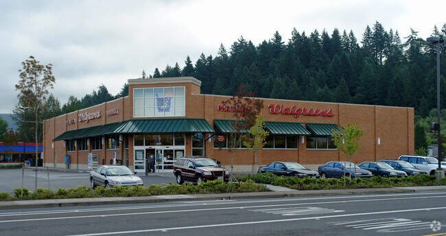

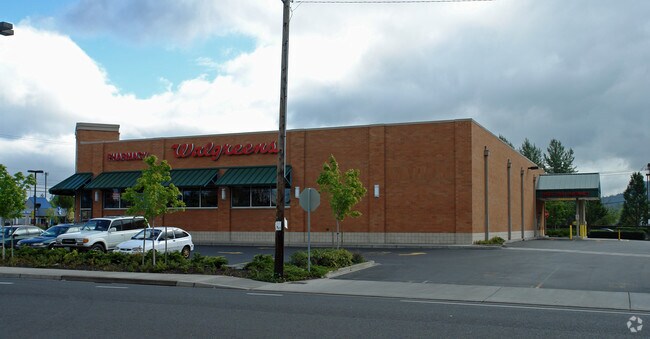

Property Detail
5807 Main St
Eugene-Springfield, OR
TL 03700
1371614
Lane
Commercialbuilding
Oregon
CC
3700
B and X Area of moderate flood hazard, usually the area between the limits of the 100-year and 500-year floods.
0.72 AC
2025
Lane County
2025
Portland
001801
NEARBY LISTINGS FOR SALE OR LEASE
DEMOGRAPHICS near 5807 Main St
1 mile
3 mile
5 mile
2025 Total Population
12,229
32,401
58,183
2030 Population
12,075
32,073
57,603
Pop Growth 2025-2030
(1.26%)
(1.01%)
(1.00%)
Average Age
41
40
41
2025 Total Households
4,672
11,978
22,655
HH Growth 2025-2030
(1.48%)
(1.12%)
(1.08%)
Median Household Inc
$69,753
$79,033
$75,962
Avg Household Size
2.50
2.60
2.50
2025 Avg HH Vehicles
2.00
2.00
2.00
Median Home Value
$343,488
$375,331
$382,326
Median Year Built
1978
1978
1974
Nearby Places
Map Layers
Map Styles
 Street
 Aerial
Layers
 Traffic
 Biking
Places
Listings with unknown addresses are not visible on the map
- Restaurants
- Banks
- Shops
- Fitness
- Groceries
PUBLIC TRANSPORTATION
COMMUTER RAIL
Eugene (Amtrak Cascades - Amtrak, Coast Starlight - Amtrak)
Drive
Walk
Distance
Eugene (Amtrak Cascades - Amtrak, Coast Starlight - Amtrak)
13 min
9.4 mi
AIRPORT
Mahlon Sweet Field
Drive
Walk
Distance
Mahlon Sweet Field
28 min
17.9 mi
Freight Ports
Port of Coos Bay, OR
Drive
Walk
Distance
Port of Coos Bay, OR
163 min
117.9 mi
Nearby Properties
Address
Land Use
TOTAL SIZE
Lot Size
Zoning
Address
Land Use
TOTAL SIZE
Lot Size
Zoning
Address
Land Use
TOTAL SIZE
Lot Size
Zoning
179 AC
E30
Address
Land Use
TOTAL SIZE
Lot Size
Zoning
50.28 AC
LD
Address
Land Use
TOTAL SIZE
Lot Size
Zoning
27.44 AC
LD
Address
Land Use
TOTAL SIZE
Lot Size
Zoning
Address
Land Use
TOTAL SIZE
Lot Size
Zoning
11.12 AC
HI
Address
Land Use
TOTAL SIZE
Lot Size
Zoning
9.19 AC
E25
Address
Land Use
TOTAL SIZE
Lot Size
Zoning
5.39 AC
LD
Address
Land Use
TOTAL SIZE
Lot Size
Zoning
3.58 AC
HD
Address
Land Use
TOTAL SIZE
Lot Size
Zoning
13.84 AC
HD
Address
Land Use
TOTAL SIZE
Lot Size
Zoning
9.23 AC
LD
Address
Land Use
TOTAL SIZE
Lot Size
Zoning
18.70 AC
E30
Address
Land Use
TOTAL SIZE
Lot Size
Zoning
7.78 AC
LD
Address
Land Use
TOTAL SIZE
Lot Size
Zoning
5.88 AC
LD
Address
Land Use
TOTAL SIZE
Lot Size
Zoning
119.04 AC
E30
Address
Land Use
TOTAL SIZE
Lot Size
Zoning
5.14 AC
LD
Address
Land Use
TOTAL SIZE
Lot Size
Zoning
4.47 AC
CC
Address
Land Use
TOTAL SIZE
Lot Size
Zoning
5.09 AC
LD
Address
Land Use
TOTAL SIZE
Lot Size
Zoning
3.92 AC
CC
Address
Land Use
TOTAL SIZE
Lot Size
Zoning
8.06 AC
HD
Address
Land Use
TOTAL SIZE
Lot Size
Zoning
7.79 AC
E30
Address
Land Use
TOTAL SIZE
Lot Size
Zoning
6.58 AC
LD
Address
Land Use
TOTAL SIZE
Lot Size
Zoning
9.93 AC
LD
Address
Land Use
TOTAL SIZE
Lot Size
Zoning
32.97 AC
E30
Address
Land Use
TOTAL SIZE
Lot Size
Zoning
3.49 AC
HI
Address
Land Use
TOTAL SIZE
Lot Size
Zoning
46.87 AC
E30
Address
Land Use
TOTAL SIZE
Lot Size
Zoning
5.40 AC
HI
Address
Land Use
TOTAL SIZE
Lot Size
Zoning
2.20 AC
HD
Address
Land Use
TOTAL SIZE
Lot Size
Zoning
5.63 AC
LD
Address
Land Use
TOTAL SIZE
Lot Size
Zoning
3.28 AC
CC
The World's #1 Commercial Real Estate Marketplace
Connect with us
© 2026 CoStar Group
The information above has been obtained from sources believed reliable. While we do not doubt its accuracy we have not verified it and make no guarantee, warranty or representation about it. It is your responsibility to independently confirm its accuracy and completeness. Any projections, opinions, assumptions, or estimates used are for example only and do not represent the current or future performance of the property. The value of this transaction to you depends on tax and other factors which should be evaluated by your tax, financial, and legal advisors. You and your advisors should conduct a careful, independent investigation of the property to determine to your satisfaction the suitability of the property for your needs.