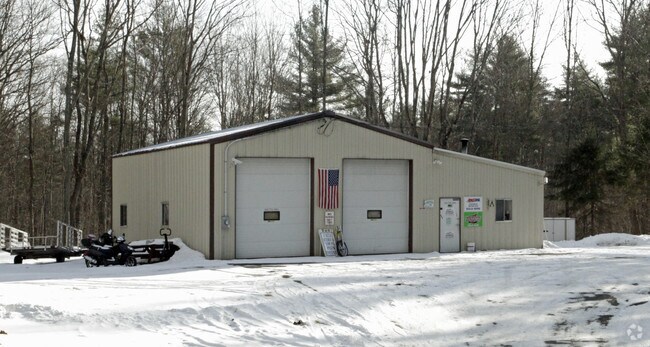
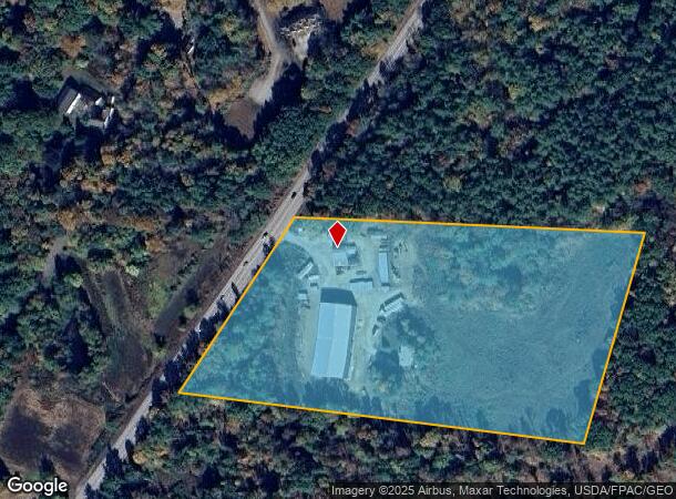
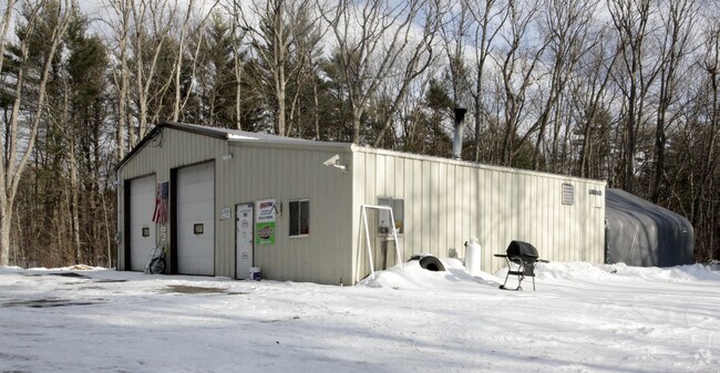
Property Record
581 Calef Hwy, Epping, NH 03042
NEARBY LISTINGS FOR SALE OR LEASE
Property Detail
581 Calef Hwy
EPPI-000005-000029-000001
Rockingham
Sfr
New Hampshire
A
1
33015C0210F
12 AC
2024
Rockingham
2024
Boston
059000
Boston-Cambridge-Newton, MA-NH
1,344 SF
DEMOGRAPHICS near 581 Calef Hwy
1 mile
3 mile
5 mile
2024 Total Population
293
6,494
21,207
2029 Population
304
6,729
21,971
Pop Growth 2024-2029
+ 3.75%
+ 3.62%
+ 3.60%
Average Age
43
43
42
2024 Total Households
112
2,514
8,344
HH Growth 2024-2029
+ 3.57%
+ 3.62%
+ 3.58%
Median Household Inc
$114,166
$107,792
$103,727
Avg Household Size
2.60
2.60
2.50
2024 Avg HH Vehicles
2.00
2.00
2.00
Median Home Value
$428,571
$425,516
$404,025
Median Year Built
1988
1989
1986
Nearby Places
Map Layers
Map Styles
 Street
 Aerial
Transit
 Traffic
 Biking
Places
Listings with unknown addresses are not visible on the map
- Restaurants
- Banks
- Shops
- Fitness
- Groceries
PUBLIC TRANSPORTATION
COMMUTER RAIL
Drive
Walk
Distance
16 min
9.7 mi
AIRPORT
Portsmouth International at Pease
Drive
Walk
Distance
Portsmouth International at Pease
32 min
19.6 mi
Manchester Boston Regional
Drive
Walk
Distance
Manchester Boston Regional
45 min
30.2 mi
Freight Ports
Portland, ME
Drive
Walk
Distance
Portland, ME
91 min
71.9 mi
Nearby Properties
Address
Land Use
TOTAL SIZE
Lot Size
Zoning
Address
Land Use
TOTAL SIZE
Lot Size
Zoning
149,874 SF
23 AC
HDR
Address
Land Use
TOTAL SIZE
Lot Size
Zoning
Address
Land Use
TOTAL SIZE
Lot Size
Zoning
25,960 SF
4.86 AC
HC
Address
Land Use
TOTAL SIZE
Lot Size
Zoning
53,502 SF
HDR
Address
Land Use
TOTAL SIZE
Lot Size
Zoning
34,128 SF
6.42 AC
HDR
Address
Land Use
TOTAL SIZE
Lot Size
Zoning
1,056 SF
27.36 AC
HC
Address
Land Use
TOTAL SIZE
Lot Size
Zoning
77,724 SF
3.90 AC
IC
Address
Land Use
TOTAL SIZE
Lot Size
Zoning
13,624 SF
6.49 AC
IC
Address
Land Use
TOTAL SIZE
Lot Size
Zoning
77,568 SF
2.02 AC
IC
Address
Land Use
TOTAL SIZE
Lot Size
Zoning
1,323 SF
93.62 AC
RES
Address
Land Use
TOTAL SIZE
Lot Size
Zoning
6,756 SF
17.23 AC
RES
Address
Land Use
TOTAL SIZE
Lot Size
Zoning
23,320 SF
8.46 AC
HC
Address
Land Use
TOTAL SIZE
Lot Size
Zoning
17,256 SF
2.73 AC
RES
Address
Land Use
TOTAL SIZE
Lot Size
Zoning
6,000 SF
6.20 AC
HC
Address
Land Use
TOTAL SIZE
Lot Size
Zoning
480 SF
58 AC
R
Address
Land Use
TOTAL SIZE
Lot Size
Zoning
6,637 SF
18.88 AC
HC
Address
Land Use
TOTAL SIZE
Lot Size
Zoning
9,135 SF
81.98 AC
RES
Address
Land Use
TOTAL SIZE
Lot Size
Zoning
5,232 SF
6.90 AC
RA - R
Address
Land Use
TOTAL SIZE
Lot Size
Zoning
27,680 SF
4.76 AC
HC
Address
Land Use
TOTAL SIZE
Lot Size
Zoning
11,432 SF
2.23 AC
HC
Address
Land Use
TOTAL SIZE
Lot Size
Zoning
3,972 SF
2.16 AC
HC
Address
Land Use
TOTAL SIZE
Lot Size
Zoning
6,148 SF
37 AC
RES
Address
Land Use
TOTAL SIZE
Lot Size
Zoning
5,035 SF
3.88 AC
HC
Address
Land Use
TOTAL SIZE
Lot Size
Zoning
920 SF
77 AC
RES
Address
Land Use
TOTAL SIZE
Lot Size
Zoning
2,836 SF
1.66 AC
HDR
Address
Land Use
TOTAL SIZE
Lot Size
Zoning
4,765 SF
3.86 AC
B3
Address
Land Use
TOTAL SIZE
Lot Size
Zoning
2,584 SF
0.99 AC
IC
Address
Land Use
TOTAL SIZE
Lot Size
Zoning
10,412 SF
4.24 AC
HC
Address
Land Use
TOTAL SIZE
Lot Size
Zoning
4,075 SF
114.14 AC
RES
Address
Land Use
TOTAL SIZE
Lot Size
Zoning
3,013 SF
200.63 AC
RES
The World's #1 Commercial Real Estate Marketplace
Connect with us
© 2026 CoStar Group
The information above has been obtained from sources believed reliable. While we do not doubt its accuracy we have not verified it and make no guarantee, warranty or representation about it. It is your responsibility to independently confirm its accuracy and completeness. Any projections, opinions, assumptions, or estimates used are for example only and do not represent the current or future performance of the property. The value of this transaction to you depends on tax and other factors which should be evaluated by your tax, financial, and legal advisors. You and your advisors should conduct a careful, independent investigation of the property to determine to your satisfaction the suitability of the property for your needs.