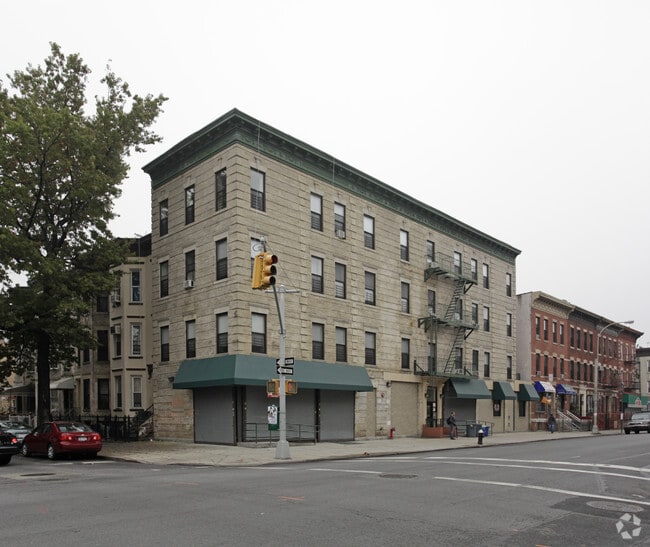
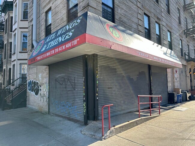
Property Record
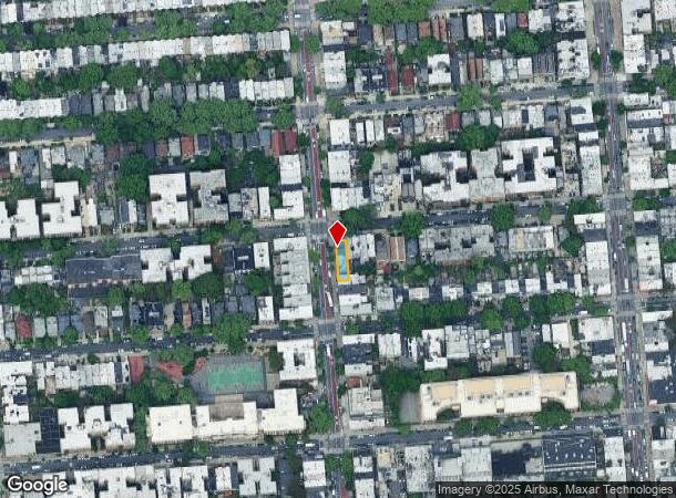
581 Rogers Ave, Brooklyn, NY 11225
NEARBY LISTINGS FOR SALE OR LEASE
Property Detail
581 Rogers Ave
05047-0006
DOCID-2015100400056002ADDL BLK-LOT: 5128-1, 5212-43
Commercialofficeresidentialmixeduse
Kings
X
New York
3604970212F
6
2024
0.06 AC
2025
North Brooklyn
080200
Long Island (New York)
9,030 SF
New York-Jersey City-White Plains, NY-NJ
DEMOGRAPHICS near 581 Rogers Ave
1 Mile
3 Mile
5 Mile
2024 Total Population
179,301
1,302,973
2,654,137
2029 Population
171,583
1,225,520
2,475,914
Pop Growth 2024-2029
(4.30%)
(5.94%)
(6.71%)
Average Age
40
38
39
2024 Total Households
68,529
478,750
984,653
HH Growth 2024-2029
(4.67%)
(6.30%)
(7.02%)
Median Household Inc
$67,321
$70,668
$70,702
Avg Household Size
2.50
2.60
2.60
2024 Avg HH Vehicles
.00
.00
1.00
Median Home Value
$811,933
$870,963
$846,075
Median Year Built
1947
1948
1948
Nearby Places
Map Layers
Map Styles
 Street
 Aerial
- Restaurants
- Banks
- Shops
- Fitness
- Groceries
PUBLIC TRANSPORTATION
TRANSIT/SUBWAY
Winthrop Street (2 - New York MTA Subway (The Subway), 5 - New York MTA Subway (The Subway))
DRIVE
WALK
Distance
Winthrop Street (2 - New York MTA Subway (The Subway), 5 - New York MTA Subway (The Subway))
1 min
4 min
0.2 mi
Sterling Street (2 - New York MTA Subway (The Subway), 5 - New York MTA Subway (The Subway))
DRIVE
WALK
Distance
Sterling Street (2 - New York MTA Subway (The Subway), 5 - New York MTA Subway (The Subway))
2 min
10 min
0.5 mi
Parkside Avenue (Q - New York MTA Subway (The Subway))
DRIVE
WALK
Distance
Parkside Avenue (Q - New York MTA Subway (The Subway))
2 min
10 min
0.6 mi
Church Avenue (2,5 Line) (2 - New York MTA Subway (The Subway), 5 - New York MTA Subway (The Subway))
DRIVE
WALK
Distance
Church Avenue (2,5 Line) (2 - New York MTA Subway (The Subway), 5 - New York MTA Subway (The Subway))
2 min
11 min
0.6 mi
Prospect Park (B,Q,S Line) (B - New York MTA Subway (The Subway), Franklin Avenue Shuttle - New York MTA Subway (The Subway), Q - New York MTA Subway (The Subway))
DRIVE
WALK
Distance
Prospect Park (B,Q,S Line) (B - New York MTA Subway (The Subway), Franklin Avenue Shuttle - New York MTA Subway (The Subway), Q - New York MTA Subway (The Subway))
3 min
15 min
0.8 mi
COMMUTER RAIL
Nostrand Avenue Station (Far Rockaway Branch - Long Island Rail Road, Hempstead Branch - Long Island Rail Road, Long Beach Branch - Long Island Rail Road, West Hempstead Branch - Long Island Rail Road)
DRIVE
WALK
Distance
Nostrand Avenue Station (Far Rockaway Branch - Long Island Rail Road, Hempstead Branch - Long Island Rail Road, Long Beach Branch - Long Island Rail Road, West Hempstead Branch - Long Island Rail Road)
6 min
1.7 mi
Atlantic Terminal (Babylon Branch - Long Island Rail Road, City Terminal Zone - Long Island Rail Road, Hempstead Branch - Long Island Rail Road, West Hempstead Branch - Long Island Rail Road)
DRIVE
WALK
Distance
Atlantic Terminal (Babylon Branch - Long Island Rail Road, City Terminal Zone - Long Island Rail Road, Hempstead Branch - Long Island Rail Road, West Hempstead Branch - Long Island Rail Road)
7 min
2.6 mi
AIRPORT
LaGuardia
DRIVE
WALK
Distance
LaGuardia
24 min
11.6 mi
John F Kennedy International
DRIVE
WALK
Distance
John F Kennedy International
21 min
11.6 mi
Newark Liberty International
DRIVE
WALK
Distance
Newark Liberty International
32 min
17.4 mi
Freight Ports
NY - Red Hook Container Terminal
DRIVE
WALK
Distance
NY - Red Hook Container Terminal
10 min
4.6 mi
SALE & LEASE HISTORY
LISTING DATE
SALE/LEASE

Jan 24, 2024
For Lease
Jan 15, 2019
For Lease
Nearby Properties
Address
Land Use
TOTAL SIZE
Lot Size
Zoning
Address
Land Use
TOTAL SIZE
Lot Size
Zoning
869,038 SF
1.53 AC
M1-1
Address
Land Use
TOTAL SIZE
Lot Size
Zoning
92,440 SF
466.23 AC
R5
Address
Land Use
TOTAL SIZE
Lot Size
Zoning
1,503,150 SF
20.47 AC
R5
Address
Land Use
TOTAL SIZE
Lot Size
Zoning
393.54 AC
PARK
Address
Land Use
TOTAL SIZE
Lot Size
Zoning
577,381 SF
3.19 AC
R6
Address
Land Use
TOTAL SIZE
Lot Size
Zoning
902,000 SF
6.44 AC
M3-1
Address
Land Use
TOTAL SIZE
Lot Size
Zoning
1,258,851 SF
2.20 AC
C6-4
Address
Land Use
TOTAL SIZE
Lot Size
Zoning
965,600 SF
6.65 AC
R5
Address
Land Use
TOTAL SIZE
Lot Size
Zoning
1,061,228 SF
8.86 AC
R5
Address
Land Use
TOTAL SIZE
Lot Size
Zoning
579,404 SF
4.80 AC
R6
Address
Land Use
TOTAL SIZE
Lot Size
Zoning
879,916 SF
1.35 AC
C6-4
Address
Land Use
TOTAL SIZE
Lot Size
Zoning
1,073,920 SF
16.53 AC
R6
Address
Land Use
TOTAL SIZE
Lot Size
Zoning
627,018 SF
1.21 AC
C6-4
Address
Land Use
TOTAL SIZE
Lot Size
Zoning
561,945 SF
11.58 AC
R6
Address
Land Use
TOTAL SIZE
Lot Size
Zoning
61.60 AC
PARK
Address
Land Use
TOTAL SIZE
Lot Size
Zoning
335,800 SF
1.51 AC
R6
Address
Land Use
TOTAL SIZE
Lot Size
Zoning
785,450 SF
14.22 AC
R6
Address
Land Use
TOTAL SIZE
Lot Size
Zoning
296,915 SF
0.31 AC
C5-3
Address
Land Use
TOTAL SIZE
Lot Size
Zoning
582,359 SF
0.99 AC
C6-4
Address
Land Use
TOTAL SIZE
Lot Size
Zoning
566,000 SF
12.33 AC
R6
Address
Land Use
TOTAL SIZE
Lot Size
Zoning
600,000 SF
2.51 AC
R6B
Address
Land Use
TOTAL SIZE
Lot Size
Zoning
389,125 SF
3.48 AC
C6-4
Address
Land Use
TOTAL SIZE
Lot Size
Zoning
489,344 SF
3.78 AC
C6-4
Address
Land Use
TOTAL SIZE
Lot Size
Zoning
710,746 SF
1.88 AC
C63A
Address
Land Use
TOTAL SIZE
Lot Size
Zoning
427,208 SF
1.30 AC
R6
Address
Land Use
TOTAL SIZE
Lot Size
Zoning
511,776 SF
2.33 AC
R6
Address
Land Use
TOTAL SIZE
Lot Size
Zoning
335,000 SF
3.95 AC
R6
Address
Land Use
TOTAL SIZE
Lot Size
Zoning
429,750 SF
0.36 AC
C64.5
Address
Land Use
TOTAL SIZE
Lot Size
Zoning
500,000 SF
1.39 AC
C62A
Address
Land Use
TOTAL SIZE
Lot Size
Zoning
338,600 SF
C64.5
The World's #1 Commercial Real Estate Marketplace
Connect with us
© 2026 CoStar Group
The information above has been obtained from sources believed reliable. While we do not doubt its accuracy we have not verified it and make no guarantee, warranty or representation about it. It is your responsibility to independently confirm its accuracy and completeness. Any projections, opinions, assumptions, or estimates used are for example only and do not represent the current or future performance of the property. The value of this transaction to you depends on tax and other factors which should be evaluated by your tax, financial, and legal advisors. You and your advisors should conduct a careful, independent investigation of the property to determine to your satisfaction the suitability of the property for your needs.