Property Record
5810 Blackshire Path, Inver Grove Heights, MN 55076
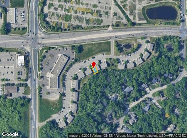
NEARBY LISTINGS FOR SALE OR LEASE
Property Detail
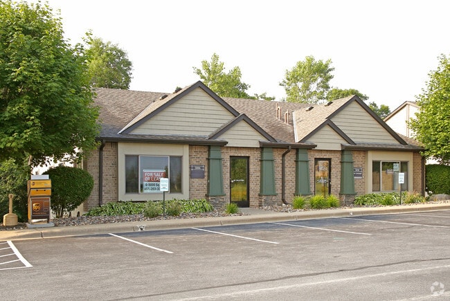
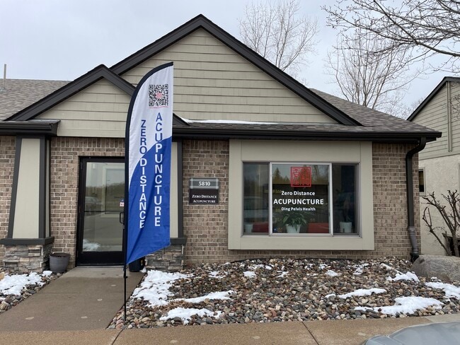
5810 Blackshire Path
Minneapolis-St. Paul-Bloomington, MN-WI
Blackberry Town Office Park
20-14160-01-180
18 1 CIC #309 BLACKBERRY TOWN OFFICE PARK LOT 18 BLK 1 & COMMON AREA KNOWN AS OUTLOT B & LOT 32 BLK 1 EX BEG SW COR E ON MOST S'LY LINE 105.79 FT TO PT ON NW/LY R/W BLACKBERRY TRL NE ON R/W 30.13 FT N ON E LINE LOT 32 263.24 FT W 131.61 FT TO W LINE
Commercialnec
Dakota
X
Minnesota
27037C0110E
18
2024
0.05 AC
2024
Suburban St Paul
060506
Minneapolis/St Paul
2,688 SF
DEMOGRAPHICS near 5810 Blackshire Path
1 Mile
3 Mile
5 Mile
2024 Total Population
9,630
60,480
137,300
2029 Population
9,750
62,206
140,783
Pop Growth 2024-2029
+ 1.25%
+ 2.85%
+ 2.54%
Average Age
40
40
40
2024 Total Households
4,077
25,127
54,479
HH Growth 2024-2029
+ 1.23%
+ 2.86%
+ 2.55%
Median Household Inc
$73,183
$73,927
$84,209
Avg Household Size
2.30
2.30
2.40
2024 Avg HH Vehicles
2.00
2.00
2.00
Median Home Value
$265,849
$282,295
$301,712
Median Year Built
1980
1977
1978
Nearby Places
Map Layers
Map Styles
 Street
 Aerial
- Restaurants
- Banks
- Shops
- Fitness
- Groceries
PUBLIC TRANSPORTATION
AIRPORT
Minneapolis-St Paul International/Wold-Chamberlain
DRIVE
WALK
Distance
Minneapolis-St Paul International/Wold-Chamberlain
15 min
11.4 mi
Freight Ports
Port of Shreveport
DRIVE
WALK
Distance
Port of Shreveport
1 min
864.9 mi
SALE & LEASE HISTORY
LISTING DATE
SALE/LEASE

Oct 10, 2025
For Lease
Nov 01, 2024
For Lease
May 10, 2017
For Lease
May 10, 2017
For Sale
Jun 29, 2018
For Sale
Jul 19, 2021
For Sale
Apr 01, 2025
For Lease
Nearby Properties
Address
Land Use
TOTAL SIZE
Lot Size
Zoning
Address
Land Use
TOTAL SIZE
Lot Size
Zoning
Address
Land Use
TOTAL SIZE
Lot Size
Zoning
146,085 SF
46.83 AC
Address
Land Use
TOTAL SIZE
Lot Size
Zoning
217,703 SF
3.51 AC
Address
Land Use
TOTAL SIZE
Lot Size
Zoning
293,970 SF
31.92 AC
Address
Land Use
TOTAL SIZE
Lot Size
Zoning
381,158 SF
11.86 AC
Address
Land Use
TOTAL SIZE
Lot Size
Zoning
605,774 SF
44.50 AC
Address
Land Use
TOTAL SIZE
Lot Size
Zoning
228,050 SF
0.32 AC
Address
Land Use
TOTAL SIZE
Lot Size
Zoning
228,810 SF
6.30 AC
Address
Land Use
TOTAL SIZE
Lot Size
Zoning
245,570 SF
2.85 AC
Address
Land Use
TOTAL SIZE
Lot Size
Zoning
210,540 SF
5.35 AC
Address
Land Use
TOTAL SIZE
Lot Size
Zoning
71,164 SF
10.79 AC
Address
Land Use
TOTAL SIZE
Lot Size
Zoning
Address
Land Use
TOTAL SIZE
Lot Size
Zoning
163,985 SF
7.06 AC
Address
Land Use
TOTAL SIZE
Lot Size
Zoning
482,008 SF
23.78 AC
Address
Land Use
TOTAL SIZE
Lot Size
Zoning
452,836 SF
17.81 AC
Address
Land Use
TOTAL SIZE
Lot Size
Zoning
Address
Land Use
TOTAL SIZE
Lot Size
Zoning
229,442 SF
9.50 AC
Address
Land Use
TOTAL SIZE
Lot Size
Zoning
532,778 SF
4.99 AC
Address
Land Use
TOTAL SIZE
Lot Size
Zoning
138,609 SF
3.76 AC
Address
Land Use
TOTAL SIZE
Lot Size
Zoning
160,669 SF
5.10 AC
Address
Land Use
TOTAL SIZE
Lot Size
Zoning
Address
Land Use
TOTAL SIZE
Lot Size
Zoning
41,040 SF
11.38 AC
Address
Land Use
TOTAL SIZE
Lot Size
Zoning
236,378 SF
7.57 AC
Address
Land Use
TOTAL SIZE
Lot Size
Zoning
150,469 SF
10.73 AC
Address
Land Use
TOTAL SIZE
Lot Size
Zoning
152,098 SF
8.23 AC
Address
Land Use
TOTAL SIZE
Lot Size
Zoning
174,820 SF
7.79 AC
Address
Land Use
TOTAL SIZE
Lot Size
Zoning
173,500 SF
12.48 AC
Address
Land Use
TOTAL SIZE
Lot Size
Zoning
28,461 SF
16.13 AC
Address
Land Use
TOTAL SIZE
Lot Size
Zoning
128,798 SF
4.22 AC
The World's #1 Commercial Real Estate Marketplace
Connect with us
© 2026 CoStar Group
The information above has been obtained from sources believed reliable. While we do not doubt its accuracy we have not verified it and make no guarantee, warranty or representation about it. It is your responsibility to independently confirm its accuracy and completeness. Any projections, opinions, assumptions, or estimates used are for example only and do not represent the current or future performance of the property. The value of this transaction to you depends on tax and other factors which should be evaluated by your tax, financial, and legal advisors. You and your advisors should conduct a careful, independent investigation of the property to determine to your satisfaction the suitability of the property for your needs.