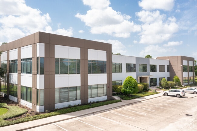
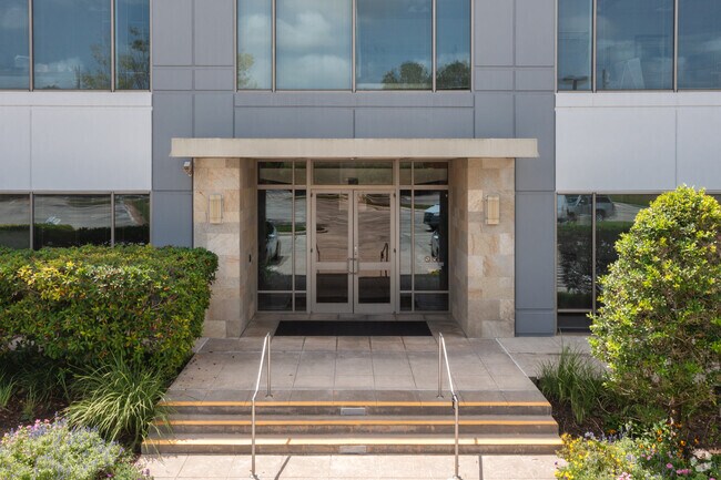
Property Record
5810 Wilson Rd, Humble, TX 77396

Save to a Folder
{{folder.Name}}
{{folder.ListingIds.length}} Properties
{{folder.ListingIds.length}} Property
Create a New Folder
Current Lease Availabilities
Property Detail
5810 Wilson Rd
1238900020003
RES D BLK 2 (OFFICE BUILDING/FACILITIES) REDSTONE GOLF CLUB
Officebuilding
HARRIS
AE The base floodplain where base flood elevations are provided. AE Zones are now used on new format FIRMs instead of A1-A30 Zones.
Texas
2025
2.73 AC
2025
Northeast Near
232202
Houston
40,836 SF
Houston-Pasadena-The Woodlands, TX
NEARBY LISTINGS FOR SALE OR LEASE
DEMOGRAPHICS near 5810 Wilson Rd
1 mile
3 mile
5 mile
2025 Total Population
8,467
54,401
164,027
2030 Population
9,031
58,028
175,801
Pop Growth 2025-2030
+ 6.66%
+ 6.67%
+ 7.18%
Average Age
34
34
34
2025 Total Households
3,055
17,600
51,931
HH Growth 2025-2030
+ 6.91%
+ 6.76%
+ 7.35%
Median Household Inc
$89,980
$70,317
$67,569
Avg Household Size
2.80
3.10
3.10
2025 Avg HH Vehicles
2.00
2.00
2.00
Median Home Value
$391,418
$268,092
$245,562
Median Year Built
2006
2002
1999
Nearby Places
Map Layers
Map Styles
 Street
 Aerial
Layers
 Traffic
 Biking
Places
Listings with unknown addresses are not visible on the map
- Restaurants
- Banks
- Shops
- Fitness
- Groceries
PUBLIC TRANSPORTATION
AIRPORT
George Bush Intcntl/Houston
Drive
Walk
Distance
George Bush Intcntl/Houston
13 min
9.0 mi
William P Hobby
Drive
Walk
Distance
William P Hobby
46 min
29.2 mi
Freight Ports
Port of Houston
Drive
Walk
Distance
Port of Houston
34 min
21.2 mi
Nearby Properties
Address
Land Use
TOTAL SIZE
Lot Size
Zoning
Address
Land Use
TOTAL SIZE
Lot Size
Zoning
1,290,468 SF
Address
Land Use
TOTAL SIZE
Lot Size
Zoning
1,036,748 SF
72.42 AC
Address
Land Use
TOTAL SIZE
Lot Size
Zoning
642,163 SF
37.07 AC
Address
Land Use
TOTAL SIZE
Lot Size
Zoning
306,652 SF
10.67 AC
Address
Land Use
TOTAL SIZE
Lot Size
Zoning
320,798 SF
14.25 AC
Address
Land Use
TOTAL SIZE
Lot Size
Zoning
382,632 SF
22.14 AC
Address
Land Use
TOTAL SIZE
Lot Size
Zoning
260,427 SF
4.50 AC
Address
Land Use
TOTAL SIZE
Lot Size
Zoning
73,500 SF
115.96 AC
Address
Land Use
TOTAL SIZE
Lot Size
Zoning
301,200 SF
27.48 AC
Address
Land Use
TOTAL SIZE
Lot Size
Zoning
321,604 SF
16.68 AC
Address
Land Use
TOTAL SIZE
Lot Size
Zoning
246,712 SF
13.33 AC
Address
Land Use
TOTAL SIZE
Lot Size
Zoning
315,434 SF
13.16 AC
Address
Land Use
TOTAL SIZE
Lot Size
Zoning
247,045 SF
Address
Land Use
TOTAL SIZE
Lot Size
Zoning
219,483 SF
95.68 AC
Address
Land Use
TOTAL SIZE
Lot Size
Zoning
398,984 SF
80.43 AC
Address
Land Use
TOTAL SIZE
Lot Size
Zoning
262,010 SF
12.64 AC
Address
Land Use
TOTAL SIZE
Lot Size
Zoning
264,945 SF
11.74 AC
Address
Land Use
TOTAL SIZE
Lot Size
Zoning
260,630 SF
15.16 AC
Address
Land Use
TOTAL SIZE
Lot Size
Zoning
259,500 SF
12.28 AC
Address
Land Use
TOTAL SIZE
Lot Size
Zoning
149,623 SF
5.62 AC
Address
Land Use
TOTAL SIZE
Lot Size
Zoning
113,604 SF
10.70 AC
Address
Land Use
TOTAL SIZE
Lot Size
Zoning
216,082 SF
19.43 AC
Address
Land Use
TOTAL SIZE
Lot Size
Zoning
163.70 AC
Address
Land Use
TOTAL SIZE
Lot Size
Zoning
144,408 SF
10.54 AC
Address
Land Use
TOTAL SIZE
Lot Size
Zoning
54,012 SF
4.47 AC
Address
Land Use
TOTAL SIZE
Lot Size
Zoning
64,442 SF
8.02 AC
Address
Land Use
TOTAL SIZE
Lot Size
Zoning
130,418 SF
4.66 AC
Address
Land Use
TOTAL SIZE
Lot Size
Zoning
70.38 AC
Address
Land Use
TOTAL SIZE
Lot Size
Zoning
144,919 SF
3.15 AC
Address
Land Use
TOTAL SIZE
Lot Size
Zoning
125,272 SF
16.68 AC
The World's #1 Commercial Real Estate Marketplace
Connect with us
© 2026 CoStar Group
The information above has been obtained from sources believed reliable. While we do not doubt its accuracy we have not verified it and make no guarantee, warranty or representation about it. It is your responsibility to independently confirm its accuracy and completeness. Any projections, opinions, assumptions, or estimates used are for example only and do not represent the current or future performance of the property. The value of this transaction to you depends on tax and other factors which should be evaluated by your tax, financial, and legal advisors. You and your advisors should conduct a careful, independent investigation of the property to determine to your satisfaction the suitability of the property for your needs.