Property Record
5811 Maple St, Mission, KS 66202
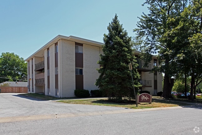


Property Detail
5811 Maple St
KP27500000-0045
MISSIONHILL ACRES LT 45 MIC-0180
Apartment
Johnson
MS2
Kansas
B and X Area of moderate flood hazard, usually the area between the limits of the 100-year and 500-year floods.
45
2024
0.39 AC
2025
Outlying Johnson County KS
050302
Kansas City
13,956 SF
Kansas City, MO-KS
NEARBY LISTINGS FOR SALE OR LEASE
DEMOGRAPHICS near 5811 Maple St
1 mile
3 mile
5 mile
2025 Total Population
11,490
90,554
271,834
2030 Population
11,783
92,608
278,315
Pop Growth 2025-2030
+ 2.55%
+ 2.27%
+ 2.38%
Average Age
41
40
39
2025 Total Households
5,592
40,807
123,453
HH Growth 2025-2030
+ 2.72%
+ 2.44%
+ 2.54%
Median Household Inc
$92,690
$83,212
$76,458
Avg Household Size
2.00
2.20
2.10
2025 Avg HH Vehicles
2.00
2.00
2.00
Median Home Value
$299,961
$336,150
$307,575
Median Year Built
1956
1957
1958
Nearby Places
Map Layers
Map Styles
 Street
 Aerial
Layers
 Traffic
 Biking
Places
Listings with unknown addresses are not visible on the map
- Restaurants
- Banks
- Shops
- Fitness
- Groceries
PUBLIC TRANSPORTATION
COMMUTER RAIL
Drive
Walk
Distance
15 min
7.7 mi
AIRPORT
Kansas City International
Drive
Walk
Distance
Kansas City International
35 min
26.5 mi
Nearby Properties
Address
Land Use
TOTAL SIZE
Lot Size
Zoning
Address
Land Use
TOTAL SIZE
Lot Size
Zoning
857,568 SF
38.48 AC
PUD-G
Address
Land Use
TOTAL SIZE
Lot Size
Zoning
191,956 SF
10.45 AC
KR1B
Address
Land Use
TOTAL SIZE
Lot Size
Zoning
195,691 SF
36.94 AC
R-1A
Address
Land Use
TOTAL SIZE
Lot Size
Zoning
312,446 SF
39.35 AC
R-1
Address
Land Use
TOTAL SIZE
Lot Size
Zoning
34,649 SF
20.26 AC
R-1
Address
Land Use
TOTAL SIZE
Lot Size
Zoning
133,505 SF
16.41 AC
R-1
Address
Land Use
TOTAL SIZE
Lot Size
Zoning
213,073 SF
30.09 AC
PUB
Address
Land Use
TOTAL SIZE
Lot Size
Zoning
96,501 SF
6.49 AC
Address
Land Use
TOTAL SIZE
Lot Size
Zoning
74,212 SF
8.01 AC
R-1
Address
Land Use
TOTAL SIZE
Lot Size
Zoning
41,676 SF
18.45 AC
R-1
Address
Land Use
TOTAL SIZE
Lot Size
Zoning
69,130 SF
6.49 AC
R-1
Address
Land Use
TOTAL SIZE
Lot Size
Zoning
63,471 SF
7.36 AC
PARK
Address
Land Use
TOTAL SIZE
Lot Size
Zoning
42,597 SF
4.39 AC
MS2
Address
Land Use
TOTAL SIZE
Lot Size
Zoning
168,438 SF
3.13 AC
C-O
Address
Land Use
TOTAL SIZE
Lot Size
Zoning
90,774 SF
1.73 AC
MS2
Address
Land Use
TOTAL SIZE
Lot Size
Zoning
99,812 SF
3.85 AC
R-1A
Address
Land Use
TOTAL SIZE
Lot Size
Zoning
65,932 SF
3.72 AC
PUD-G
Address
Land Use
TOTAL SIZE
Lot Size
Zoning
68,134 SF
5.24 AC
C-O
Address
Land Use
TOTAL SIZE
Lot Size
Zoning
93,418 SF
12.07 AC
R-1
Address
Land Use
TOTAL SIZE
Lot Size
Zoning
124,249 SF
6.13 AC
R-1B
Address
Land Use
TOTAL SIZE
Lot Size
Zoning
109,798 SF
16.93 AC
R-1A
Address
Land Use
TOTAL SIZE
Lot Size
Zoning
100,784 SF
4.68 AC
C-2B
Address
Land Use
TOTAL SIZE
Lot Size
Zoning
74,802 SF
10.55 AC
CP-O
Address
Land Use
TOTAL SIZE
Lot Size
Zoning
667,586 SF
18.06 AC
PUD-G
Address
Land Use
TOTAL SIZE
Lot Size
Zoning
311,454 SF
40.91 AC
PUD-G
Address
Land Use
TOTAL SIZE
Lot Size
Zoning
82,035 SF
8.49 AC
R-1
Address
Land Use
TOTAL SIZE
Lot Size
Zoning
111,880 SF
36.74 AC
KR1
Address
Land Use
TOTAL SIZE
Lot Size
Zoning
40,931 SF
16.55 AC
R-1A
Address
Land Use
TOTAL SIZE
Lot Size
Zoning
77,648 SF
6.90 AC
R-1
Address
Land Use
TOTAL SIZE
Lot Size
Zoning
34,745 SF
8.96 AC
PARK
The World's #1 Commercial Real Estate Marketplace
Connect with us
© 2026 CoStar Group
The information above has been obtained from sources believed reliable. While we do not doubt its accuracy we have not verified it and make no guarantee, warranty or representation about it. It is your responsibility to independently confirm its accuracy and completeness. Any projections, opinions, assumptions, or estimates used are for example only and do not represent the current or future performance of the property. The value of this transaction to you depends on tax and other factors which should be evaluated by your tax, financial, and legal advisors. You and your advisors should conduct a careful, independent investigation of the property to determine to your satisfaction the suitability of the property for your needs.