Property Record
5811 Sandpiper Dr, Missoula, MT 59808

NEARBY LISTINGS FOR SALE OR LEASE
Property Detail
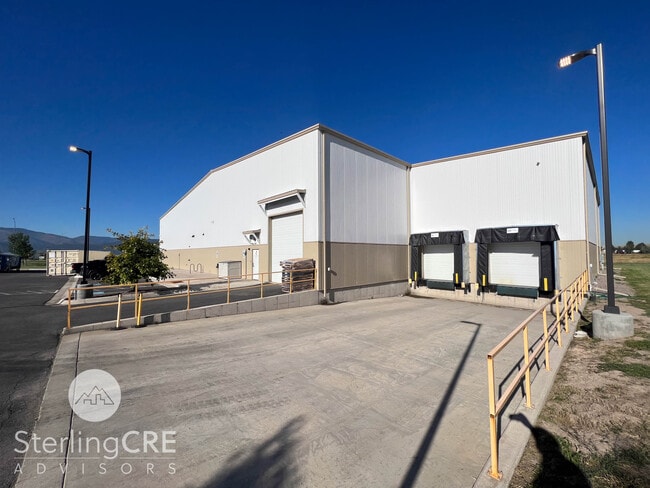
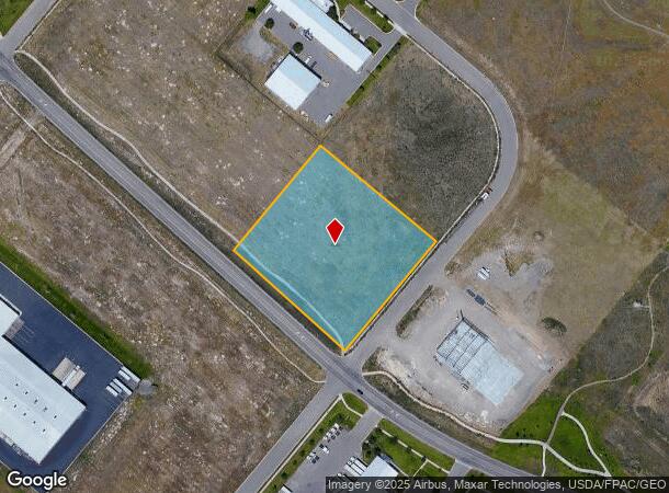
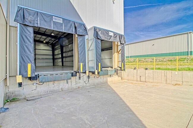
5811 Sandpiper Dr
Missoula, MT
Missoula Development Park - Phase 4
04-2325-35-4-03-11-0000
MISSOULA DEVELOPMENT PARK - PHASE 4, S35, T14 N, R20 W, BLOCK 3, LOT 10
Commercialnec
Missoula
X
Montana
30063C1190E
10
2024
2.85 AC
2025
Missoula
000206
Other Market Areas
18,300 SF
DEMOGRAPHICS near 5811 Sandpiper Dr
1 Mile
3 Mile
5 Mile
2024 Total Population
315
13,263
35,460
2029 Population
347
14,551
38,503
Pop Growth 2024-2029
+ 10.16%
+ 9.71%
+ 8.58%
Average Age
43
39
39
2024 Total Households
128
5,323
15,723
HH Growth 2024-2029
+ 10.16%
+ 9.92%
+ 8.85%
Median Household Inc
$101,042
$85,870
$66,116
Avg Household Size
2.40
2.40
2.20
2024 Avg HH Vehicles
2.00
2.00
2.00
Median Home Value
$478,787
$372,536
$351,399
Median Year Built
2000
2005
2000
Nearby Places
Map Layers
Map Styles
 Street
 Aerial
- Restaurants
- Banks
- Shops
- Fitness
- Groceries
PUBLIC TRANSPORTATION
AIRPORT
Missoula Montana
DRIVE
WALK
Distance
Missoula Montana
6 min
1.8 mi
SALE & LEASE HISTORY
LISTING DATE
SALE/LEASE

Sep 20, 2023
For Lease
Nov 08, 2024
For Lease
Nearby Properties
Address
Land Use
TOTAL SIZE
Lot Size
Zoning
Address
Land Use
TOTAL SIZE
Lot Size
Zoning
61,762 SF
8.48 AC
Address
Land Use
TOTAL SIZE
Lot Size
Zoning
179,712 SF
7.60 AC
Address
Land Use
TOTAL SIZE
Lot Size
Zoning
61,800 SF
6.11 AC
Address
Land Use
TOTAL SIZE
Lot Size
Zoning
73,710 SF
12.42 AC
Address
Land Use
TOTAL SIZE
Lot Size
Zoning
73,710 SF
12.42 AC
Address
Land Use
TOTAL SIZE
Lot Size
Zoning
55,528 SF
36.48 AC
Address
Land Use
TOTAL SIZE
Lot Size
Zoning
73,143 SF
6.54 AC
7
Address
Land Use
TOTAL SIZE
Lot Size
Zoning
55,280 SF
3.12 AC
Address
Land Use
TOTAL SIZE
Lot Size
Zoning
98,144 SF
7.50 AC
6
Address
Land Use
TOTAL SIZE
Lot Size
Zoning
1,342.09 AC
Address
Land Use
TOTAL SIZE
Lot Size
Zoning
34,404 SF
10.25 AC
6
Address
Land Use
TOTAL SIZE
Lot Size
Zoning
102,818 SF
10.92 AC
7
Address
Land Use
TOTAL SIZE
Lot Size
Zoning
87,325 SF
3.22 AC
6
Address
Land Use
TOTAL SIZE
Lot Size
Zoning
32,136 SF
101.71 AC
6
Address
Land Use
TOTAL SIZE
Lot Size
Zoning
14,910 SF
4.15 AC
Address
Land Use
TOTAL SIZE
Lot Size
Zoning
81,829 SF
3.53 AC
1
Address
Land Use
TOTAL SIZE
Lot Size
Zoning
46,236 SF
3.03 AC
1
Address
Land Use
TOTAL SIZE
Lot Size
Zoning
31,530 SF
2.78 AC
Address
Land Use
TOTAL SIZE
Lot Size
Zoning
63,776 SF
10.68 AC
Address
Land Use
TOTAL SIZE
Lot Size
Zoning
68,310 SF
5.41 AC
Address
Land Use
TOTAL SIZE
Lot Size
Zoning
42,962 SF
4.96 AC
Address
Land Use
TOTAL SIZE
Lot Size
Zoning
72,000 SF
7.67 AC
Address
Land Use
TOTAL SIZE
Lot Size
Zoning
128,173 SF
5.89 AC
Address
Land Use
TOTAL SIZE
Lot Size
Zoning
55,511 SF
2.20 AC
6
Address
Land Use
TOTAL SIZE
Lot Size
Zoning
89,902 SF
3.17 AC
Address
Land Use
TOTAL SIZE
Lot Size
Zoning
55,185 SF
2.22 AC
6
Address
Land Use
TOTAL SIZE
Lot Size
Zoning
34,090 SF
2.76 AC
6
Address
Land Use
TOTAL SIZE
Lot Size
Zoning
91,275 SF
8.28 AC
Address
Land Use
TOTAL SIZE
Lot Size
Zoning
58,542 SF
6.88 AC
6
The World's #1 Commercial Real Estate Marketplace
Connect with us
© 2025 CoStar Group
The information above has been obtained from sources believed reliable. While we do not doubt its accuracy we have not verified it and make no guarantee, warranty or representation about it. It is your responsibility to independently confirm its accuracy and completeness. Any projections, opinions, assumptions, or estimates used are for example only and do not represent the current or future performance of the property. The value of this transaction to you depends on tax and other factors which should be evaluated by your tax, financial, and legal advisors. You and your advisors should conduct a careful, independent investigation of the property to determine to your satisfaction the suitability of the property for your needs.