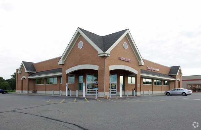
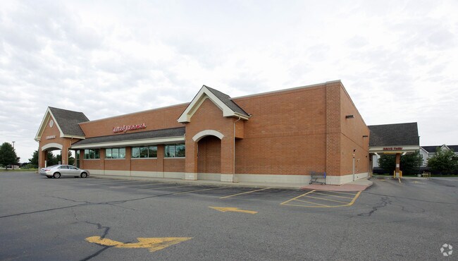
Property Record
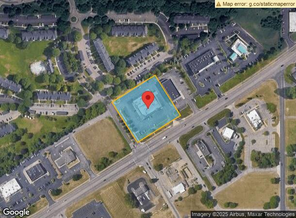
5815 Gull Rd, Kalamazoo, MI 49048
NEARBY LISTINGS FOR SALE OR LEASE
Property Detail
5815 Gull Rd
07-06-270-033
SEC 6-2-10 COMMENCING AT THE EAST 1/4 POST OF SECTION 6, T. 2 S., R 10 W., COMSTOCK TOWNSHIP, KALAMAZOO COUNTY, MICHIGAN;
Commercialnec
Kalamazoo
X
Michigan
26077C0185E
1.83 AC
2025
NE Kalamazoo County
2025
West Michigan
002204
Kalamazoo-Portage, MI
14,748 SF
DEMOGRAPHICS near 5815 Gull Rd
1 Mile
3 Mile
5 Mile
2024 Total Population
4,891
28,800
67,299
2029 Population
4,862
28,677
67,474
Pop Growth 2024-2029
(0.59%)
(0.43%)
+ 0.26%
Average Age
39
39
37
2024 Total Households
2,374
12,191
27,629
HH Growth 2024-2029
(0.51%)
(0.43%)
+ 0.31%
Median Household Inc
$64,406
$59,416
$50,010
Avg Household Size
2.00
2.30
2.30
2024 Avg HH Vehicles
2.00
2.00
2.00
Median Home Value
$196,080
$152,752
$151,289
Median Year Built
1990
1966
1960
Nearby Places
Map Layers
Map Styles
 Street
 Aerial
- Restaurants
- Banks
- Shops
- Fitness
- Groceries
PUBLIC TRANSPORTATION
COMMUTER RAIL
DRIVE
WALK
Distance
8 min
4.6 mi
AIRPORT
Kalamazoo/Battle Creek International
DRIVE
WALK
Distance
Kalamazoo/Battle Creek International
19 min
7.8 mi
Nearby Properties
Address
Land Use
TOTAL SIZE
Lot Size
Zoning
Address
Land Use
TOTAL SIZE
Lot Size
Zoning
306,158 SF
569.84 AC
RP
Address
Land Use
TOTAL SIZE
Lot Size
Zoning
20.94 AC
Address
Land Use
TOTAL SIZE
Lot Size
Zoning
185,107 SF
25.12 AC
RM
Address
Land Use
TOTAL SIZE
Lot Size
Zoning
196,221 SF
26.26 AC
RM
Address
Land Use
TOTAL SIZE
Lot Size
Zoning
185,092 SF
26.86 AC
RM
Address
Land Use
TOTAL SIZE
Lot Size
Zoning
12.58 AC
Address
Land Use
TOTAL SIZE
Lot Size
Zoning
274,412 SF
12.10 AC
RM-1
Address
Land Use
TOTAL SIZE
Lot Size
Zoning
226,051 SF
44.98 AC
B-2
Address
Land Use
TOTAL SIZE
Lot Size
Zoning
217,600 SF
21.30 AC
N/A
Address
Land Use
TOTAL SIZE
Lot Size
Zoning
133,600 SF
15.08 AC
B-1
Address
Land Use
TOTAL SIZE
Lot Size
Zoning
193,194 SF
23.96 AC
B-3
Address
Land Use
TOTAL SIZE
Lot Size
Zoning
99,017 SF
9.42 AC
RM
Address
Land Use
TOTAL SIZE
Lot Size
Zoning
185,528 SF
17.20 AC
R5
Address
Land Use
TOTAL SIZE
Lot Size
Zoning
98,360 SF
13.58 AC
R4
Address
Land Use
TOTAL SIZE
Lot Size
Zoning
118,104 SF
10.40 AC
R4
Address
Land Use
TOTAL SIZE
Lot Size
Zoning
9.65 AC
RM-36
Address
Land Use
TOTAL SIZE
Lot Size
Zoning
49,216 SF
2.90 AC
RM-2
Address
Land Use
TOTAL SIZE
Lot Size
Zoning
8,214 SF
2.39 AC
C-3 GEN
Address
Land Use
TOTAL SIZE
Lot Size
Zoning
155,756 SF
0.67 AC
RM-2
Address
Land Use
TOTAL SIZE
Lot Size
Zoning
102,300 SF
10.12 AC
B-1
Address
Land Use
TOTAL SIZE
Lot Size
Zoning
84,360 SF
5.31 AC
R4
Address
Land Use
TOTAL SIZE
Lot Size
Zoning
53,003 SF
3.20 AC
RM-36
Address
Land Use
TOTAL SIZE
Lot Size
Zoning
112,736 SF
15.84 AC
R-1C
Address
Land Use
TOTAL SIZE
Lot Size
Zoning
109,892 SF
12.24 AC
RM-1
Address
Land Use
TOTAL SIZE
Lot Size
Zoning
2,164 SF
3.48 AC
B-2
Address
Land Use
TOTAL SIZE
Lot Size
Zoning
42,649 SF
3.22 AC
CN-1
Address
Land Use
TOTAL SIZE
Lot Size
Zoning
Address
Land Use
TOTAL SIZE
Lot Size
Zoning
56,224 SF
9.09 AC
RM
Address
Land Use
TOTAL SIZE
Lot Size
Zoning
91,820 SF
6.78 AC
R4
Address
Land Use
TOTAL SIZE
Lot Size
Zoning
805,184 SF
67.79 AC
AGR
The World's #1 Commercial Real Estate Marketplace
Connect with us
© 2026 CoStar Group
The information above has been obtained from sources believed reliable. While we do not doubt its accuracy we have not verified it and make no guarantee, warranty or representation about it. It is your responsibility to independently confirm its accuracy and completeness. Any projections, opinions, assumptions, or estimates used are for example only and do not represent the current or future performance of the property. The value of this transaction to you depends on tax and other factors which should be evaluated by your tax, financial, and legal advisors. You and your advisors should conduct a careful, independent investigation of the property to determine to your satisfaction the suitability of the property for your needs.