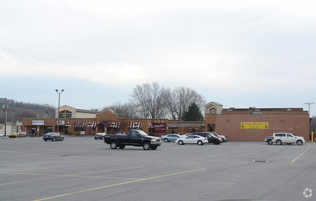
Property Record
5818 6Th Ave, Altoona, PA 16602

NEARBY LISTINGS FOR SALE OR LEASE
Property Detail
5818 6Th Ave
01-02118470
28 6TH AVE REAR; 150 X 150 IRR
Commercialofficeresidentialmixeduse
Blair
X
Pennsylvania
42013C0231D
0.52 AC
2025
Altoona/Johnstown
2025
Other Market Areas
101500
Altoona, PA
DEMOGRAPHICS near 5818 6Th Ave
1 Mile
3 Mile
5 Mile
2024 Total Population
4,784
27,522
66,321
2029 Population
4,655
26,820
64,584
Pop Growth 2024-2029
(2.70%)
(2.55%)
(2.62%)
Average Age
45
44
43
2024 Total Households
2,043
11,647
28,170
HH Growth 2024-2029
(2.74%)
(2.60%)
(2.66%)
Median Household Inc
$64,154
$57,757
$55,195
Avg Household Size
2.20
2.20
2.20
2024 Avg HH Vehicles
2.00
2.00
2.00
Median Home Value
$138,593
$125,823
$129,014
Median Year Built
1963
1951
1952
Nearby Places
Map Layers
Map Styles
 Street
 Aerial
- Restaurants
- Banks
- Shops
- Fitness
- Groceries
PUBLIC TRANSPORTATION
COMMUTER RAIL
Altoona Amtrak Station (Pennsylvanian - Amtrak)
DRIVE
WALK
Distance
Altoona Amtrak Station (Pennsylvanian - Amtrak)
6 min
3.7 mi
Freight Ports
Port of Baltimore
DRIVE
WALK
Distance
Port of Baltimore
209 min
177.0 mi
Nearby Properties
Address
Land Use
TOTAL SIZE
Lot Size
Zoning
Address
Land Use
TOTAL SIZE
Lot Size
Zoning
109.17 AC
Address
Land Use
TOTAL SIZE
Lot Size
Zoning
96.29 AC
Address
Land Use
TOTAL SIZE
Lot Size
Zoning
5.48 AC
Address
Land Use
TOTAL SIZE
Lot Size
Zoning
Address
Land Use
TOTAL SIZE
Lot Size
Zoning
Address
Land Use
TOTAL SIZE
Lot Size
Zoning
Address
Land Use
TOTAL SIZE
Lot Size
Zoning
6.67 AC
Address
Land Use
TOTAL SIZE
Lot Size
Zoning
40.89 AC
Address
Land Use
TOTAL SIZE
Lot Size
Zoning
14.40 AC
Address
Land Use
TOTAL SIZE
Lot Size
Zoning
12.72 AC
Address
Land Use
TOTAL SIZE
Lot Size
Zoning
16.22 AC
Address
Land Use
TOTAL SIZE
Lot Size
Zoning
Address
Land Use
TOTAL SIZE
Lot Size
Zoning
5.09 AC
Address
Land Use
TOTAL SIZE
Lot Size
Zoning
12.70 AC
Address
Land Use
TOTAL SIZE
Lot Size
Zoning
13.37 AC
Address
Land Use
TOTAL SIZE
Lot Size
Zoning
Address
Land Use
TOTAL SIZE
Lot Size
Zoning
21.73 AC
Address
Land Use
TOTAL SIZE
Lot Size
Zoning
Address
Land Use
TOTAL SIZE
Lot Size
Zoning
Address
Land Use
TOTAL SIZE
Lot Size
Zoning
16.35 AC
Address
Land Use
TOTAL SIZE
Lot Size
Zoning
14.23 AC
Address
Land Use
TOTAL SIZE
Lot Size
Zoning
Address
Land Use
TOTAL SIZE
Lot Size
Zoning
15.33 AC
Address
Land Use
TOTAL SIZE
Lot Size
Zoning
11.96 AC
Address
Land Use
TOTAL SIZE
Lot Size
Zoning
Address
Land Use
TOTAL SIZE
Lot Size
Zoning
13.69 AC
Address
Land Use
TOTAL SIZE
Lot Size
Zoning
13.57 AC
Address
Land Use
TOTAL SIZE
Lot Size
Zoning
14.93 AC
Address
Land Use
TOTAL SIZE
Lot Size
Zoning
18.29 AC
Address
Land Use
TOTAL SIZE
Lot Size
Zoning
The World's #1 Commercial Real Estate Marketplace
Connect with us
© 2026 CoStar Group
The information above has been obtained from sources believed reliable. While we do not doubt its accuracy we have not verified it and make no guarantee, warranty or representation about it. It is your responsibility to independently confirm its accuracy and completeness. Any projections, opinions, assumptions, or estimates used are for example only and do not represent the current or future performance of the property. The value of this transaction to you depends on tax and other factors which should be evaluated by your tax, financial, and legal advisors. You and your advisors should conduct a careful, independent investigation of the property to determine to your satisfaction the suitability of the property for your needs.