Property Record
5818 Maplecrest Rd, Fort Wayne, IN 46835
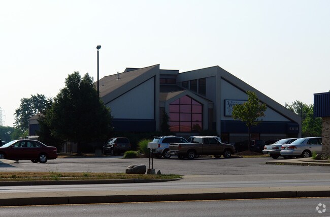

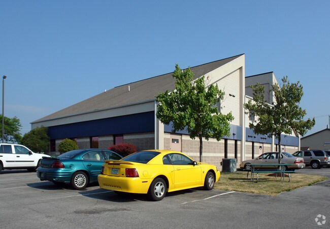
Property Detail
5818 Maplecrest Rd
02-08-22-101-006.000-072
4-22-5-017 E 105.6 OF W 370.6 OF S 187.5 OF N 412.5 NW1/4 SEC 22
Medicalbuilding
Allen
B and X Area of moderate flood hazard, usually the area between the limits of the 100-year and 500-year floods.
Indiana
2025
4.50 AC
2025
North Fort Wayne
010804
Fort Wayne
8,304 SF
Fort Wayne, IN
NEARBY LISTINGS FOR SALE OR LEASE
DEMOGRAPHICS near 5818 Maplecrest Rd
1 mile
3 mile
5 mile
2025 Total Population
9,149
67,303
132,620
2030 Population
9,292
68,934
136,130
Pop Growth 2025-2030
+ 1.56%
+ 2.42%
+ 2.65%
Average Age
40
40
39
2025 Total Households
3,679
27,688
54,656
HH Growth 2025-2030
+ 1.66%
+ 2.54%
+ 2.80%
Median Household Inc
$72,829
$69,811
$66,098
Avg Household Size
2.50
2.40
2.30
2025 Avg HH Vehicles
2.00
2.00
2.00
Median Home Value
$182,706
$219,374
$212,190
Median Year Built
1975
1978
1976
Nearby Places
Map Layers
Map Styles
 Street
 Aerial
Layers
 Traffic
 Biking
Places
Listings with unknown addresses are not visible on the map
- Restaurants
- Banks
- Shops
- Fitness
- Groceries
PUBLIC TRANSPORTATION
AIRPORT
Fort Wayne International
Drive
Walk
Distance
Fort Wayne International
34 min
17.4 mi
Nearby Properties
Address
Land Use
TOTAL SIZE
Lot Size
Zoning
Address
Land Use
TOTAL SIZE
Lot Size
Zoning
855,487 SF
95.76 AC
Address
Land Use
TOTAL SIZE
Lot Size
Zoning
702,400 SF
37.91 AC
Address
Land Use
TOTAL SIZE
Lot Size
Zoning
401,523 SF
273.50 AC
Address
Land Use
TOTAL SIZE
Lot Size
Zoning
303,926 SF
1,956.20 AC
Address
Land Use
TOTAL SIZE
Lot Size
Zoning
298,087 SF
24.71 AC
Address
Land Use
TOTAL SIZE
Lot Size
Zoning
68,817 SF
14.72 AC
Address
Land Use
TOTAL SIZE
Lot Size
Zoning
144,297 SF
19.63 AC
Address
Land Use
TOTAL SIZE
Lot Size
Zoning
75,690 SF
268.40 AC
Address
Land Use
TOTAL SIZE
Lot Size
Zoning
295,073 SF
27.09 AC
Address
Land Use
TOTAL SIZE
Lot Size
Zoning
32,189 SF
9.65 AC
Address
Land Use
TOTAL SIZE
Lot Size
Zoning
125,249 SF
362.70 AC
Address
Land Use
TOTAL SIZE
Lot Size
Zoning
215,768 SF
235.57 AC
Address
Land Use
TOTAL SIZE
Lot Size
Zoning
58,913 SF
226.43 AC
Address
Land Use
TOTAL SIZE
Lot Size
Zoning
229,678 SF
264.24 AC
Address
Land Use
TOTAL SIZE
Lot Size
Zoning
87,317 SF
125.91 AC
Address
Land Use
TOTAL SIZE
Lot Size
Zoning
25,272 SF
25.84 AC
Address
Land Use
TOTAL SIZE
Lot Size
Zoning
255,864 SF
9.21 AC
Address
Land Use
TOTAL SIZE
Lot Size
Zoning
206,618 SF
212 AC
Address
Land Use
TOTAL SIZE
Lot Size
Zoning
210,230 SF
353.02 AC
Address
Land Use
TOTAL SIZE
Lot Size
Zoning
180,238 SF
22.50 AC
Address
Land Use
TOTAL SIZE
Lot Size
Zoning
232,515 SF
306.20 AC
Address
Land Use
TOTAL SIZE
Lot Size
Zoning
19,872 SF
14.05 AC
Address
Land Use
TOTAL SIZE
Lot Size
Zoning
50,072 SF
8.27 AC
Address
Land Use
TOTAL SIZE
Lot Size
Zoning
94,025 SF
89.40 AC
Address
Land Use
TOTAL SIZE
Lot Size
Zoning
126,957 SF
212.70 AC
Address
Land Use
TOTAL SIZE
Lot Size
Zoning
154,746 SF
87.54 AC
Address
Land Use
TOTAL SIZE
Lot Size
Zoning
72,240 SF
94.11 AC
Address
Land Use
TOTAL SIZE
Lot Size
Zoning
142,983 SF
10.55 AC
Address
Land Use
TOTAL SIZE
Lot Size
Zoning
88,894 SF
165.50 AC
Address
Land Use
TOTAL SIZE
Lot Size
Zoning
121,567 SF
73.70 AC
The World's #1 Commercial Real Estate Marketplace
Connect with us
© 2026 CoStar Group
The information above has been obtained from sources believed reliable. While we do not doubt its accuracy we have not verified it and make no guarantee, warranty or representation about it. It is your responsibility to independently confirm its accuracy and completeness. Any projections, opinions, assumptions, or estimates used are for example only and do not represent the current or future performance of the property. The value of this transaction to you depends on tax and other factors which should be evaluated by your tax, financial, and legal advisors. You and your advisors should conduct a careful, independent investigation of the property to determine to your satisfaction the suitability of the property for your needs.