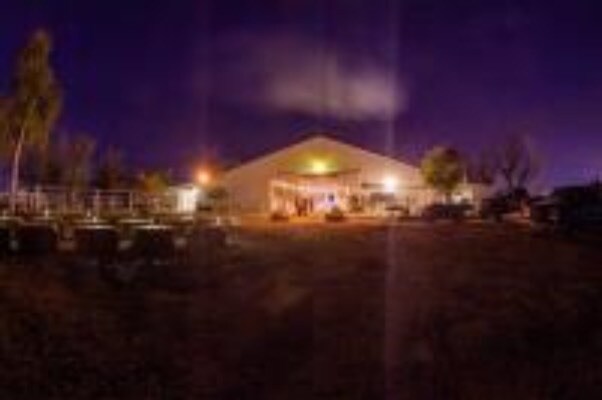
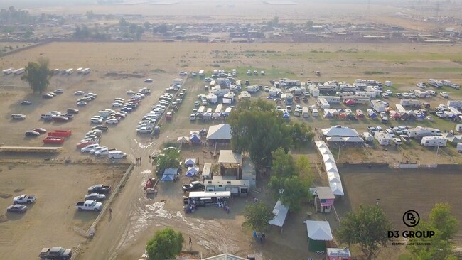
Property Record
5818 S Fairfax Rd, Bakersfield, CA 93307

NEARBY LISTINGS FOR SALE OR LEASE
Property Detail
5818 S Fairfax Rd
174-092-21-02-8
Parcel Map No. 315
Livestock
PARCEL MAP 315 , LOT PTNB
AO
Kern
06029C2325E
California
2024
30 AC
2025
Southeast Bakersfield
002403
Bakersfield
3,267 SF
Bakersfield, CA
DEMOGRAPHICS near 5818 S Fairfax Rd
1 Mile
3 Mile
5 Mile
2024 Total Population
167
10,338
114,111
2029 Population
165
10,303
113,833
Pop Growth 2024-2029
(1.20%)
(0.34%)
(0.24%)
Average Age
35
32
32
2024 Total Households
43
2,653
29,788
HH Growth 2024-2029
(2.33%)
(0.41%)
(0.32%)
Median Household Inc
$57,499
$44,436
$44,019
Avg Household Size
3.90
3.80
3.70
2024 Avg HH Vehicles
3.00
2.00
2.00
Median Home Value
$377,272
$271,035
$218,733
Median Year Built
1986
1976
1978
Nearby Places
Map Layers
Map Styles
 Street
 Aerial
- Restaurants
- Banks
- Shops
- Fitness
- Groceries
PUBLIC TRANSPORTATION
COMMUTER RAIL
Bakersfield (San Joaquins - Amtrak)
DRIVE
WALK
Distance
Bakersfield (San Joaquins - Amtrak)
19 min
9.7 mi
AIRPORT
Meadows Field
DRIVE
WALK
Distance
Meadows Field
30 min
16.5 mi
Freight Ports
The Port of Hueneme
DRIVE
WALK
Distance
The Port of Hueneme
157 min
120.6 mi
SALE & LEASE HISTORY
LISTING DATE
SALE/LEASE

May 03, 2021
For Sale
Nearby Properties
Address
Land Use
TOTAL SIZE
Lot Size
Zoning
Address
Land Use
TOTAL SIZE
Lot Size
Zoning
38.14 AC
M-3
Address
Land Use
TOTAL SIZE
Lot Size
Zoning
3,600 SF
18 AC
AG
Address
Land Use
TOTAL SIZE
Lot Size
Zoning
196.78 AC
A
Address
Land Use
TOTAL SIZE
Lot Size
Zoning
83.70 AC
A
Address
Land Use
TOTAL SIZE
Lot Size
Zoning
17,217 SF
1.52 AC
C2
Address
Land Use
TOTAL SIZE
Lot Size
Zoning
83.70 AC
A
Address
Land Use
TOTAL SIZE
Lot Size
Zoning
Address
Land Use
TOTAL SIZE
Lot Size
Zoning
72.55 AC
A
Address
Land Use
TOTAL SIZE
Lot Size
Zoning
31,608 SF
2.68 AC
R-2
Address
Land Use
TOTAL SIZE
Lot Size
Zoning
153.69 AC
A
Address
Land Use
TOTAL SIZE
Lot Size
Zoning
2,682 SF
1.04 AC
C-2 FPS
Address
Land Use
TOTAL SIZE
Lot Size
Zoning
7,594 SF
79.09 AC
A
Address
Land Use
TOTAL SIZE
Lot Size
Zoning
9,100 SF
0.94 AC
C-2
Address
Land Use
TOTAL SIZE
Lot Size
Zoning
3,600 SF
4.61 AC
C2
Address
Land Use
TOTAL SIZE
Lot Size
Zoning
36.64 AC
A
Address
Land Use
TOTAL SIZE
Lot Size
Zoning
2,450 SF
0.69 AC
C2
Address
Land Use
TOTAL SIZE
Lot Size
Zoning
3,325 SF
19.65 AC
A
Address
Land Use
TOTAL SIZE
Lot Size
Zoning
0.65 AC
C-2
Address
Land Use
TOTAL SIZE
Lot Size
Zoning
14.31 AC
Address
Land Use
TOTAL SIZE
Lot Size
Zoning
4,296 SF
0.70 AC
C-2
Address
Land Use
TOTAL SIZE
Lot Size
Zoning
5,622 SF
1.05 AC
C2 PD FPS
Address
Land Use
TOTAL SIZE
Lot Size
Zoning
11,524 SF
56.89 AC
A
Address
Land Use
TOTAL SIZE
Lot Size
Zoning
9,802 SF
0.64 AC
C2 FPS
Address
Land Use
TOTAL SIZE
Lot Size
Zoning
5,224 SF
5.38 AC
M2
Address
Land Use
TOTAL SIZE
Lot Size
Zoning
5.72 AC
A1
Address
Land Use
TOTAL SIZE
Lot Size
Zoning
6,761 SF
114.81 AC
A
Address
Land Use
TOTAL SIZE
Lot Size
Zoning
1,408 SF
38.18 AC
A1
Address
Land Use
TOTAL SIZE
Lot Size
Zoning
Address
Land Use
TOTAL SIZE
Lot Size
Zoning
12,979 SF
0.23 AC
C2
Address
Land Use
TOTAL SIZE
Lot Size
Zoning
312.47 AC
A
The World's #1 Commercial Real Estate Marketplace
Connect with us
© 2025 CoStar Group
The information above has been obtained from sources believed reliable. While we do not doubt its accuracy we have not verified it and make no guarantee, warranty or representation about it. It is your responsibility to independently confirm its accuracy and completeness. Any projections, opinions, assumptions, or estimates used are for example only and do not represent the current or future performance of the property. The value of this transaction to you depends on tax and other factors which should be evaluated by your tax, financial, and legal advisors. You and your advisors should conduct a careful, independent investigation of the property to determine to your satisfaction the suitability of the property for your needs.