Property Record
5819 S 49Th Ave W, Tulsa, OK 74107


NEARBY LISTINGS FOR SALE OR LEASE
Property Detail
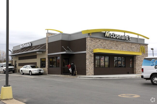
5819 S 49Th Ave W
Tulsa, OK
Bozarth Acres
52550-92-33-05630
PRT LTS 6 THRU 8 BEG 25E SWC LT 8 TH N180.38 E275 S TO PT W275 POB BLK 3
Restaurantbuilding
Tulsa
X
Oklahoma
40143C0333L
6
2025
1.14 AC
2025
West Tulsa
004700
Tulsa
4,141 SF
DEMOGRAPHICS near 5819 S 49Th Ave W
1 Mile
3 Mile
5 Mile
2024 Total Population
2,589
25,530
82,907
2029 Population
2,722
26,353
85,973
Pop Growth 2024-2029
+ 5.14%
+ 3.22%
+ 3.70%
Average Age
38
40
39
2024 Total Households
971
10,110
36,563
HH Growth 2024-2029
+ 5.15%
+ 3.04%
+ 3.69%
Median Household Inc
$46,601
$56,831
$53,135
Avg Household Size
2.60
2.40
2.20
2024 Avg HH Vehicles
2.00
2.00
2.00
Median Home Value
$94,664
$153,606
$172,403
Median Year Built
1972
1974
1975
Nearby Places
Map Layers
Map Styles
 Street
 Aerial
- Restaurants
- Banks
- Shops
- Fitness
- Groceries
PUBLIC TRANSPORTATION
AIRPORT
Tulsa International
DRIVE
WALK
Distance
Tulsa International
23 min
15.7 mi
Freight Ports
DRIVE
WALK
Distance
32 min
24.5 mi
Nearby Properties
Address
Land Use
TOTAL SIZE
Lot Size
Zoning
Address
Land Use
TOTAL SIZE
Lot Size
Zoning
1,134,776 SF
35.85 AC
CN
Address
Land Use
TOTAL SIZE
Lot Size
Zoning
290,963 SF
10.77 AC
RM1
Address
Land Use
TOTAL SIZE
Lot Size
Zoning
119,056 SF
28.06 AC
CM
Address
Land Use
TOTAL SIZE
Lot Size
Zoning
110,382 SF
9.81 AC
RS3
Address
Land Use
TOTAL SIZE
Lot Size
Zoning
35,845 SF
14.38 AC
CS
Address
Land Use
TOTAL SIZE
Lot Size
Zoning
270,584 SF
28.85 AC
CO
Address
Land Use
TOTAL SIZE
Lot Size
Zoning
6,162 SF
4.25 AC
CH
Address
Land Use
TOTAL SIZE
Lot Size
Zoning
143,520 SF
25.14 AC
IM
Address
Land Use
TOTAL SIZE
Lot Size
Zoning
47,670 SF
10.05 AC
RS
Address
Land Use
TOTAL SIZE
Lot Size
Zoning
50,109 SF
28.71 AC
NCU
Address
Land Use
TOTAL SIZE
Lot Size
Zoning
22,078 SF
5.08 AC
CS
Address
Land Use
TOTAL SIZE
Lot Size
Zoning
32,847 SF
28.03 AC
RS3
Address
Land Use
TOTAL SIZE
Lot Size
Zoning
23,269 SF
263.40 AC
NCU
Address
Land Use
TOTAL SIZE
Lot Size
Zoning
136,079 SF
9 AC
CO
Address
Land Use
TOTAL SIZE
Lot Size
Zoning
301,395 SF
13.07 AC
CO
Address
Land Use
TOTAL SIZE
Lot Size
Zoning
32,722 SF
8.40 AC
RS3
Address
Land Use
TOTAL SIZE
Lot Size
Zoning
32,672 SF
8.56 AC
CS
Address
Land Use
TOTAL SIZE
Lot Size
Zoning
1,025 SF
64.46 AC
AG
Address
Land Use
TOTAL SIZE
Lot Size
Zoning
251,601 SF
16.75 AC
RM1
Address
Land Use
TOTAL SIZE
Lot Size
Zoning
117,372 SF
11.87 AC
CN
Address
Land Use
TOTAL SIZE
Lot Size
Zoning
20,771 SF
1.11 AC
RS3
Address
Land Use
TOTAL SIZE
Lot Size
Zoning
35.39 AC
AG
Address
Land Use
TOTAL SIZE
Lot Size
Zoning
17,245 SF
1.80 AC
PUD
Address
Land Use
TOTAL SIZE
Lot Size
Zoning
370,891 SF
26.43 AC
IM
Address
Land Use
TOTAL SIZE
Lot Size
Zoning
16,000 SF
5 AC
CS
Address
Land Use
TOTAL SIZE
Lot Size
Zoning
69,616 SF
1.86 AC
RS3
Address
Land Use
TOTAL SIZE
Lot Size
Zoning
38,940 SF
16.24 AC
Address
Land Use
TOTAL SIZE
Lot Size
Zoning
56,698 SF
8.77 AC
IL
Address
Land Use
TOTAL SIZE
Lot Size
Zoning
132,940 SF
3.92 AC
CS
Address
Land Use
TOTAL SIZE
Lot Size
Zoning
15,066 SF
2.16 AC
RS3
The World's #1 Commercial Real Estate Marketplace
Connect with us
© 2026 CoStar Group
The information above has been obtained from sources believed reliable. While we do not doubt its accuracy we have not verified it and make no guarantee, warranty or representation about it. It is your responsibility to independently confirm its accuracy and completeness. Any projections, opinions, assumptions, or estimates used are for example only and do not represent the current or future performance of the property. The value of this transaction to you depends on tax and other factors which should be evaluated by your tax, financial, and legal advisors. You and your advisors should conduct a careful, independent investigation of the property to determine to your satisfaction the suitability of the property for your needs.