Property Record
582 Hillview Rd, Hampton, GA 30228

Save to a Folder
{{folder.Name}}
{{folder.ListingIds.length}} Properties
{{folder.ListingIds.length}} Property
Create a New Folder
Property Detail
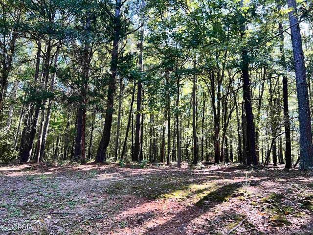
582 Hillview Rd
240-01-007
HILLVIEW RD 74.85 AC
Agriculturalland
Spalding
AR1
Georgia
A Areas with a 1% annual chance of flooding and a 26% chance of flooding over the life of a 30-year mortgage.
74.85 AC
2025
Spalding County
2025
Atlanta
160402
Atlanta-Sandy Springs-Roswell, GA
NEARBY LISTINGS FOR SALE OR LEASE
DEMOGRAPHICS near 582 Hillview Rd
1 mile
3 mile
5 mile
2025 Total Population
1,145
13,374
38,955
2030 Population
1,226
14,248
41,431
Pop Growth 2025-2030
+ 7.07%
+ 6.54%
+ 6.36%
Average Age
38
40
40
2025 Total Households
364
4,694
13,792
HH Growth 2025-2030
+ 6.87%
+ 6.48%
+ 6.32%
Median Household Inc
$67,500
$73,503
$79,288
Avg Household Size
3.20
2.80
2.80
2025 Avg HH Vehicles
2.00
2.00
2.00
Median Home Value
$300,847
$287,035
$301,363
Median Year Built
2002
1999
2001
Nearby Places
Map Layers
Map Styles
 Street
 Aerial
Layers
 Traffic
 Biking
Places
Listings with unknown addresses are not visible on the map
- Restaurants
- Banks
- Shops
- Fitness
- Groceries
PUBLIC TRANSPORTATION
AIRPORT
Hartsfield - Jackson Atlanta International
Drive
Walk
Distance
Hartsfield - Jackson Atlanta International
41 min
25.4 mi
Freight Ports
Georgia Ports - Savannah
Drive
Walk
Distance
Georgia Ports - Savannah
256 min
221.0 mi
Nearby Properties
Address
Land Use
TOTAL SIZE
Lot Size
Zoning
Address
Land Use
TOTAL SIZE
Lot Size
Zoning
1,424,654 SF
172.86 AC
Address
Land Use
TOTAL SIZE
Lot Size
Zoning
1,389,488 SF
166.64 AC
Address
Land Use
TOTAL SIZE
Lot Size
Zoning
11,520 SF
8.77 AC
C-1B
Address
Land Use
TOTAL SIZE
Lot Size
Zoning
20 AC
AR-1
Address
Land Use
TOTAL SIZE
Lot Size
Zoning
41,568 SF
29.31 AC
M2
Address
Land Use
TOTAL SIZE
Lot Size
Zoning
594 SF
4.08 AC
C-1B
Address
Land Use
TOTAL SIZE
Lot Size
Zoning
4,824 SF
15.10 AC
RM
Address
Land Use
TOTAL SIZE
Lot Size
Zoning
39,681 SF
6.19 AC
C2
Address
Land Use
TOTAL SIZE
Lot Size
Zoning
341.53 AC
RA
Address
Land Use
TOTAL SIZE
Lot Size
Zoning
5,518 SF
11.39 AC
C-1
Address
Land Use
TOTAL SIZE
Lot Size
Zoning
19,500 SF
3.09 AC
C
Address
Land Use
TOTAL SIZE
Lot Size
Zoning
9,020 SF
3.30 AC
C1
Address
Land Use
TOTAL SIZE
Lot Size
Zoning
308.50 AC
Address
Land Use
TOTAL SIZE
Lot Size
Zoning
6,880 SF
7.89 AC
M2
Address
Land Use
TOTAL SIZE
Lot Size
Zoning
40,411 SF
47.18 AC
C1
Address
Land Use
TOTAL SIZE
Lot Size
Zoning
30.24 AC
M1
Address
Land Use
TOTAL SIZE
Lot Size
Zoning
40,536 SF
6 AC
Address
Land Use
TOTAL SIZE
Lot Size
Zoning
10,200 SF
8.35 AC
Address
Land Use
TOTAL SIZE
Lot Size
Zoning
23,233 SF
5 AC
Address
Land Use
TOTAL SIZE
Lot Size
Zoning
16,080 SF
2.91 AC
C2
Address
Land Use
TOTAL SIZE
Lot Size
Zoning
19,026 SF
4.75 AC
RA
Address
Land Use
TOTAL SIZE
Lot Size
Zoning
9,049 SF
0.62 AC
AAR
Address
Land Use
TOTAL SIZE
Lot Size
Zoning
73,390 SF
6.35 AC
M2
Address
Land Use
TOTAL SIZE
Lot Size
Zoning
16,800 SF
2.66 AC
The World's #1 Commercial Real Estate Marketplace
Connect with us
© 2026 CoStar Group
The information above has been obtained from sources believed reliable. While we do not doubt its accuracy we have not verified it and make no guarantee, warranty or representation about it. It is your responsibility to independently confirm its accuracy and completeness. Any projections, opinions, assumptions, or estimates used are for example only and do not represent the current or future performance of the property. The value of this transaction to you depends on tax and other factors which should be evaluated by your tax, financial, and legal advisors. You and your advisors should conduct a careful, independent investigation of the property to determine to your satisfaction the suitability of the property for your needs.