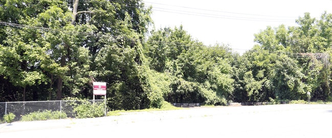
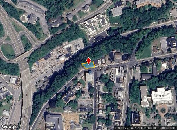
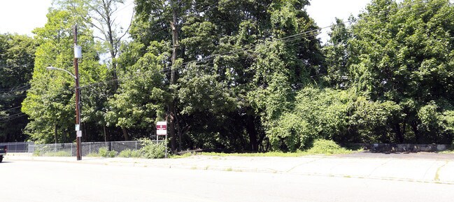
Property Record
582 South St, Peekskill, NY 10566
NEARBY LISTINGS FOR SALE OR LEASE
Property Detail
582 South St
1200-032-012-00004-000-0014
Westchester
Residentialacreage
New York
X
14.000
36119C0016F
0.14 AC
2025
Northwest
2024
Westchester/So Connecticut
014100
New York-Jersey City-White Plains, NY-NJ
DEMOGRAPHICS near 582 South St
1 Mile
3 Mile
5 Mile
2024 Total Population
15,339
41,354
75,347
2029 Population
14,922
40,176
73,553
Pop Growth 2024-2029
(2.72%)
(2.85%)
(2.38%)
Average Age
39
41
43
2024 Total Households
5,684
15,089
27,385
HH Growth 2024-2029
(2.73%)
(3.04%)
(2.62%)
Median Household Inc
$67,769
$96,931
$106,259
Avg Household Size
2.50
2.60
2.60
2024 Avg HH Vehicles
1.00
2.00
2.00
Median Home Value
$285,797
$382,432
$415,336
Median Year Built
1958
1961
1962
Nearby Places
Map Layers
Map Styles
 Street
 Aerial
- Restaurants
- Banks
- Shops
- Fitness
- Groceries
PUBLIC TRANSPORTATION
COMMUTER RAIL
Peekskill Station (Hudson Line - Metro-North Commuter Railroad Company (Metro-North))
DRIVE
WALK
Distance
Peekskill Station (Hudson Line - Metro-North Commuter Railroad Company (Metro-North))
1 min
12 min
0.5 mi
Cortlandt Station (Hudson Line - Metro-North Commuter Railroad Company (Metro-North))
DRIVE
WALK
Distance
Cortlandt Station (Hudson Line - Metro-North Commuter Railroad Company (Metro-North))
9 min
3.6 mi
AIRPORT
New York Stewart International
DRIVE
WALK
Distance
New York Stewart International
42 min
24.6 mi
Westchester County
DRIVE
WALK
Distance
Westchester County
41 min
29.7 mi
Freight Ports
NY - Red Hook Container Terminal
DRIVE
WALK
Distance
NY - Red Hook Container Terminal
80 min
53.6 mi
SALE & LEASE HISTORY
LISTING DATE
SALE/LEASE

Nov 04, 2016
For Sale
Apr 18, 2017
For Sale
Nearby Properties
Address
Land Use
TOTAL SIZE
Lot Size
Zoning
Address
Land Use
TOTAL SIZE
Lot Size
Zoning
Address
Land Use
TOTAL SIZE
Lot Size
Zoning
Address
Land Use
TOTAL SIZE
Lot Size
Zoning
Address
Land Use
TOTAL SIZE
Lot Size
Zoning
157 AC
Address
Land Use
TOTAL SIZE
Lot Size
Zoning
74.84 AC
Address
Land Use
TOTAL SIZE
Lot Size
Zoning
Address
Land Use
TOTAL SIZE
Lot Size
Zoning
Address
Land Use
TOTAL SIZE
Lot Size
Zoning
Address
Land Use
TOTAL SIZE
Lot Size
Zoning
Address
Land Use
TOTAL SIZE
Lot Size
Zoning
Address
Land Use
TOTAL SIZE
Lot Size
Zoning
2.70 AC
Address
Land Use
TOTAL SIZE
Lot Size
Zoning
18.27 AC
R80
Address
Land Use
TOTAL SIZE
Lot Size
Zoning
Address
Land Use
TOTAL SIZE
Lot Size
Zoning
Address
Land Use
TOTAL SIZE
Lot Size
Zoning
7,254 SF
17.72 AC
R80
Address
Land Use
TOTAL SIZE
Lot Size
Zoning
9,707 SF
5.51 AC
R80
Address
Land Use
TOTAL SIZE
Lot Size
Zoning
22.61 AC
Address
Land Use
TOTAL SIZE
Lot Size
Zoning
8.93 AC
Address
Land Use
TOTAL SIZE
Lot Size
Zoning
2.99 AC
Address
Land Use
TOTAL SIZE
Lot Size
Zoning
Address
Land Use
TOTAL SIZE
Lot Size
Zoning
Address
Land Use
TOTAL SIZE
Lot Size
Zoning
Address
Land Use
TOTAL SIZE
Lot Size
Zoning
7.50 AC
Address
Land Use
TOTAL SIZE
Lot Size
Zoning
Address
Land Use
TOTAL SIZE
Lot Size
Zoning
5,149 SF
34.05 AC
R80
Address
Land Use
TOTAL SIZE
Lot Size
Zoning
23.27 AC
Address
Land Use
TOTAL SIZE
Lot Size
Zoning
9,498 SF
0.21 AC
R10
Address
Land Use
TOTAL SIZE
Lot Size
Zoning
48.07 AC
Address
Land Use
TOTAL SIZE
Lot Size
Zoning
26.80 AC
Address
Land Use
TOTAL SIZE
Lot Size
Zoning
The World's #1 Commercial Real Estate Marketplace
Connect with us
© 2025 CoStar Group
The information above has been obtained from sources believed reliable. While we do not doubt its accuracy we have not verified it and make no guarantee, warranty or representation about it. It is your responsibility to independently confirm its accuracy and completeness. Any projections, opinions, assumptions, or estimates used are for example only and do not represent the current or future performance of the property. The value of this transaction to you depends on tax and other factors which should be evaluated by your tax, financial, and legal advisors. You and your advisors should conduct a careful, independent investigation of the property to determine to your satisfaction the suitability of the property for your needs.