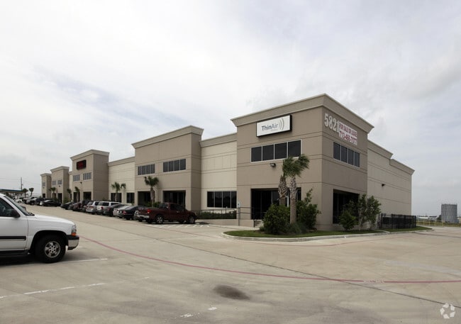
Property Record
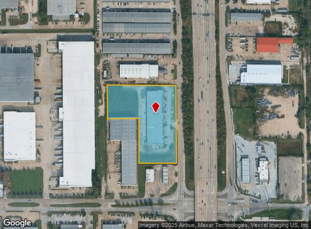
5821 W Sam Houston Pkwy N, Houston, TX 77041
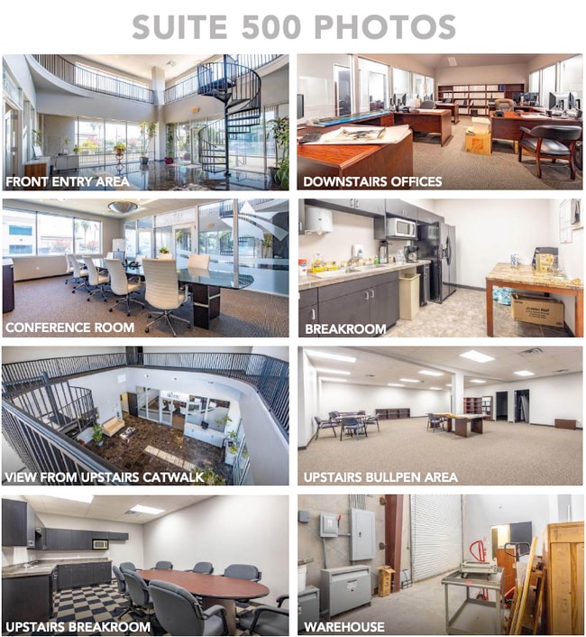
Current Lease Availabilities
NEARBY LISTINGS FOR SALE OR LEASE
Property Detail
5821 W Sam Houston Pkwy N
1217670010001
Spencer Site 282
Warehouse
RES B BLK 1 SPENCER SITE 282
AE
Harris
48201C0630M
Texas
2024
4.05 AC
2025
Northwest Inner Loop
540102
Houston
35,300 SF
Houston-The Woodlands-Sugar Land, TX
DEMOGRAPHICS near 5821 W Sam Houston Pkwy N
1 Mile
3 Mile
5 Mile
2024 Total Population
2,464
55,766
250,708
2029 Population
2,502
56,817
255,399
Pop Growth 2024-2029
+ 1.54%
+ 1.88%
+ 1.87%
Average Age
36
39
37
2024 Total Households
762
20,278
89,985
HH Growth 2024-2029
+ 1.57%
+ 1.99%
+ 1.87%
Median Household Inc
$71,226
$73,308
$65,770
Avg Household Size
3.00
2.70
2.70
2024 Avg HH Vehicles
3.00
2.00
2.00
Median Home Value
$237,239
$284,052
$250,599
Median Year Built
1986
1985
1985
Nearby Places
- Restaurants
- Banks
- Shops
- Fitness
- Groceries
PUBLIC TRANSPORTATION
AIRPORT
George Bush Intcntl/Houston
DRIVE
WALK
Distance
George Bush Intcntl/Houston
30 min
22.7 mi
William P Hobby
DRIVE
WALK
Distance
William P Hobby
47 min
30.3 mi
Freight Ports
Port of Houston
DRIVE
WALK
Distance
Port of Houston
39 min
25.1 mi
Nearby Properties
Address
Land Use
TOTAL SIZE
Lot Size
Zoning
Address
Land Use
TOTAL SIZE
Lot Size
Zoning
578,530 SF
32.81 AC
Address
Land Use
TOTAL SIZE
Lot Size
Zoning
793,669 SF
121.83 AC
Address
Land Use
TOTAL SIZE
Lot Size
Zoning
519,220 SF
6.23 AC
Address
Land Use
TOTAL SIZE
Lot Size
Zoning
380,959 SF
21.43 AC
Address
Land Use
TOTAL SIZE
Lot Size
Zoning
342,163 SF
8.50 AC
Address
Land Use
TOTAL SIZE
Lot Size
Zoning
427,921 SF
18.14 AC
Address
Land Use
TOTAL SIZE
Lot Size
Zoning
336,681 SF
16.10 AC
Address
Land Use
TOTAL SIZE
Lot Size
Zoning
Address
Land Use
TOTAL SIZE
Lot Size
Zoning
300,348 SF
6.10 AC
Address
Land Use
TOTAL SIZE
Lot Size
Zoning
647,228 SF
9.85 AC
Address
Land Use
TOTAL SIZE
Lot Size
Zoning
408,730 SF
24.68 AC
Address
Land Use
TOTAL SIZE
Lot Size
Zoning
281,843 SF
13.97 AC
Address
Land Use
TOTAL SIZE
Lot Size
Zoning
312,065 SF
17.83 AC
Address
Land Use
TOTAL SIZE
Lot Size
Zoning
157,698 SF
5.98 AC
Address
Land Use
TOTAL SIZE
Lot Size
Zoning
172,326 SF
8.07 AC
Address
Land Use
TOTAL SIZE
Lot Size
Zoning
350,057 SF
19.96 AC
Address
Land Use
TOTAL SIZE
Lot Size
Zoning
Address
Land Use
TOTAL SIZE
Lot Size
Zoning
491,051 SF
50 AC
Address
Land Use
TOTAL SIZE
Lot Size
Zoning
347,694 SF
17.61 AC
Address
Land Use
TOTAL SIZE
Lot Size
Zoning
363,896 SF
21.69 AC
Address
Land Use
TOTAL SIZE
Lot Size
Zoning
327,674 SF
15.32 AC
Address
Land Use
TOTAL SIZE
Lot Size
Zoning
287,212 SF
12.52 AC
Address
Land Use
TOTAL SIZE
Lot Size
Zoning
472,988 SF
9 AC
Address
Land Use
TOTAL SIZE
Lot Size
Zoning
212,017 SF
14.11 AC
Address
Land Use
TOTAL SIZE
Lot Size
Zoning
251,461 SF
21.74 AC
Address
Land Use
TOTAL SIZE
Lot Size
Zoning
418,892 SF
19.81 AC
Address
Land Use
TOTAL SIZE
Lot Size
Zoning
358,361 SF
11.35 AC
Address
Land Use
TOTAL SIZE
Lot Size
Zoning
403,200 SF
20.53 AC
Address
Land Use
TOTAL SIZE
Lot Size
Zoning
272,209 SF
18.15 AC
Address
Land Use
TOTAL SIZE
Lot Size
Zoning
312,939 SF
22.80 AC
The World's #1 Commercial Real Estate Marketplace
Connect with us
© 2025 CoStar Group
The information above has been obtained from sources believed reliable. While we do not doubt its accuracy we have not verified it and make no guarantee, warranty or representation about it. It is your responsibility to independently confirm its accuracy and completeness. Any projections, opinions, assumptions, or estimates used are for example only and do not represent the current or future performance of the property. The value of this transaction to you depends on tax and other factors which should be evaluated by your tax, financial, and legal advisors. You and your advisors should conduct a careful, independent investigation of the property to determine to your satisfaction the suitability of the property for your needs.