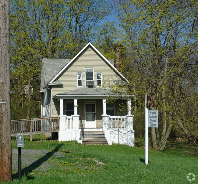
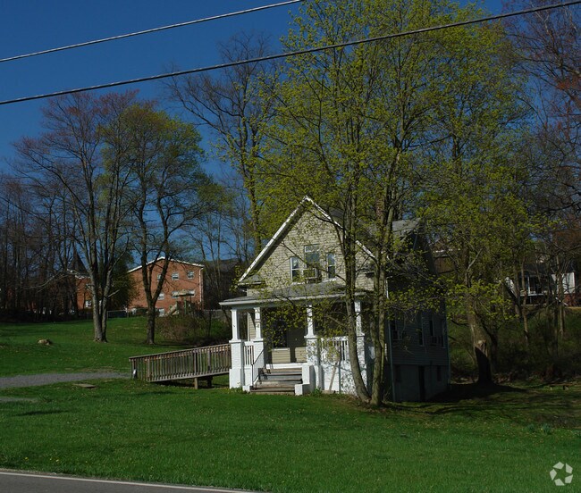
Property Record
5825 Heckert Rd, Bakerstown, PA 15007

Property Detail
5825 Heckert Rd
Pittsburgh, PA
LOT = 545.59 FRONTING WITH 21 TOTAL BEARINGS
2007-S-00271-0000-00
ALLEGHENY
Religious
Pennsylvania
B and X Area of moderate flood hazard, usually the area between the limits of the 100-year and 500-year floods.
271
2023
4.94 AC
2025
Northeast Pittsburgh
408001
Pittsburgh
1,020 SF
NEARBY LISTINGS FOR SALE OR LEASE
-
-
View all Bakerstown listings for sale on LoopNet.com
DEMOGRAPHICS near 5825 Heckert Rd
1 mile
3 mile
5 mile
2025 Total Population
2,352
19,746
48,642
2030 Population
2,314
19,464
48,235
Pop Growth 2025-2030
(1.62%)
(1.43%)
(0.84%)
Average Age
43
44
44
2025 Total Households
887
7,696
18,691
HH Growth 2025-2030
(1.69%)
(1.42%)
(0.87%)
Median Household Inc
$144,601
$119,644
$119,447
Avg Household Size
2.60
2.50
2.60
2025 Avg HH Vehicles
2.00
2.00
2.00
Median Home Value
$450,320
$360,188
$389,655
Median Year Built
1987
1984
1985
Nearby Places
Map Layers
Map Styles
 Street
 Aerial
Layers
 Traffic
 Biking
Places
Listings with unknown addresses are not visible on the map
- Restaurants
- Banks
- Shops
- Fitness
- Groceries
PUBLIC TRANSPORTATION
AIRPORT
Pittsburgh International
Drive
Walk
Distance
Pittsburgh International
50 min
25.3 mi
Freight Ports
Port of Toledo
Drive
Walk
Distance
Port of Toledo
255 min
225.0 mi
Nearby Properties
Address
Land Use
TOTAL SIZE
Lot Size
Zoning
Address
Land Use
TOTAL SIZE
Lot Size
Zoning
36.18 AC
Address
Land Use
TOTAL SIZE
Lot Size
Zoning
211.69 AC
Address
Land Use
TOTAL SIZE
Lot Size
Zoning
28.38 AC
Address
Land Use
TOTAL SIZE
Lot Size
Zoning
5,902 SF
368.70 AC
Address
Land Use
TOTAL SIZE
Lot Size
Zoning
Address
Land Use
TOTAL SIZE
Lot Size
Zoning
Address
Land Use
TOTAL SIZE
Lot Size
Zoning
12.25 AC
Address
Land Use
TOTAL SIZE
Lot Size
Zoning
1,465 SF
11.68 AC
Address
Land Use
TOTAL SIZE
Lot Size
Zoning
13.17 AC
Address
Land Use
TOTAL SIZE
Lot Size
Zoning
1,426 SF
16.11 AC
Address
Land Use
TOTAL SIZE
Lot Size
Zoning
8.23 AC
Address
Land Use
TOTAL SIZE
Lot Size
Zoning
4,434 SF
11.82 AC
Address
Land Use
TOTAL SIZE
Lot Size
Zoning
Address
Land Use
TOTAL SIZE
Lot Size
Zoning
6.67 AC
Address
Land Use
TOTAL SIZE
Lot Size
Zoning
14.55 AC
Address
Land Use
TOTAL SIZE
Lot Size
Zoning
41.36 AC
Address
Land Use
TOTAL SIZE
Lot Size
Zoning
21.70 AC
Address
Land Use
TOTAL SIZE
Lot Size
Zoning
Address
Land Use
TOTAL SIZE
Lot Size
Zoning
8.36 AC
Address
Land Use
TOTAL SIZE
Lot Size
Zoning
12.31 AC
Address
Land Use
TOTAL SIZE
Lot Size
Zoning
0.72 AC
Address
Land Use
TOTAL SIZE
Lot Size
Zoning
3.50 AC
Address
Land Use
TOTAL SIZE
Lot Size
Zoning
105.71 AC
Address
Land Use
TOTAL SIZE
Lot Size
Zoning
31.93 AC
Address
Land Use
TOTAL SIZE
Lot Size
Zoning
6.62 AC
Address
Land Use
TOTAL SIZE
Lot Size
Zoning
4.70 AC
Address
Land Use
TOTAL SIZE
Lot Size
Zoning
39.94 AC
Address
Land Use
TOTAL SIZE
Lot Size
Zoning
Address
Land Use
TOTAL SIZE
Lot Size
Zoning
10.14 AC
The World's #1 Commercial Real Estate Marketplace
Connect with us
© 2026 CoStar Group
The information above has been obtained from sources believed reliable. While we do not doubt its accuracy we have not verified it and make no guarantee, warranty or representation about it. It is your responsibility to independently confirm its accuracy and completeness. Any projections, opinions, assumptions, or estimates used are for example only and do not represent the current or future performance of the property. The value of this transaction to you depends on tax and other factors which should be evaluated by your tax, financial, and legal advisors. You and your advisors should conduct a careful, independent investigation of the property to determine to your satisfaction the suitability of the property for your needs.