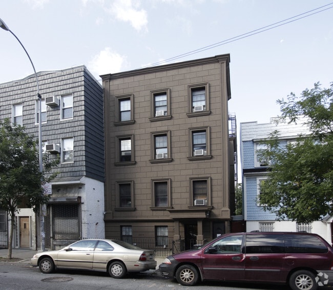
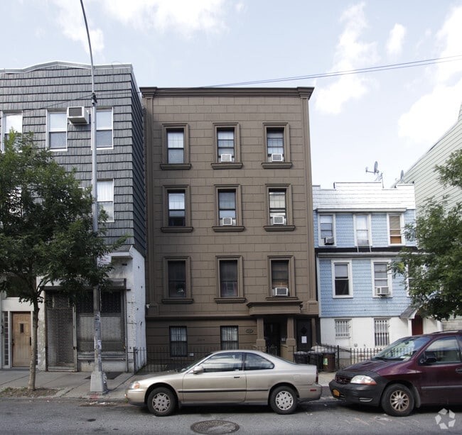
Property Record
583 Lorimer St, Brooklyn, NY 11211

Property Detail
583 Lorimer St
02756-0025
DOCID-2022020401046001
Apartment
Kings
R7A
New York
B and X Area of moderate flood hazard, usually the area between the limits of the 100-year and 500-year floods.
25
2024
0.06 AC
2025
Williamsburg
050100
Long Island (New York)
8,619 SF
New York-Jersey City-White Plains, NY-NJ
NEARBY LISTINGS FOR SALE OR LEASE
DEMOGRAPHICS near 583 Lorimer St
1 mile
3 mile
5 mile
2025 Total Population
175,810
1,373,966
3,328,054
2030 Population
179,028
1,402,737
3,383,906
Pop Growth 2025-2030
+ 1.83%
+ 2.09%
+ 1.68%
Average Age
35
38
40
2025 Total Households
72,210
595,100
1,424,360
HH Growth 2025-2030
+ 1.55%
+ 2.29%
+ 2.12%
Median Household Inc
$105,245
$103,074
$102,960
Avg Household Size
2.40
2.20
2.20
2025 Avg HH Vehicles
.00
.00
.00
Median Home Value
$1,051,731
$1,001,567
$947,334
Median Year Built
1962
1951
1952
Nearby Places
Map Layers
Map Styles
 Street
 Aerial
Transit
 Traffic
 Biking
Places
Listings with unknown addresses are not visible on the map
- Restaurants
- Banks
- Shops
- Fitness
- Groceries
Nearby Properties
Address
Land Use
TOTAL SIZE
Lot Size
Zoning
Address
Land Use
TOTAL SIZE
Lot Size
Zoning
8,462,176 SF
61.41 AC
R7-2
Address
Land Use
TOTAL SIZE
Lot Size
Zoning
2,812,739 SF
2.10 AC
C5-3
Address
Land Use
TOTAL SIZE
Lot Size
Zoning
2,400,000 SF
15.14 AC
C5-2
Address
Land Use
TOTAL SIZE
Lot Size
Zoning
2,124,441 SF
17.29 AC
R8
Address
Land Use
TOTAL SIZE
Lot Size
Zoning
1,233,394 SF
1.78 AC
C5-3
Address
Land Use
TOTAL SIZE
Lot Size
Zoning
1,104,505 SF
2.32 AC
C4-7
Address
Land Use
TOTAL SIZE
Lot Size
Zoning
916,553 SF
1.39 AC
C5-3
Address
Land Use
TOTAL SIZE
Lot Size
Zoning
940,000 SF
1.44 AC
C6-2
Address
Land Use
TOTAL SIZE
Lot Size
Zoning
1,050,990 SF
1.21 AC
C52.5
Address
Land Use
TOTAL SIZE
Lot Size
Zoning
7,058,736 SF
147.61 AC
M3-1
Address
Land Use
TOTAL SIZE
Lot Size
Zoning
869,038 SF
1.53 AC
M1-1
Address
Land Use
TOTAL SIZE
Lot Size
Zoning
1,260,362 SF
4.32 AC
C1-7
Address
Land Use
TOTAL SIZE
Lot Size
Zoning
3,122,165 SF
19.02 AC
R7-2
Address
Land Use
TOTAL SIZE
Lot Size
Zoning
1,653,794 SF
3.15 AC
C6-4
Address
Land Use
TOTAL SIZE
Lot Size
Zoning
704,950 SF
1.19 AC
C5-2
Address
Land Use
TOTAL SIZE
Lot Size
Zoning
1,065,915 SF
2.13 AC
M16R10
Address
Land Use
TOTAL SIZE
Lot Size
Zoning
1,385,425 SF
6.43 AC
R8
Address
Land Use
TOTAL SIZE
Lot Size
Zoning
1,035,307 SF
0.86 AC
C5-3
Address
Land Use
TOTAL SIZE
Lot Size
Zoning
900,514 SF
0.87 AC
C5-3
Address
Land Use
TOTAL SIZE
Lot Size
Zoning
553,725 SF
0.84 AC
C5-2
Address
Land Use
TOTAL SIZE
Lot Size
Zoning
599,102 SF
0.81 AC
C5-3
Address
Land Use
TOTAL SIZE
Lot Size
Zoning
1,092,665 SF
1.06 AC
C62A
Address
Land Use
TOTAL SIZE
Lot Size
Zoning
840,000 SF
1.04 AC
C4-6
Address
Land Use
TOTAL SIZE
Lot Size
Zoning
1,503,235 SF
5.28 AC
C2-7
Address
Land Use
TOTAL SIZE
Lot Size
Zoning
805,287 SF
1 AC
R10
Address
Land Use
TOTAL SIZE
Lot Size
Zoning
986,431 SF
1.06 AC
C52.5
Address
Land Use
TOTAL SIZE
Lot Size
Zoning
778,203 SF
0.85 AC
C5-3
Address
Land Use
TOTAL SIZE
Lot Size
Zoning
1,159,795 SF
1.93 AC
C5-3
Address
Land Use
TOTAL SIZE
Lot Size
Zoning
666,376 SF
0.80 AC
C5-3
Address
Land Use
TOTAL SIZE
Lot Size
Zoning
2,948,300 SF
27.71 AC
R7-2
The World's #1 Commercial Real Estate Marketplace
Connect with us
© 2026 CoStar Group
The information above has been obtained from sources believed reliable. While we do not doubt its accuracy we have not verified it and make no guarantee, warranty or representation about it. It is your responsibility to independently confirm its accuracy and completeness. Any projections, opinions, assumptions, or estimates used are for example only and do not represent the current or future performance of the property. The value of this transaction to you depends on tax and other factors which should be evaluated by your tax, financial, and legal advisors. You and your advisors should conduct a careful, independent investigation of the property to determine to your satisfaction the suitability of the property for your needs.