Property Record
583 Roanoke Dr, Fort Mill, SC 29715
Property Detail
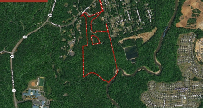
583 Roanoke Dr
7350000009
S HWY 674 APPROX 10 AC
Agriculturalland
YORK
RDII
South Carolina
AE The base floodplain where base flood elevations are provided. AE Zones are now used on new format FIRMs instead of A1-A30 Zones.
26 AC
2025
York County
2025
Charlotte
061008
Charlotte-Concord-Gastonia, NC-SC
NEARBY LISTINGS FOR SALE OR LEASE
DEMOGRAPHICS near 583 Roanoke Dr
1 mile
3 mile
5 mile
2025 Total Population
3,478
42,478
140,688
2030 Population
3,756
46,136
151,987
Pop Growth 2025-2030
+ 7.99%
+ 8.61%
+ 8.03%
Average Age
38
38
38
2025 Total Households
1,232
15,440
52,531
HH Growth 2025-2030
+ 7.95%
+ 8.70%
+ 8.11%
Median Household Inc
$172,883
$130,143
$117,957
Avg Household Size
2.80
2.70
2.70
2025 Avg HH Vehicles
2.00
2.00
2.00
Median Home Value
$692,678
$485,581
$494,980
Median Year Built
2010
2007
2006
Nearby Places
Map Layers
Map Styles
 Street
 Aerial
Layers
 Traffic
 Biking
Places
Listings with unknown addresses are not visible on the map
- Restaurants
- Banks
- Shops
- Fitness
- Groceries
PUBLIC TRANSPORTATION
AIRPORT
Charlotte/Douglas International
Drive
Walk
Distance
Charlotte/Douglas International
33 min
15.7 mi
Concord-Padgett Regional
Drive
Walk
Distance
Concord-Padgett Regional
51 min
32.6 mi
SALE & LEASE HISTORY
LISTING DATE
SALE/LEASE

Oct 16, 2024
For Sale
Nearby Properties
Address
Land Use
TOTAL SIZE
Lot Size
Zoning
Address
Land Use
TOTAL SIZE
Lot Size
Zoning
234,912 SF
11.60 AC
R3
Address
Land Use
TOTAL SIZE
Lot Size
Zoning
532,223 SF
29.11 AC
LI
Address
Land Use
TOTAL SIZE
Lot Size
Zoning
234,931 SF
133.39 AC
PDD
Address
Land Use
TOTAL SIZE
Lot Size
Zoning
108,195 SF
28.29 AC
INS
Address
Land Use
TOTAL SIZE
Lot Size
Zoning
401.79 AC
Address
Land Use
TOTAL SIZE
Lot Size
Zoning
335.85 AC
AGC
Address
Land Use
TOTAL SIZE
Lot Size
Zoning
167.49 AC
MULTIPLEZ
Address
Land Use
TOTAL SIZE
Lot Size
Zoning
162.78 AC
RCI
Address
Land Use
TOTAL SIZE
Lot Size
Zoning
64,113 SF
6.69 AC
Address
Land Use
TOTAL SIZE
Lot Size
Zoning
197,864 SF
39.37 AC
Address
Land Use
TOTAL SIZE
Lot Size
Zoning
79,600 SF
9.58 AC
Address
Land Use
TOTAL SIZE
Lot Size
Zoning
17,223 SF
2.55 AC
NS
Address
Land Use
TOTAL SIZE
Lot Size
Zoning
10,328 SF
56.48 AC
R-MF
Address
Land Use
TOTAL SIZE
Lot Size
Zoning
13,475 SF
39.11 AC
MX
Address
Land Use
TOTAL SIZE
Lot Size
Zoning
7,772 SF
4.75 AC
Address
Land Use
TOTAL SIZE
Lot Size
Zoning
8,615 SF
0.87 AC
NS
Address
Land Use
TOTAL SIZE
Lot Size
Zoning
14,000 SF
3.32 AC
Address
Land Use
TOTAL SIZE
Lot Size
Zoning
21,761 SF
30.22 AC
AGC
Address
Land Use
TOTAL SIZE
Lot Size
Zoning
4,398 SF
15.25 AC
Address
Land Use
TOTAL SIZE
Lot Size
Zoning
6,494 SF
19.99 AC
PDD
Address
Land Use
TOTAL SIZE
Lot Size
Zoning
56.64 AC
MDR
Address
Land Use
TOTAL SIZE
Lot Size
Zoning
48,912 SF
14.66 AC
Address
Land Use
TOTAL SIZE
Lot Size
Zoning
28,104 SF
11.47 AC
BDII
Address
Land Use
TOTAL SIZE
Lot Size
Zoning
11,016 SF
4.04 AC
INS
Address
Land Use
TOTAL SIZE
Lot Size
Zoning
10.57 AC
Address
Land Use
TOTAL SIZE
Lot Size
Zoning
31.08 AC
MDR
Address
Land Use
TOTAL SIZE
Lot Size
Zoning
5,750 SF
0.54 AC
Address
Land Use
TOTAL SIZE
Lot Size
Zoning
24,200 SF
2.18 AC
Address
Land Use
TOTAL SIZE
Lot Size
Zoning
4,058 SF
28.55 AC
AGC
Address
Land Use
TOTAL SIZE
Lot Size
Zoning
16.05 AC
The World's #1 Commercial Real Estate Marketplace
Connect with us
© 2026 CoStar Group
The information above has been obtained from sources believed reliable. While we do not doubt its accuracy we have not verified it and make no guarantee, warranty or representation about it. It is your responsibility to independently confirm its accuracy and completeness. Any projections, opinions, assumptions, or estimates used are for example only and do not represent the current or future performance of the property. The value of this transaction to you depends on tax and other factors which should be evaluated by your tax, financial, and legal advisors. You and your advisors should conduct a careful, independent investigation of the property to determine to your satisfaction the suitability of the property for your needs.