Property Record
5839 Rome Taberg Rd, Rome, NY 13440


NEARBY LISTINGS FOR SALE OR LEASE
-
-
View all Rome listings for sale on LoopNet.com
Property Detail
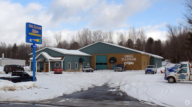
5839 Rome Taberg Rd
222-000-0001-047-000-0000
BL 75X500
Autorepair
Oneida
X
New York
36065C0551F
47.000
2025
0.85 AC
2024
Greater Rome
022702
Utica/Rome
11,063 SF
Utica-Rome, NY
DEMOGRAPHICS near 5839 Rome Taberg Rd
1 Mile
3 Mile
5 Mile
2024 Total Population
189
20,740
36,227
2029 Population
186
20,454
35,881
Pop Growth 2024-2029
(1.59%)
(1.38%)
(0.96%)
Average Age
44
42
42
2024 Total Households
82
9,049
15,278
HH Growth 2024-2029
(2.44%)
(1.43%)
(1.15%)
Median Household Inc
$62,308
$49,987
$55,248
Avg Household Size
2.20
2.20
2.20
2024 Avg HH Vehicles
2.00
1.00
2.00
Median Home Value
$119,444
$120,286
$133,986
Median Year Built
1962
1952
1955
Nearby Places
Map Layers
Map Styles
 Street
 Aerial
- Restaurants
- Banks
- Shops
- Fitness
- Groceries
PUBLIC TRANSPORTATION
COMMUTER RAIL
DRIVE
WALK
Distance
9 min
3.8 mi
DRIVE
WALK
Distance
9 min
3.8 mi
AIRPORT
Syracuse Hancock International
DRIVE
WALK
Distance
Syracuse Hancock International
61 min
39.2 mi
Nearby Properties
Address
Land Use
TOTAL SIZE
Lot Size
Zoning
Address
Land Use
TOTAL SIZE
Lot Size
Zoning
234,767 SF
7.70 AC
I
Address
Land Use
TOTAL SIZE
Lot Size
Zoning
60,450 SF
2.95 AC
R-P
Address
Land Use
TOTAL SIZE
Lot Size
Zoning
58,560 SF
2.44 AC
R-P
Address
Land Use
TOTAL SIZE
Lot Size
Zoning
112,259 SF
2.59 AC
C-3
Address
Land Use
TOTAL SIZE
Lot Size
Zoning
214,891 SF
22.90 AC
C-2
Address
Land Use
TOTAL SIZE
Lot Size
Zoning
131,001 SF
14.70 AC
R-2
Address
Land Use
TOTAL SIZE
Lot Size
Zoning
173,579 SF
14.46 AC
R-1-8
Address
Land Use
TOTAL SIZE
Lot Size
Zoning
41,262 SF
16.30 AC
R-1-8
Address
Land Use
TOTAL SIZE
Lot Size
Zoning
25,002 SF
6.53 AC
R-3
Address
Land Use
TOTAL SIZE
Lot Size
Zoning
49,643 SF
8 AC
C-1
Address
Land Use
TOTAL SIZE
Lot Size
Zoning
3,778 SF
15.52 AC
OS
Address
Land Use
TOTAL SIZE
Lot Size
Zoning
Address
Land Use
TOTAL SIZE
Lot Size
Zoning
82,918 SF
3.70 AC
W
Address
Land Use
TOTAL SIZE
Lot Size
Zoning
133,723 SF
9.28 AC
C-2
Address
Land Use
TOTAL SIZE
Lot Size
Zoning
35,832 SF
0.48 AC
C-3
Address
Land Use
TOTAL SIZE
Lot Size
Zoning
287,725 SF
15.43 AC
I-G
Address
Land Use
TOTAL SIZE
Lot Size
Zoning
78,160 SF
15.10 AC
C-1
Address
Land Use
TOTAL SIZE
Lot Size
Zoning
37.90 AC
Address
Land Use
TOTAL SIZE
Lot Size
Zoning
66,876 SF
13 AC
R-1-8
Address
Land Use
TOTAL SIZE
Lot Size
Zoning
29,574 SF
49.10 AC
I
Address
Land Use
TOTAL SIZE
Lot Size
Zoning
12,216 SF
15 AC
R-3
Address
Land Use
TOTAL SIZE
Lot Size
Zoning
30,056 SF
11.82 AC
C-2
Address
Land Use
TOTAL SIZE
Lot Size
Zoning
15,102 SF
1.87 AC
C-2
Address
Land Use
TOTAL SIZE
Lot Size
Zoning
53,424 SF
5.39 AC
I-G
Address
Land Use
TOTAL SIZE
Lot Size
Zoning
70,783 SF
3.80 AC
R-1-8
Address
Land Use
TOTAL SIZE
Lot Size
Zoning
65,856 SF
3.10 AC
I
Address
Land Use
TOTAL SIZE
Lot Size
Zoning
72,611 SF
1.62 AC
R-1-8
Address
Land Use
TOTAL SIZE
Lot Size
Zoning
18,900 SF
3.17 AC
C-2
Address
Land Use
TOTAL SIZE
Lot Size
Zoning
74,075 SF
14.46 AC
C-2
Address
Land Use
TOTAL SIZE
Lot Size
Zoning
59,018 SF
3.10 AC
R-1-8
The World's #1 Commercial Real Estate Marketplace
Connect with us
© 2025 CoStar Group
The information above has been obtained from sources believed reliable. While we do not doubt its accuracy we have not verified it and make no guarantee, warranty or representation about it. It is your responsibility to independently confirm its accuracy and completeness. Any projections, opinions, assumptions, or estimates used are for example only and do not represent the current or future performance of the property. The value of this transaction to you depends on tax and other factors which should be evaluated by your tax, financial, and legal advisors. You and your advisors should conduct a careful, independent investigation of the property to determine to your satisfaction the suitability of the property for your needs.