Property Record
5840 Artemus Rd, Gainesville, VA 20155


Property Detail
5840 Artemus Rd
Washington-Arlington-Alexandria, DC-VA-MD-WV
TRAPPERS RIDGE L-14
7498-36-5811
PRINCE WILLIAM
Vacantlandnec
Virginia
PBD
14
B and X Area of moderate flood hazard, usually the area between the limits of the 100-year and 500-year floods.
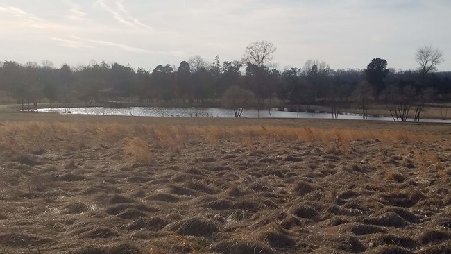
10.05 AC
2024
Route 29/I-66 Corridor
2025
Washington, DC
901507
NEARBY LISTINGS FOR SALE OR LEASE
DEMOGRAPHICS near 5840 Artemus Rd
1 mile
3 mile
5 mile
2025 Total Population
2,036
27,834
102,777
2030 Population
2,088
28,659
105,771
Pop Growth 2025-2030
+ 2.55%
+ 2.96%
+ 2.91%
Average Age
63
42
38
2025 Total Households
967
9,527
33,356
HH Growth 2025-2030
+ 2.28%
+ 2.86%
+ 2.87%
Median Household Inc
$119,539
$165,356
$156,672
Avg Household Size
2.10
2.90
3.00
2025 Avg HH Vehicles
2.00
2.00
2.00
Median Home Value
$754,844
$690,196
$686,612
Median Year Built
2004
2004
2002
Nearby Places
Map Layers
Map Styles
 Street
 Aerial
Layers
 Traffic
 Biking
Places
Listings with unknown addresses are not visible on the map
- Restaurants
- Banks
- Shops
- Fitness
- Groceries
PUBLIC TRANSPORTATION
AIRPORT
Washington Dulles International
Drive
Walk
Distance
Washington Dulles International
38 min
23.7 mi
Ronald Reagan Washington Ntl
Drive
Walk
Distance
Ronald Reagan Washington Ntl
52 min
38.3 mi
SALE & LEASE HISTORY
LISTING DATE
SALE/LEASE

Jul 01, 2019
For Sale
Nearby Properties
Address
Land Use
TOTAL SIZE
Lot Size
Zoning
Address
Land Use
TOTAL SIZE
Lot Size
Zoning
482,223 SF
28.10 AC
PBD
Address
Land Use
TOTAL SIZE
Lot Size
Zoning
560,942 SF
90.90 AC
B1
Address
Land Use
TOTAL SIZE
Lot Size
Zoning
117.22 AC
M1
Address
Land Use
TOTAL SIZE
Lot Size
Zoning
252,966 SF
10.54 AC
PMD
Address
Land Use
TOTAL SIZE
Lot Size
Zoning
258,716 SF
58.54 AC
M1
Address
Land Use
TOTAL SIZE
Lot Size
Zoning
58.30 AC
M1
Address
Land Use
TOTAL SIZE
Lot Size
Zoning
482,200 SF
29.18 AC
PBD
Address
Land Use
TOTAL SIZE
Lot Size
Zoning
161.28 AC
PBD
Address
Land Use
TOTAL SIZE
Lot Size
Zoning
124.18 AC
PBD
Address
Land Use
TOTAL SIZE
Lot Size
Zoning
298,474 SF
11.60 AC
PMR
Address
Land Use
TOTAL SIZE
Lot Size
Zoning
280,221 SF
78.35 AC
RPC
Address
Land Use
TOTAL SIZE
Lot Size
Zoning
28.38 AC
PBD
Address
Land Use
TOTAL SIZE
Lot Size
Zoning
175,260 SF
30.39 AC
MT
Address
Land Use
TOTAL SIZE
Lot Size
Zoning
23.65 AC
R4
Address
Land Use
TOTAL SIZE
Lot Size
Zoning
39,078 SF
84.24 AC
MIXED
Address
Land Use
TOTAL SIZE
Lot Size
Zoning
9,100 SF
217.60 AC
MRHI
Address
Land Use
TOTAL SIZE
Lot Size
Zoning
92,182 SF
19.90 AC
B1
Address
Land Use
TOTAL SIZE
Lot Size
Zoning
363,220 SF
20.35 AC
PBD
Address
Land Use
TOTAL SIZE
Lot Size
Zoning
125,157 SF
18.53 AC
B1
Address
Land Use
TOTAL SIZE
Lot Size
Zoning
62.97 AC
PBD
Address
Land Use
TOTAL SIZE
Lot Size
Zoning
189,787 SF
12.13 AC
M2
Address
Land Use
TOTAL SIZE
Lot Size
Zoning
121,672 SF
11.05 AC
M2
Address
Land Use
TOTAL SIZE
Lot Size
Zoning
285,889 SF
19.61 AC
M1
Address
Land Use
TOTAL SIZE
Lot Size
Zoning
165,730 SF
20.39 AC
M2
Address
Land Use
TOTAL SIZE
Lot Size
Zoning
125,653 SF
19.78 AC
MIXED
Address
Land Use
TOTAL SIZE
Lot Size
Zoning
80,141 SF
8.67 AC
B1
Address
Land Use
TOTAL SIZE
Lot Size
Zoning
93,460 SF
8.99 AC
M1
Address
Land Use
TOTAL SIZE
Lot Size
Zoning
137,350 SF
8.72 AC
M1
Address
Land Use
TOTAL SIZE
Lot Size
Zoning
134,520 SF
11.12 AC
MIXED
Address
Land Use
TOTAL SIZE
Lot Size
Zoning
137,500 SF
8.81 AC
M1
The World's #1 Commercial Real Estate Marketplace
Connect with us
© 2026 CoStar Group
The information above has been obtained from sources believed reliable. While we do not doubt its accuracy we have not verified it and make no guarantee, warranty or representation about it. It is your responsibility to independently confirm its accuracy and completeness. Any projections, opinions, assumptions, or estimates used are for example only and do not represent the current or future performance of the property. The value of this transaction to you depends on tax and other factors which should be evaluated by your tax, financial, and legal advisors. You and your advisors should conduct a careful, independent investigation of the property to determine to your satisfaction the suitability of the property for your needs.