Property Record
5842 Nw 72Nd Pl, Warr Acres, OK 73132

NEARBY LISTINGS FOR SALE OR LEASE
Property Detail
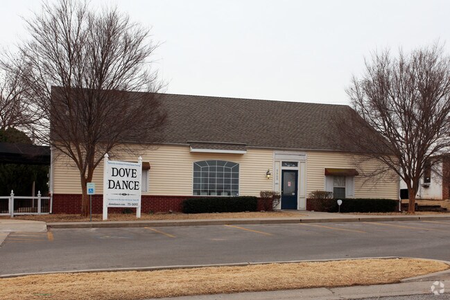
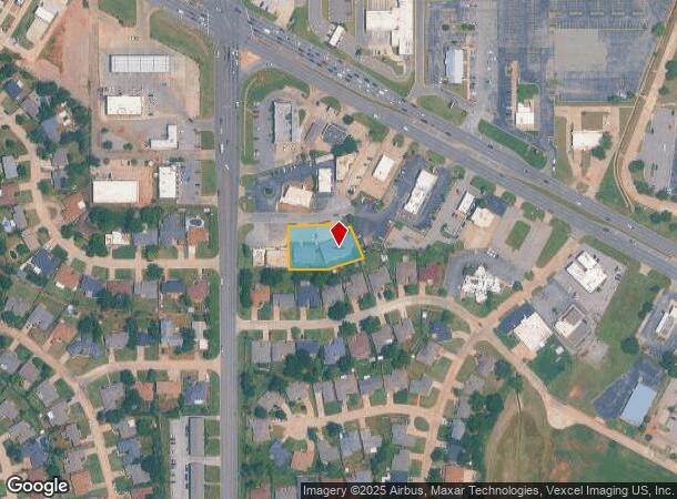
5842 Nw 72Nd Pl
Oklahoma City, OK
Cherokee Hills Sec 4
188451010
CHEROKEE HILLS SEC 4 022 000 PT LOT 1 BEG 125FT E SW/C SD LOT 1 TH E107.82FT NELY 110FT NWLY 107.21FT TO POINT ON CURVE ALONG SD CURVE 34FT TO POINT ON REVERSE CURVE ALONG SD CURVE 32.51FT TO POINT ON REVERSE CURVE WLY ALONG SD CURVE 28FT W75FT S125.
Storebuilding
Oklahoma
X
Oklahoma
40109C0165H
1
2023
0.54 AC
2024
Northwest
106705
Oklahoma City
6,900 SF
DEMOGRAPHICS near 5842 Nw 72Nd Pl
1 Mile
3 Mile
5 Mile
2024 Total Population
14,279
79,460
226,323
2029 Population
14,834
81,341
233,694
Pop Growth 2024-2029
+ 3.89%
+ 2.37%
+ 3.26%
Average Age
36
39
39
2024 Total Households
5,788
33,757
96,542
HH Growth 2024-2029
+ 4.08%
+ 2.49%
+ 3.19%
Median Household Inc
$48,157
$55,465
$58,844
Avg Household Size
2.40
2.30
2.30
2024 Avg HH Vehicles
2.00
2.00
2.00
Median Home Value
$176,269
$178,211
$188,155
Median Year Built
1973
1974
1973
Nearby Places
Map Layers
Map Styles
 Street
 Aerial
- Restaurants
- Banks
- Shops
- Fitness
- Groceries
PUBLIC TRANSPORTATION
AIRPORT
Will Rogers World
DRIVE
WALK
Distance
Will Rogers World
21 min
13.8 mi
Nearby Properties
Address
Land Use
TOTAL SIZE
Lot Size
Zoning
Address
Land Use
TOTAL SIZE
Lot Size
Zoning
44,519 SF
3.39 AC
SPUD
Address
Land Use
TOTAL SIZE
Lot Size
Zoning
37,400 SF
4.23 AC
PUD
Address
Land Use
TOTAL SIZE
Lot Size
Zoning
312,308 SF
9.76 AC
C-3
Address
Land Use
TOTAL SIZE
Lot Size
Zoning
90,059 SF
14.99 AC
O-2
Address
Land Use
TOTAL SIZE
Lot Size
Zoning
430,092 SF
17.35 AC
R-4
Address
Land Use
TOTAL SIZE
Lot Size
Zoning
10,922 SF
1.04 AC
SPUD
Address
Land Use
TOTAL SIZE
Lot Size
Zoning
641,860 SF
62.12 AC
R-4
Address
Land Use
TOTAL SIZE
Lot Size
Zoning
28,099 SF
1.21 AC
O-2
Address
Land Use
TOTAL SIZE
Lot Size
Zoning
49,950 SF
3.69 AC
Address
Land Use
TOTAL SIZE
Lot Size
Zoning
21,111 SF
2.57 AC
R-4
Address
Land Use
TOTAL SIZE
Lot Size
Zoning
347,288 SF
19 AC
C-3
Address
Land Use
TOTAL SIZE
Lot Size
Zoning
213,085 SF
3.64 AC
Address
Land Use
TOTAL SIZE
Lot Size
Zoning
29,274 SF
0.93 AC
C-3
Address
Land Use
TOTAL SIZE
Lot Size
Zoning
286,485 SF
14.86 AC
R-4
Address
Land Use
TOTAL SIZE
Lot Size
Zoning
363,374 SF
15.85 AC
R-4
Address
Land Use
TOTAL SIZE
Lot Size
Zoning
164,880 SF
8.95 AC
O-2
Address
Land Use
TOTAL SIZE
Lot Size
Zoning
226,800 SF
30.07 AC
R-2
Address
Land Use
TOTAL SIZE
Lot Size
Zoning
69,370 SF
O-2
Address
Land Use
TOTAL SIZE
Lot Size
Zoning
263,560 SF
13.10 AC
R-4
Address
Land Use
TOTAL SIZE
Lot Size
Zoning
327,372 SF
14.79 AC
R-4
Address
Land Use
TOTAL SIZE
Lot Size
Zoning
157,279 SF
15.07 AC
PUD
Address
Land Use
TOTAL SIZE
Lot Size
Zoning
259,024 SF
28.32 AC
R-4
Address
Land Use
TOTAL SIZE
Lot Size
Zoning
153,065 SF
13.87 AC
C-3
Address
Land Use
TOTAL SIZE
Lot Size
Zoning
342,342 SF
27.20 AC
R-4
Address
Land Use
TOTAL SIZE
Lot Size
Zoning
252,731 SF
7.39 AC
C-3
Address
Land Use
TOTAL SIZE
Lot Size
Zoning
245,768 SF
15.93 AC
Address
Land Use
TOTAL SIZE
Lot Size
Zoning
220,304 SF
19.54 AC
PUD
Address
Land Use
TOTAL SIZE
Lot Size
Zoning
69,060 SF
4.90 AC
C-CBD
Address
Land Use
TOTAL SIZE
Lot Size
Zoning
199,832 SF
9.72 AC
PUD
Address
Land Use
TOTAL SIZE
Lot Size
Zoning
224,982 SF
7.63 AC
O-2
The World's #1 Commercial Real Estate Marketplace
Connect with us
© 2025 CoStar Group
The information above has been obtained from sources believed reliable. While we do not doubt its accuracy we have not verified it and make no guarantee, warranty or representation about it. It is your responsibility to independently confirm its accuracy and completeness. Any projections, opinions, assumptions, or estimates used are for example only and do not represent the current or future performance of the property. The value of this transaction to you depends on tax and other factors which should be evaluated by your tax, financial, and legal advisors. You and your advisors should conduct a careful, independent investigation of the property to determine to your satisfaction the suitability of the property for your needs.