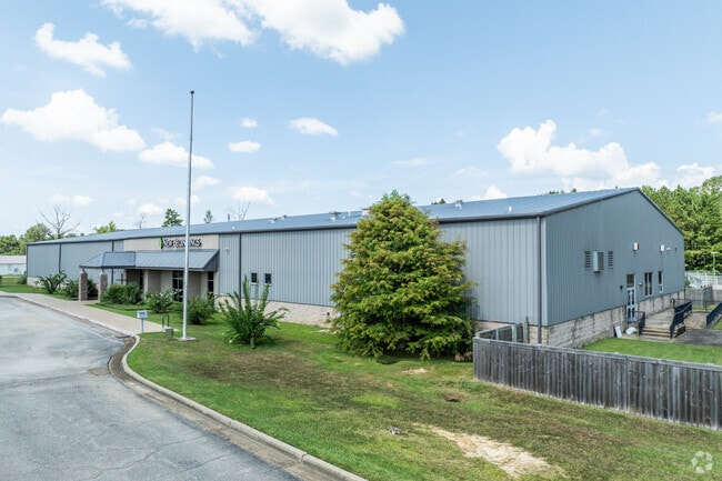
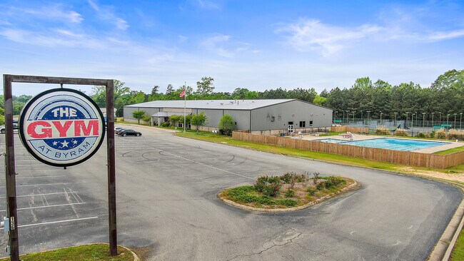
Property Record
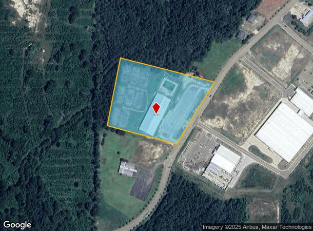
5843 Byram Pkwy, Byram, MS 39272

NEARBY LISTINGS FOR SALE OR LEASE
Property Detail
5843 Byram Pkwy
4851-0269-012
BEG 609.84 FT N & 59.79 FT SELY NW COR SW 1/4 SE 1/4 SEC 14 SELY 450.85 FT NELY 468.47 FT NWLY 618.98 FT SWLY 444.96 FT TO POB IN NW 1/4 SE 1/4 SEC 14 T4N R1W
Commercialnec
Hinds
X
Mississippi
28121C0295F
5.47 AC
2024
Outlying Hinds County
2025
Jackson
011104
Jackson, MS
25,880 SF
DEMOGRAPHICS near 5843 Byram Pkwy
1 Mile
3 Mile
5 Mile
2024 Total Population
2,701
13,668
28,784
2029 Population
2,457
12,710
26,991
Pop Growth 2024-2029
(9.03%)
(7.01%)
(6.23%)
Average Age
36
38
39
2024 Total Households
1,111
5,332
11,215
HH Growth 2024-2029
(9.72%)
(7.26%)
(6.42%)
Median Household Inc
$55,156
$67,017
$59,970
Avg Household Size
2.30
2.50
2.50
2024 Avg HH Vehicles
2.00
2.00
2.00
Median Home Value
$156,321
$157,704
$148,679
Median Year Built
1997
1996
1990
Nearby Places
Map Layers
Map Styles
 Street
 Aerial
- Restaurants
- Banks
- Shops
- Fitness
- Groceries
PUBLIC TRANSPORTATION
AIRPORT
Jackson-Medgar Wiley Evers International
DRIVE
WALK
Distance
Jackson-Medgar Wiley Evers International
28 min
19.5 mi
Freight Ports
Port of Greater Baton Rouge
DRIVE
WALK
Distance
Port of Greater Baton Rouge
187 min
167.4 mi
SALE & LEASE HISTORY
LISTING DATE
SALE/LEASE

Apr 28, 2021
For Sale
Nearby Properties
Address
Land Use
TOTAL SIZE
Lot Size
Zoning
Address
Land Use
TOTAL SIZE
Lot Size
Zoning
110,876 SF
8.80 AC
Address
Land Use
TOTAL SIZE
Lot Size
Zoning
489,330 SF
27.90 AC
Address
Land Use
TOTAL SIZE
Lot Size
Zoning
288.50 AC
Address
Land Use
TOTAL SIZE
Lot Size
Zoning
232,136 SF
16.06 AC
Address
Land Use
TOTAL SIZE
Lot Size
Zoning
190,029 SF
24.47 AC
Address
Land Use
TOTAL SIZE
Lot Size
Zoning
31,980 SF
9.10 AC
Address
Land Use
TOTAL SIZE
Lot Size
Zoning
Address
Land Use
TOTAL SIZE
Lot Size
Zoning
229,741 SF
17.28 AC
Address
Land Use
TOTAL SIZE
Lot Size
Zoning
34,900 SF
6.60 AC
Address
Land Use
TOTAL SIZE
Lot Size
Zoning
8.90 AC
Address
Land Use
TOTAL SIZE
Lot Size
Zoning
838 SF
24 AC
Address
Land Use
TOTAL SIZE
Lot Size
Zoning
351,384 SF
16.69 AC
Address
Land Use
TOTAL SIZE
Lot Size
Zoning
136,190 SF
10.06 AC
Address
Land Use
TOTAL SIZE
Lot Size
Zoning
45.60 AC
Address
Land Use
TOTAL SIZE
Lot Size
Zoning
18,200 SF
1.66 AC
Address
Land Use
TOTAL SIZE
Lot Size
Zoning
134,417 SF
10 AC
Address
Land Use
TOTAL SIZE
Lot Size
Zoning
Address
Land Use
TOTAL SIZE
Lot Size
Zoning
230,745 SF
18.40 AC
Address
Land Use
TOTAL SIZE
Lot Size
Zoning
Address
Land Use
TOTAL SIZE
Lot Size
Zoning
173,863 SF
30.67 AC
Address
Land Use
TOTAL SIZE
Lot Size
Zoning
Address
Land Use
TOTAL SIZE
Lot Size
Zoning
81,983 SF
7.20 AC
Address
Land Use
TOTAL SIZE
Lot Size
Zoning
222,160 SF
37.66 AC
Address
Land Use
TOTAL SIZE
Lot Size
Zoning
94,621 SF
23.37 AC
Address
Land Use
TOTAL SIZE
Lot Size
Zoning
29.50 AC
Address
Land Use
TOTAL SIZE
Lot Size
Zoning
Address
Land Use
TOTAL SIZE
Lot Size
Zoning
68,315 SF
6.36 AC
Address
Land Use
TOTAL SIZE
Lot Size
Zoning
12,500 SF
3.40 AC
Address
Land Use
TOTAL SIZE
Lot Size
Zoning
11,260 SF
1.86 AC
The World's #1 Commercial Real Estate Marketplace
Connect with us
© 2026 CoStar Group
The information above has been obtained from sources believed reliable. While we do not doubt its accuracy we have not verified it and make no guarantee, warranty or representation about it. It is your responsibility to independently confirm its accuracy and completeness. Any projections, opinions, assumptions, or estimates used are for example only and do not represent the current or future performance of the property. The value of this transaction to you depends on tax and other factors which should be evaluated by your tax, financial, and legal advisors. You and your advisors should conduct a careful, independent investigation of the property to determine to your satisfaction the suitability of the property for your needs.