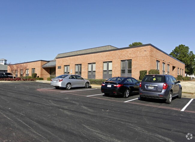
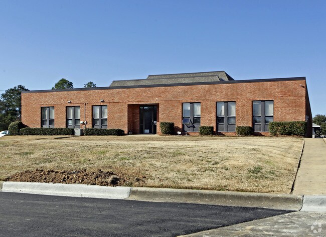
Property Record
5845 Carmichael Rd, Montgomery, AL 36117

Property Detail
5845 Carmichael Rd
10-06-13-4-003-001.001
1006134003001001
Officebuilding
Montgomery
B-3
Alabama
B and X Area of moderate flood hazard, usually the area between the limits of the 100-year and 500-year floods.
8
0
1.42 AC
2025
North Montgomery
005409
Montgomery
15,491 SF
Montgomery, AL
NEARBY LISTINGS FOR SALE OR LEASE
DEMOGRAPHICS near 5845 Carmichael Rd
1 mile
3 mile
5 mile
2025 Total Population
6,233
57,742
130,007
2030 Population
6,069
55,702
126,747
Pop Growth 2025-2030
(2.63%)
(3.53%)
(2.51%)
Average Age
36
38
38
2025 Total Households
3,032
25,671
54,879
HH Growth 2025-2030
(2.57%)
(3.60%)
(2.60%)
Median Household Inc
$63,291
$65,465
$65,817
Avg Household Size
2.00
2.20
2.30
2025 Avg HH Vehicles
2.00
2.00
2.00
Median Home Value
$190,507
$186,402
$189,447
Median Year Built
1983
1985
1983
Nearby Places
Map Layers
Map Styles
 Street
 Aerial
Layers
 Traffic
 Biking
Places
Listings with unknown addresses are not visible on the map
- Restaurants
- Banks
- Shops
- Fitness
- Groceries
PUBLIC TRANSPORTATION
AIRPORT
Montgomery Regional (Dannelly Field)
Drive
Walk
Distance
Montgomery Regional (Dannelly Field)
31 min
16.6 mi
Nearby Properties
Address
Land Use
TOTAL SIZE
Lot Size
Zoning
Address
Land Use
TOTAL SIZE
Lot Size
Zoning
117,161 SF
12.07 AC
INST
Address
Land Use
TOTAL SIZE
Lot Size
Zoning
4,998 SF
27.50 AC
R-65-M
Address
Land Use
TOTAL SIZE
Lot Size
Zoning
16,400 SF
28.35 AC
R-65-M
Address
Land Use
TOTAL SIZE
Lot Size
Zoning
1,343 SF
31.75 AC
R-65-M
Address
Land Use
TOTAL SIZE
Lot Size
Zoning
4,597 SF
12.36 AC
PUD
Address
Land Use
TOTAL SIZE
Lot Size
Zoning
4,836 SF
16.25 AC
R-75-M
Address
Land Use
TOTAL SIZE
Lot Size
Zoning
129,776 SF
6.13 AC
PUD
Address
Land Use
TOTAL SIZE
Lot Size
Zoning
15,932 SF
25.50 AC
R-60-M
Address
Land Use
TOTAL SIZE
Lot Size
Zoning
76,996 SF
15.51 AC
B-3
Address
Land Use
TOTAL SIZE
Lot Size
Zoning
38,646 SF
12.26 AC
PUD
Address
Land Use
TOTAL SIZE
Lot Size
Zoning
385,644 SF
26.60 AC
B-2
Address
Land Use
TOTAL SIZE
Lot Size
Zoning
1,554 SF
18.26 AC
R-75-M
Address
Land Use
TOTAL SIZE
Lot Size
Zoning
31,205 SF
59 AC
INST
Address
Land Use
TOTAL SIZE
Lot Size
Zoning
10,317 SF
16.70 AC
AGR-1
Address
Land Use
TOTAL SIZE
Lot Size
Zoning
127,082 SF
7.81 AC
PUD
Address
Land Use
TOTAL SIZE
Lot Size
Zoning
2,885 SF
14 AC
R-75-M
Address
Land Use
TOTAL SIZE
Lot Size
Zoning
92,200 SF
9.74 AC
O-1
Address
Land Use
TOTAL SIZE
Lot Size
Zoning
7,040 SF
11.70 AC
R-65-M
Address
Land Use
TOTAL SIZE
Lot Size
Zoning
201,515 SF
4.46 AC
Address
Land Use
TOTAL SIZE
Lot Size
Zoning
24,360 SF
26.59 AC
R-65-M
Address
Land Use
TOTAL SIZE
Lot Size
Zoning
224,132 SF
26.57 AC
AGR-2
Address
Land Use
TOTAL SIZE
Lot Size
Zoning
30.36 AC
PUD
Address
Land Use
TOTAL SIZE
Lot Size
Zoning
223,000 SF
26 AC
O-1
Address
Land Use
TOTAL SIZE
Lot Size
Zoning
30,536 SF
18.06 AC
AGR-1
Address
Land Use
TOTAL SIZE
Lot Size
Zoning
1,964 SF
13.40 AC
R-75-M
Address
Land Use
TOTAL SIZE
Lot Size
Zoning
56,446 SF
18.67 AC
PUD
Address
Land Use
TOTAL SIZE
Lot Size
Zoning
5,606 SF
21 AC
R-75-M
Address
Land Use
TOTAL SIZE
Lot Size
Zoning
108,176 SF
4.27 AC
B-1-B
Address
Land Use
TOTAL SIZE
Lot Size
Zoning
154,375 SF
21.19 AC
B-3
Address
Land Use
TOTAL SIZE
Lot Size
Zoning
75,510 SF
10.97 AC
B-2
The World's #1 Commercial Real Estate Marketplace
Connect with us
© 2026 CoStar Group
The information above has been obtained from sources believed reliable. While we do not doubt its accuracy we have not verified it and make no guarantee, warranty or representation about it. It is your responsibility to independently confirm its accuracy and completeness. Any projections, opinions, assumptions, or estimates used are for example only and do not represent the current or future performance of the property. The value of this transaction to you depends on tax and other factors which should be evaluated by your tax, financial, and legal advisors. You and your advisors should conduct a careful, independent investigation of the property to determine to your satisfaction the suitability of the property for your needs.