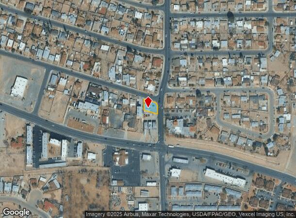
Property Record
585 Giles Rd, El Paso, TX 79915
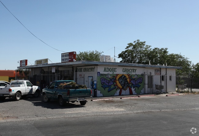
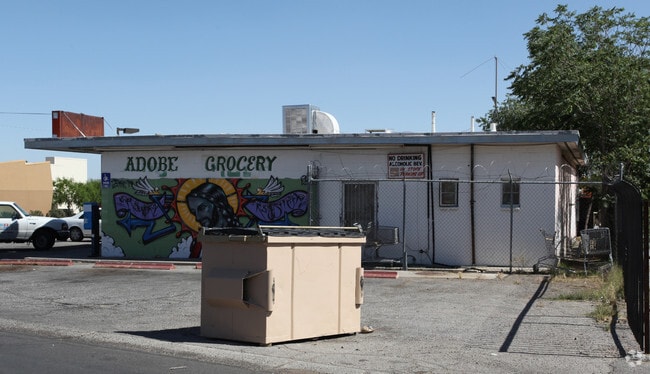
This Property Is For Sale
Current Lease Availabilities
NEARBY LISTINGS FOR SALE OR LEASE
Property Detail
585 Giles Rd
A765-999-005E-0127
Ascarate
Commercialnec
5 ASCARATE TR 1-F-1-E-1 (0.1538 AC)
X
El Paso
4802140044C
Texas
2024
0.15 AC
2025
East
004201
El Paso
2,400 SF
El Paso, TX
DEMOGRAPHICS near 585 Giles Rd
1 Mile
3 Mile
5 Mile
2024 Total Population
15,336
97,333
234,196
2029 Population
15,434
98,140
235,901
Pop Growth 2024-2029
+ 0.64%
+ 0.83%
+ 0.73%
Average Age
40
40
39
2024 Total Households
5,582
36,866
85,765
HH Growth 2024-2029
+ 0.61%
+ 0.82%
+ 0.74%
Median Household Inc
$32,821
$41,346
$46,538
Avg Household Size
2.70
2.60
2.70
2024 Avg HH Vehicles
2.00
2.00
2.00
Median Home Value
$105,612
$139,390
$143,620
Median Year Built
1961
1972
1977
Nearby Places
Map Layers
Map Styles
 Street
 Aerial
- Restaurants
- Banks
- Shops
- Fitness
- Groceries
PUBLIC TRANSPORTATION
AIRPORT
El Paso International
DRIVE
WALK
Distance
El Paso International
19 min
8.5 mi
Freight Ports
Port of Corpus Christi
DRIVE
WALK
Distance
Port of Corpus Christi
672 min
686.8 mi
Nearby Properties
Address
Land Use
TOTAL SIZE
Lot Size
Zoning
Address
Land Use
TOTAL SIZE
Lot Size
Zoning
600,211 SF
114.73 AC
RF
Address
Land Use
TOTAL SIZE
Lot Size
Zoning
753,996 SF
23.50 AC
C4
Address
Land Use
TOTAL SIZE
Lot Size
Zoning
1,122,782 SF
55.24 AC
C4
Address
Land Use
TOTAL SIZE
Lot Size
Zoning
1 SF
M1
Address
Land Use
TOTAL SIZE
Lot Size
Zoning
1 SF
214 AC
M3
Address
Land Use
TOTAL SIZE
Lot Size
Zoning
380,811 SF
22.75 AC
M1
Address
Land Use
TOTAL SIZE
Lot Size
Zoning
343,190 SF
31.84 AC
C4
Address
Land Use
TOTAL SIZE
Lot Size
Zoning
1 SF
Address
Land Use
TOTAL SIZE
Lot Size
Zoning
289.07 AC
Address
Land Use
TOTAL SIZE
Lot Size
Zoning
377,168 SF
8.40 AC
C1
Address
Land Use
TOTAL SIZE
Lot Size
Zoning
166,671 SF
24.61 AC
C4S
Address
Land Use
TOTAL SIZE
Lot Size
Zoning
125,896 SF
8.67 AC
R3
Address
Land Use
TOTAL SIZE
Lot Size
Zoning
192,261 SF
8.07 AC
A3C
Address
Land Use
TOTAL SIZE
Lot Size
Zoning
206,726 SF
24.42 AC
M1S
Address
Land Use
TOTAL SIZE
Lot Size
Zoning
111,558 SF
16.25 AC
C4
Address
Land Use
TOTAL SIZE
Lot Size
Zoning
196,860 SF
10.15 AC
C4
Address
Land Use
TOTAL SIZE
Lot Size
Zoning
272,601 SF
14.97 AC
AO
Address
Land Use
TOTAL SIZE
Lot Size
Zoning
259,968 SF
10.54 AC
AO
Address
Land Use
TOTAL SIZE
Lot Size
Zoning
184,016 SF
14.17 AC
C4
Address
Land Use
TOTAL SIZE
Lot Size
Zoning
269,974 SF
15.87 AC
A2S
Address
Land Use
TOTAL SIZE
Lot Size
Zoning
235,213 SF
11.98 AC
A3O
Address
Land Use
TOTAL SIZE
Lot Size
Zoning
333,673 SF
15 AC
AO
Address
Land Use
TOTAL SIZE
Lot Size
Zoning
109,578 SF
17.84 AC
RF
Address
Land Use
TOTAL SIZE
Lot Size
Zoning
186,950 SF
14.30 AC
C1
Address
Land Use
TOTAL SIZE
Lot Size
Zoning
144,211 SF
17.20 AC
C4
Address
Land Use
TOTAL SIZE
Lot Size
Zoning
189,234 SF
10.01 AC
AO
Address
Land Use
TOTAL SIZE
Lot Size
Zoning
341,541 SF
22.51 AC
A2
Address
Land Use
TOTAL SIZE
Lot Size
Zoning
54,062 SF
4.92 AC
R4
Address
Land Use
TOTAL SIZE
Lot Size
Zoning
163,540 SF
18.75 AC
C3
Address
Land Use
TOTAL SIZE
Lot Size
Zoning
226,736 SF
12 AC
A2
The World's #1 Commercial Real Estate Marketplace
Connect with us
© 2025 CoStar Group
The information above has been obtained from sources believed reliable. While we do not doubt its accuracy we have not verified it and make no guarantee, warranty or representation about it. It is your responsibility to independently confirm its accuracy and completeness. Any projections, opinions, assumptions, or estimates used are for example only and do not represent the current or future performance of the property. The value of this transaction to you depends on tax and other factors which should be evaluated by your tax, financial, and legal advisors. You and your advisors should conduct a careful, independent investigation of the property to determine to your satisfaction the suitability of the property for your needs.