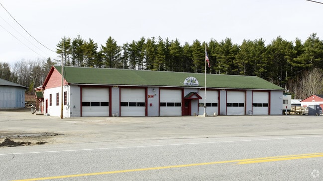
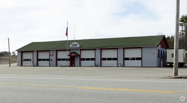
Property Record
585 N Berwick Rd, Wells, ME 04090

Property Detail
585 N Berwick Rd
WLLS-000040-000009-000000-EX000000E
YORK
Governmentalpublicusegeneral
Maine
EX
9-exe
A Areas with a 1% annual chance of flooding and a 26% chance of flooding over the life of a 30-year mortgage.
68 AC
0
York County
2025
Portland/South Portland
034002
Portland-South Portland, ME
9,600 SF
NEARBY LISTINGS FOR SALE OR LEASE
-
-
View all Wells listings for sale on LoopNet.com
DEMOGRAPHICS near 585 N Berwick Rd
1 mile
3 mile
5 mile
2025 Total Population
301
5,665
17,472
2030 Population
324
5,955
18,339
Pop Growth 2025-2030
+ 7.64%
+ 5.12%
+ 4.96%
Average Age
45
46
49
2025 Total Households
123
2,370
7,711
HH Growth 2025-2030
+ 7.32%
+ 5.15%
+ 5.16%
Median Household Inc
$120,833
$108,007
$94,874
Avg Household Size
2.30
2.30
2.20
2025 Avg HH Vehicles
2.00
2.00
2.00
Median Home Value
$564,655
$530,915
$518,101
Median Year Built
2000
1998
1990
Nearby Places
Map Layers
Map Styles
 Street
 Aerial
Layers
 Traffic
 Biking
Places
Listings with unknown addresses are not visible on the map
- Restaurants
- Banks
- Shops
- Fitness
- Groceries
PUBLIC TRANSPORTATION
COMMUTER RAIL
Wells (Downeaster - Amtrak)
Drive
Walk
Distance
Wells (Downeaster - Amtrak)
4 min
2.1 mi
AIRPORT
Portsmouth International at Pease
Drive
Walk
Distance
Portsmouth International at Pease
34 min
24.8 mi
Portland International Jetport
Drive
Walk
Distance
Portland International Jetport
38 min
30.4 mi
Freight Ports
Portland, ME
Drive
Walk
Distance
Portland, ME
39 min
33.0 mi
Nearby Properties
Address
Land Use
TOTAL SIZE
Lot Size
Zoning
Address
Land Use
TOTAL SIZE
Lot Size
Zoning
Address
Land Use
TOTAL SIZE
Lot Size
Zoning
381,495 SF
44.05 AC
LI
Address
Land Use
TOTAL SIZE
Lot Size
Zoning
76,411 SF
84.80 AC
RA
Address
Land Use
TOTAL SIZE
Lot Size
Zoning
71,230 SF
11.81 AC
RC
Address
Land Use
TOTAL SIZE
Lot Size
Zoning
145,412 SF
39.02 AC
LI
Address
Land Use
TOTAL SIZE
Lot Size
Zoning
2,730 SF
51 AC
R
Address
Land Use
TOTAL SIZE
Lot Size
Zoning
2,415 SF
44.88 AC
R
Address
Land Use
TOTAL SIZE
Lot Size
Zoning
0.78 AC
R
Address
Land Use
TOTAL SIZE
Lot Size
Zoning
8,504 SF
3.30 AC
RA
Address
Land Use
TOTAL SIZE
Lot Size
Zoning
2,400 SF
7.26 AC
LI
Address
Land Use
TOTAL SIZE
Lot Size
Zoning
48.78 AC
RC
Address
Land Use
TOTAL SIZE
Lot Size
Zoning
56.02 AC
LI
Address
Land Use
TOTAL SIZE
Lot Size
Zoning
9.65 AC
Address
Land Use
TOTAL SIZE
Lot Size
Zoning
1,792 SF
29 AC
LI
Address
Land Use
TOTAL SIZE
Lot Size
Zoning
23,447 SF
8.50 AC
LI
Address
Land Use
TOTAL SIZE
Lot Size
Zoning
7,727 SF
128 AC
EX
Address
Land Use
TOTAL SIZE
Lot Size
Zoning
281.89 AC
R
Address
Land Use
TOTAL SIZE
Lot Size
Zoning
4.14 AC
R
Address
Land Use
TOTAL SIZE
Lot Size
Zoning
948 SF
15 AC
R
Address
Land Use
TOTAL SIZE
Lot Size
Zoning
300.28 AC
R
Address
Land Use
TOTAL SIZE
Lot Size
Zoning
8.76 AC
RC
Address
Land Use
TOTAL SIZE
Lot Size
Zoning
7,260 SF
5.66 AC
LI
Address
Land Use
TOTAL SIZE
Lot Size
Zoning
458 AC
Address
Land Use
TOTAL SIZE
Lot Size
Zoning
7.50 AC
RC
Address
Land Use
TOTAL SIZE
Lot Size
Zoning
9,087 SF
4.12 AC
EX
Address
Land Use
TOTAL SIZE
Lot Size
Zoning
12,240 SF
16 AC
Address
Land Use
TOTAL SIZE
Lot Size
Zoning
30.90 AC
EX
Address
Land Use
TOTAL SIZE
Lot Size
Zoning
3,062 SF
39.32 AC
R
Address
Land Use
TOTAL SIZE
Lot Size
Zoning
1,404 SF
8.59 AC
R
The World's #1 Commercial Real Estate Marketplace
Connect with us
© 2026 CoStar Group
The information above has been obtained from sources believed reliable. While we do not doubt its accuracy we have not verified it and make no guarantee, warranty or representation about it. It is your responsibility to independently confirm its accuracy and completeness. Any projections, opinions, assumptions, or estimates used are for example only and do not represent the current or future performance of the property. The value of this transaction to you depends on tax and other factors which should be evaluated by your tax, financial, and legal advisors. You and your advisors should conduct a careful, independent investigation of the property to determine to your satisfaction the suitability of the property for your needs.