Property Record
5850 Sashabaw Rd, Clarkston, MI 48346


NEARBY LISTINGS FOR SALE OR LEASE
Property Detail
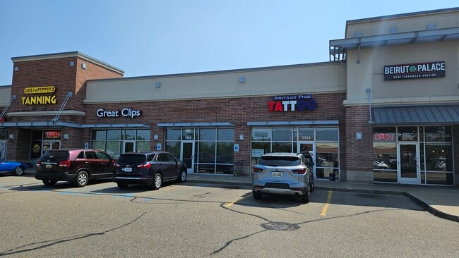
5850 Sashabaw Rd
08-27-400-033
Oakland County Condominium
Stripcommercialcenter
T4N, R9E, SEC 27 OAKLAND COUNTY CONDOMINIUM PLAN NO 1612 REGENCY INDEPENDENCE CENTER CONDOMINIUM UNIT 2 L 32487 P 640 3-17-04
X
Oakland
26125C0332F
Michigan
2024
3.98 AC
2025
St Clair & Lapeer Counties
127700
Detroit
29,064 SF
Detroit-Warren-Dearborn, MI
DEMOGRAPHICS near 5850 Sashabaw Rd
1 Mile
3 Mile
5 Mile
2024 Total Population
5,855
40,770
97,104
2029 Population
5,755
40,343
96,169
Pop Growth 2024-2029
(1.71%)
(1.05%)
(0.96%)
Average Age
42
42
42
2024 Total Households
2,474
16,400
39,358
HH Growth 2024-2029
(1.90%)
(1.17%)
(1.02%)
Median Household Inc
$87,405
$90,748
$83,371
Avg Household Size
2.30
2.40
2.40
2024 Avg HH Vehicles
2.00
2.00
2.00
Median Home Value
$265,718
$286,366
$278,305
Median Year Built
1979
1977
1975
Nearby Places
Map Layers
Map Styles
 Street
 Aerial
- Restaurants
- Banks
- Shops
- Fitness
- Groceries
PUBLIC TRANSPORTATION
COMMUTER RAIL
DRIVE
WALK
Distance
18 min
8.8 mi
AIRPORT
Bishop International
DRIVE
WALK
Distance
Bishop International
46 min
30.6 mi
Nearby Properties
Address
Land Use
TOTAL SIZE
Lot Size
Zoning
Address
Land Use
TOTAL SIZE
Lot Size
Zoning
1,075,040 SF
90.26 AC
II
Address
Land Use
TOTAL SIZE
Lot Size
Zoning
388,304 SF
69.09 AC
R2
Address
Land Use
TOTAL SIZE
Lot Size
Zoning
138,009 SF
8.03 AC
PUD
Address
Land Use
TOTAL SIZE
Lot Size
Zoning
327,435 SF
39.93 AC
R2
Address
Land Use
TOTAL SIZE
Lot Size
Zoning
17.63 AC
R3
Address
Land Use
TOTAL SIZE
Lot Size
Zoning
208,006 SF
1.24 AC
R2
Address
Land Use
TOTAL SIZE
Lot Size
Zoning
64,763 SF
27.90 AC
PUD
Address
Land Use
TOTAL SIZE
Lot Size
Zoning
415,169 SF
27.93 AC
II
Address
Land Use
TOTAL SIZE
Lot Size
Zoning
68,725 SF
4.96 AC
PUD
Address
Land Use
TOTAL SIZE
Lot Size
Zoning
34,335 SF
74.71 AC
REC
Address
Land Use
TOTAL SIZE
Lot Size
Zoning
249,200 SF
48.39 AC
R2
Address
Land Use
TOTAL SIZE
Lot Size
Zoning
327,288 SF
19.85 AC
R2
Address
Land Use
TOTAL SIZE
Lot Size
Zoning
78,261 SF
7.80 AC
PUD
Address
Land Use
TOTAL SIZE
Lot Size
Zoning
1,786 SF
78 AC
PUD
Address
Land Use
TOTAL SIZE
Lot Size
Zoning
7.18 AC
PUD
Address
Land Use
TOTAL SIZE
Lot Size
Zoning
63,331 SF
10.03 AC
R2
Address
Land Use
TOTAL SIZE
Lot Size
Zoning
128,290 SF
9.26 AC
BI
Address
Land Use
TOTAL SIZE
Lot Size
Zoning
35,155 SF
87.55 AC
REC
Address
Land Use
TOTAL SIZE
Lot Size
Zoning
44.10 AC
PUD
Address
Land Use
TOTAL SIZE
Lot Size
Zoning
36.32 AC
R1A
Address
Land Use
TOTAL SIZE
Lot Size
Zoning
120,673 SF
9.40 AC
IOP
Address
Land Use
TOTAL SIZE
Lot Size
Zoning
87,130 SF
9.01 AC
C-3
Address
Land Use
TOTAL SIZE
Lot Size
Zoning
107,005 SF
8.12 AC
BI
Address
Land Use
TOTAL SIZE
Lot Size
Zoning
9,768 SF
25.89 AC
PUD
Address
Land Use
TOTAL SIZE
Lot Size
Zoning
327,288 SF
29.09 AC
REC
Address
Land Use
TOTAL SIZE
Lot Size
Zoning
33,365 SF
320.73 AC
PRD
Address
Land Use
TOTAL SIZE
Lot Size
Zoning
Address
Land Use
TOTAL SIZE
Lot Size
Zoning
151,736 SF
26.03 AC
C-2
Address
Land Use
TOTAL SIZE
Lot Size
Zoning
111,760 SF
29.33 AC
R2
Address
Land Use
TOTAL SIZE
Lot Size
Zoning
48,645 SF
6.68 AC
PUD
The World's #1 Commercial Real Estate Marketplace
Connect with us
© 2026 CoStar Group
The information above has been obtained from sources believed reliable. While we do not doubt its accuracy we have not verified it and make no guarantee, warranty or representation about it. It is your responsibility to independently confirm its accuracy and completeness. Any projections, opinions, assumptions, or estimates used are for example only and do not represent the current or future performance of the property. The value of this transaction to you depends on tax and other factors which should be evaluated by your tax, financial, and legal advisors. You and your advisors should conduct a careful, independent investigation of the property to determine to your satisfaction the suitability of the property for your needs.