Property Record
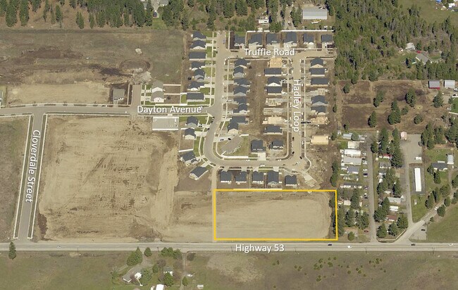
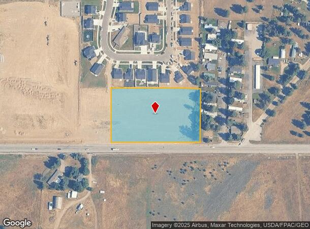
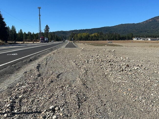
5851 W Highway 53, Rathdrum, ID 83858
NEARBY LISTINGS FOR SALE OR LEASE
Property Detail
5851 W Highway 53
Coeur D'Alene
Hadley Meadows 2Nd Add
Coeur d'Alene, ID
HADLEY MEADOWS 2ND ADD, LT 2 BLOCK 8 2952N04W
RL8560080020
Kootenai
Commercialacreage
Idaho
2025
2
2025
2.95 AC
000304
Hayden/Dalton Gardens
DEMOGRAPHICS near 5851 W Highway 53
1 Mile
3 Mile
5 Mile
2024 Total Population
2,568
15,083
26,902
2029 Population
3,032
18,012
31,918
Pop Growth 2024-2029
+ 18.07%
+ 19.42%
+ 18.65%
Average Age
39
39
41
2024 Total Households
897
5,424
9,832
HH Growth 2024-2029
+ 17.73%
+ 19.04%
+ 18.29%
Median Household Inc
$80,161
$75,282
$76,092
Avg Household Size
2.80
2.80
2.70
2024 Avg HH Vehicles
3.00
3.00
3.00
Median Home Value
$499,999
$456,491
$460,829
Median Year Built
1995
2004
1999
Nearby Places
Map Layers
Map Styles
 Street
 Aerial
- Restaurants
- Banks
- Shops
- Fitness
- Groceries
PUBLIC TRANSPORTATION
AIRPORT
Spokane International
DRIVE
WALK
Distance
Spokane International
53 min
38.3 mi
SALE & LEASE HISTORY
LISTING DATE
SALE/LEASE

Oct 23, 2024
For Sale
Nearby Properties
Address
Land Use
TOTAL SIZE
Lot Size
Zoning
Address
Land Use
TOTAL SIZE
Lot Size
Zoning
20,822 SF
10.32 AC
AG
Address
Land Use
TOTAL SIZE
Lot Size
Zoning
125,872 SF
37.45 AC
Address
Land Use
TOTAL SIZE
Lot Size
Zoning
14,159 SF
17.50 AC
Address
Land Use
TOTAL SIZE
Lot Size
Zoning
54,488 SF
19.50 AC
Address
Land Use
TOTAL SIZE
Lot Size
Zoning
124,611 SF
30.51 AC
AGSUB
Address
Land Use
TOTAL SIZE
Lot Size
Zoning
23,784 SF
7 AC
Address
Land Use
TOTAL SIZE
Lot Size
Zoning
42,365 SF
17.76 AC
RUR
Address
Land Use
TOTAL SIZE
Lot Size
Zoning
48,264 SF
10.87 AC
Address
Land Use
TOTAL SIZE
Lot Size
Zoning
47,716 SF
17.22 AC
Address
Land Use
TOTAL SIZE
Lot Size
Zoning
88,688 SF
20.51 AC
Address
Land Use
TOTAL SIZE
Lot Size
Zoning
49,446 SF
5.25 AC
Address
Land Use
TOTAL SIZE
Lot Size
Zoning
50,532 SF
4.70 AC
AGSUB
Address
Land Use
TOTAL SIZE
Lot Size
Zoning
720 SF
291.71 AC
AG
Address
Land Use
TOTAL SIZE
Lot Size
Zoning
52,690 SF
7.13 AC
Address
Land Use
TOTAL SIZE
Lot Size
Zoning
24,698 SF
5.02 AC
AGSUB
Address
Land Use
TOTAL SIZE
Lot Size
Zoning
42,000 SF
2.54 AC
Address
Land Use
TOTAL SIZE
Lot Size
Zoning
68,580 SF
4.36 AC
Address
Land Use
TOTAL SIZE
Lot Size
Zoning
60,220 SF
2.70 AC
Address
Land Use
TOTAL SIZE
Lot Size
Zoning
10,892 SF
38.79 AC
Address
Land Use
TOTAL SIZE
Lot Size
Zoning
15.19 AC
Address
Land Use
TOTAL SIZE
Lot Size
Zoning
10.56 AC
Address
Land Use
TOTAL SIZE
Lot Size
Zoning
31,880 SF
3.18 AC
Address
Land Use
TOTAL SIZE
Lot Size
Zoning
Address
Land Use
TOTAL SIZE
Lot Size
Zoning
34,635 SF
4.99 AC
Address
Land Use
TOTAL SIZE
Lot Size
Zoning
37,756 SF
2.89 AC
Address
Land Use
TOTAL SIZE
Lot Size
Zoning
808 SF
163.70 AC
AG
Address
Land Use
TOTAL SIZE
Lot Size
Zoning
29,190 SF
10.38 AC
Address
Land Use
TOTAL SIZE
Lot Size
Zoning
11,003 SF
2.07 AC
Address
Land Use
TOTAL SIZE
Lot Size
Zoning
25,785 SF
1.83 AC
The World's #1 Commercial Real Estate Marketplace
Connect with us
© 2026 CoStar Group
The information above has been obtained from sources believed reliable. While we do not doubt its accuracy we have not verified it and make no guarantee, warranty or representation about it. It is your responsibility to independently confirm its accuracy and completeness. Any projections, opinions, assumptions, or estimates used are for example only and do not represent the current or future performance of the property. The value of this transaction to you depends on tax and other factors which should be evaluated by your tax, financial, and legal advisors. You and your advisors should conduct a careful, independent investigation of the property to determine to your satisfaction the suitability of the property for your needs.