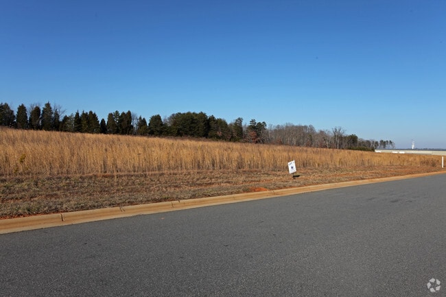
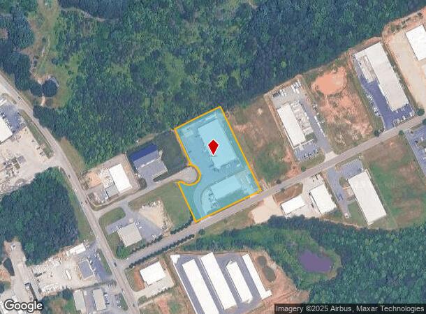
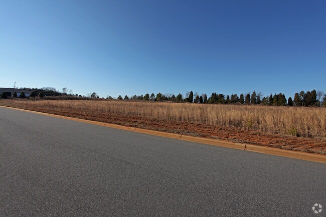
Property Record
5851 Balsom Ridge Rd, Denver, NC 28037

NEARBY LISTINGS FOR SALE OR LEASE
Property Detail
5851 Balsom Ridge Rd
Charlotte
Balsom Ridge Business Park
Charlotte-Concord-Gastonia, NC-SC
#1 LT BALSOM RIDGE BUS PK
86900
Lincoln
Multipleuses
North Carolina
2025
1
2025
2.60 AC
071101
Lincoln County
20,000 SF
DEMOGRAPHICS near 5851 Balsom Ridge Rd
1 Mile
3 Mile
5 Mile
2024 Total Population
1,867
10,745
34,227
2029 Population
2,129
12,201
39,299
Pop Growth 2024-2029
+ 14.03%
+ 13.55%
+ 14.82%
Average Age
41
42
43
2024 Total Households
736
4,246
13,406
HH Growth 2024-2029
+ 14.40%
+ 13.66%
+ 14.80%
Median Household Inc
$60,763
$73,133
$91,942
Avg Household Size
2.50
2.50
2.50
2024 Avg HH Vehicles
2.00
2.00
2.00
Median Home Value
$259,121
$307,310
$388,060
Median Year Built
1995
1996
2000
Nearby Places
Map Layers
Map Styles
 Street
 Aerial
- Restaurants
- Banks
- Shops
- Fitness
- Groceries
PUBLIC TRANSPORTATION
AIRPORT
Charlotte/Douglas International
DRIVE
WALK
Distance
Charlotte/Douglas International
46 min
27.9 mi
Concord-Padgett Regional
DRIVE
WALK
Distance
Concord-Padgett Regional
46 min
33.3 mi
Nearby Properties
Address
Land Use
TOTAL SIZE
Lot Size
Zoning
Address
Land Use
TOTAL SIZE
Lot Size
Zoning
6,264 SF
24.64 AC
ELDD B-G
Address
Land Use
TOTAL SIZE
Lot Size
Zoning
66,136 SF
18.10 AC
ELDD B-N &
Address
Land Use
TOTAL SIZE
Lot Size
Zoning
251,009 SF
20.46 AC
ELDD I-G
Address
Land Use
TOTAL SIZE
Lot Size
Zoning
32,163 SF
48.72 AC
ELDD R-T
Address
Land Use
TOTAL SIZE
Lot Size
Zoning
71,150 SF
4.70 AC
PD-CD
Address
Land Use
TOTAL SIZE
Lot Size
Zoning
1,912 SF
31.99 AC
HC
Address
Land Use
TOTAL SIZE
Lot Size
Zoning
81,228 SF
26.89 AC
ELDD B-N C
Address
Land Use
TOTAL SIZE
Lot Size
Zoning
33,342 SF
9.79 AC
RC
Address
Land Use
TOTAL SIZE
Lot Size
Zoning
1,500 SF
11.02 AC
PD
Address
Land Use
TOTAL SIZE
Lot Size
Zoning
20,923 SF
2.83 AC
R-S CU
Address
Land Use
TOTAL SIZE
Lot Size
Zoning
2,000 SF
33.70 AC
R-30
Address
Land Use
TOTAL SIZE
Lot Size
Zoning
12,000 SF
7.87 AC
ELDD B-G C
Address
Land Use
TOTAL SIZE
Lot Size
Zoning
14,736 SF
1.44 AC
HC
Address
Land Use
TOTAL SIZE
Lot Size
Zoning
12,500 SF
2.53 AC
ELDD B-G
Address
Land Use
TOTAL SIZE
Lot Size
Zoning
9,657 SF
6.29 AC
R-T
Address
Land Use
TOTAL SIZE
Lot Size
Zoning
18,266 SF
9.73 AC
PD-CD
Address
Land Use
TOTAL SIZE
Lot Size
Zoning
10,768 SF
2.20 AC
HC
Address
Land Use
TOTAL SIZE
Lot Size
Zoning
24,548 SF
11.40 AC
ELDD B-G
Address
Land Use
TOTAL SIZE
Lot Size
Zoning
60,000 SF
28.03 AC
ELDD I-G
Address
Land Use
TOTAL SIZE
Lot Size
Zoning
16,000 SF
3.12 AC
ELDD B-G
Address
Land Use
TOTAL SIZE
Lot Size
Zoning
23,940 SF
3.63 AC
I-G
Address
Land Use
TOTAL SIZE
Lot Size
Zoning
13,512 SF
2.23 AC
ELDD B-G C
Address
Land Use
TOTAL SIZE
Lot Size
Zoning
30,048 SF
2 AC
I-G
Address
Land Use
TOTAL SIZE
Lot Size
Zoning
41,606 SF
4.69 AC
PD
Address
Land Use
TOTAL SIZE
Lot Size
Zoning
8,600 SF
28.44 AC
R-T
Address
Land Use
TOTAL SIZE
Lot Size
Zoning
25,224 SF
10.99 AC
ELDD I-L
Address
Land Use
TOTAL SIZE
Lot Size
Zoning
33,442 SF
4.59 AC
HC
Address
Land Use
TOTAL SIZE
Lot Size
Zoning
32.46 AC
PD-CD
Address
Land Use
TOTAL SIZE
Lot Size
Zoning
4,060 SF
13.05 AC
R-40
The World's #1 Commercial Real Estate Marketplace
Connect with us
© 2026 CoStar Group
The information above has been obtained from sources believed reliable. While we do not doubt its accuracy we have not verified it and make no guarantee, warranty or representation about it. It is your responsibility to independently confirm its accuracy and completeness. Any projections, opinions, assumptions, or estimates used are for example only and do not represent the current or future performance of the property. The value of this transaction to you depends on tax and other factors which should be evaluated by your tax, financial, and legal advisors. You and your advisors should conduct a careful, independent investigation of the property to determine to your satisfaction the suitability of the property for your needs.