Property Record
5851 Route 42, Paramus, NJ 07652
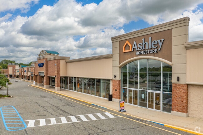

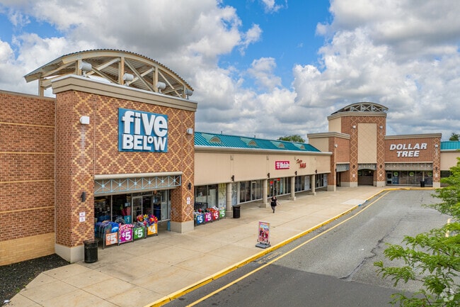
Property Detail
5851 Route 42
Philadelphia-Camden-Wilmington, PA-NJ-DE-MD
OLD #785 BHP
18-00195-0000-00019
GLOUCESTER
Regionalshoppingcenterormallwithanchorstore
New Jersey
SC
19
B and X Area of moderate flood hazard, usually the area between the limits of the 100-year and 500-year floods.
23.61 AC
2024
Gloucester County
2025
Philadelphia
042400
NEARBY LISTINGS FOR SALE OR LEASE
DEMOGRAPHICS near 5851 Route 42
1 mile
3 mile
5 mile
2025 Total Population
7,559
73,504
185,315
2030 Population
7,710
75,115
189,540
Pop Growth 2025-2030
+ 2.00%
+ 2.19%
+ 2.28%
Average Age
41
41
41
2025 Total Households
2,676
26,729
70,385
HH Growth 2025-2030
+ 2.09%
+ 2.23%
+ 2.34%
Median Household Inc
$116,196
$103,030
$93,837
Avg Household Size
2.80
2.70
2.60
2025 Avg HH Vehicles
2.00
2.00
2.00
Median Home Value
$313,492
$319,869
$302,265
Median Year Built
1973
1980
1979
Nearby Places
Map Layers
Map Styles
 Street
 Aerial
Layers
 Traffic
 Biking
Places
Listings with unknown addresses are not visible on the map
- Restaurants
- Banks
- Shops
- Fitness
- Groceries
PUBLIC TRANSPORTATION
COMMUTER RAIL
Lindenwold (NJT) (Atlantic City Line - NJ Transit Commuter Rail (NJ Transit))
Drive
Walk
Distance
Lindenwold (NJT) (Atlantic City Line - NJ Transit Commuter Rail (NJ Transit))
15 min
7.2 mi
AIRPORT
Philadelphia International
Drive
Walk
Distance
Philadelphia International
36 min
21.1 mi
Atlantic City International
Drive
Walk
Distance
Atlantic City International
68 min
38.9 mi
Freight Ports
Broadway Terminal - Pier 5
Drive
Walk
Distance
Broadway Terminal - Pier 5
20 min
12.6 mi
SALE & LEASE HISTORY
LISTING DATE
SALE/LEASE

Sep 25, 2016
For Lease
Nov 10, 2020
For Lease
Aug 21, 2017
For Lease
Aug 07, 2017
For Lease
Nearby Properties
Address
Land Use
TOTAL SIZE
Lot Size
Zoning
Address
Land Use
TOTAL SIZE
Lot Size
Zoning
Address
Land Use
TOTAL SIZE
Lot Size
Zoning
14.21 AC
INS
Address
Land Use
TOTAL SIZE
Lot Size
Zoning
54.91 AC
Address
Land Use
TOTAL SIZE
Lot Size
Zoning
68.30 AC
Address
Land Use
TOTAL SIZE
Lot Size
Zoning
48 AC
R-3
Address
Land Use
TOTAL SIZE
Lot Size
Zoning
64.09 AC
HC
Address
Land Use
TOTAL SIZE
Lot Size
Zoning
38.92 AC
HC
Address
Land Use
TOTAL SIZE
Lot Size
Zoning
49.56 AC
H
Address
Land Use
TOTAL SIZE
Lot Size
Zoning
33.50 AC
INS
Address
Land Use
TOTAL SIZE
Lot Size
Zoning
32.49 AC
Address
Land Use
TOTAL SIZE
Lot Size
Zoning
33.24 AC
INS
Address
Land Use
TOTAL SIZE
Lot Size
Zoning
69.68 AC
INS
Address
Land Use
TOTAL SIZE
Lot Size
Zoning
38.57 AC
INS
Address
Land Use
TOTAL SIZE
Lot Size
Zoning
29.87 AC
R-3
Address
Land Use
TOTAL SIZE
Lot Size
Zoning
26.77 AC
HC
Address
Land Use
TOTAL SIZE
Lot Size
Zoning
18.02 AC
HC
Address
Land Use
TOTAL SIZE
Lot Size
Zoning
21.13 AC
H
Address
Land Use
TOTAL SIZE
Lot Size
Zoning
28.68 AC
HC
Address
Land Use
TOTAL SIZE
Lot Size
Zoning
1,872 SF
180.40 AC
Address
Land Use
TOTAL SIZE
Lot Size
Zoning
1,796 SF
13.47 AC
Address
Land Use
TOTAL SIZE
Lot Size
Zoning
Address
Land Use
TOTAL SIZE
Lot Size
Zoning
15.36 AC
Address
Land Use
TOTAL SIZE
Lot Size
Zoning
14.92 AC
HC
Address
Land Use
TOTAL SIZE
Lot Size
Zoning
8.34 AC
INS
Address
Land Use
TOTAL SIZE
Lot Size
Zoning
7.04 AC
INS
Address
Land Use
TOTAL SIZE
Lot Size
Zoning
4.76 AC
Address
Land Use
TOTAL SIZE
Lot Size
Zoning
136,951 SF
18 AC
HC
Address
Land Use
TOTAL SIZE
Lot Size
Zoning
17.53 AC
HC
Address
Land Use
TOTAL SIZE
Lot Size
Zoning
The World's #1 Commercial Real Estate Marketplace
Connect with us
© 2026 CoStar Group
The information above has been obtained from sources believed reliable. While we do not doubt its accuracy we have not verified it and make no guarantee, warranty or representation about it. It is your responsibility to independently confirm its accuracy and completeness. Any projections, opinions, assumptions, or estimates used are for example only and do not represent the current or future performance of the property. The value of this transaction to you depends on tax and other factors which should be evaluated by your tax, financial, and legal advisors. You and your advisors should conduct a careful, independent investigation of the property to determine to your satisfaction the suitability of the property for your needs.