Property Record
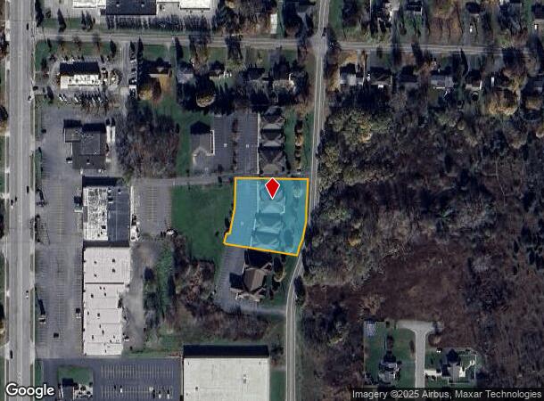
5852 Snyder Dr, Lockport, NY 14094
NEARBY LISTINGS FOR SALE OR LEASE
Property Detail
5852 Snyder Dr
292600-138-005-0002-032-001
Niagara
Officebuilding
New York
X
32.001
36063C0239E
1.23 AC
2016
Outlying Niagara County
2024
Buffalo/Niagara Falls
023401
Buffalo-Cheektowaga, NY
2,503 SF
DEMOGRAPHICS near 5852 Snyder Dr
1 Mile
3 Mile
5 Mile
2024 Total Population
5,125
32,831
45,764
2029 Population
5,130
32,375
45,145
Pop Growth 2024-2029
+ 0.10%
(1.39%)
(1.35%)
Average Age
42
41
42
2024 Total Households
2,337
14,618
19,634
HH Growth 2024-2029
+ 0.09%
(1.39%)
(1.37%)
Median Household Inc
$54,322
$59,049
$65,965
Avg Household Size
2.20
2.20
2.30
2024 Avg HH Vehicles
2.00
2.00
2.00
Median Home Value
$115,110
$137,455
$163,115
Median Year Built
1979
1965
1969
Nearby Places
Map Layers
Map Styles
 Street
 Aerial
- Restaurants
- Banks
- Shops
- Fitness
- Groceries
PUBLIC TRANSPORTATION
AIRPORT
Niagara Falls International
DRIVE
WALK
Distance
Niagara Falls International
25 min
14.7 mi
Buffalo Niagara International
DRIVE
WALK
Distance
Buffalo Niagara International
23 min
15.2 mi
SALE & LEASE HISTORY
LISTING DATE
SALE/LEASE

Jan 19, 2020
For Sale
Nearby Properties
Address
Land Use
TOTAL SIZE
Lot Size
Zoning
Address
Land Use
TOTAL SIZE
Lot Size
Zoning
198.40 AC
Address
Land Use
TOTAL SIZE
Lot Size
Zoning
78,240 SF
330.20 AC
I3
Address
Land Use
TOTAL SIZE
Lot Size
Zoning
Address
Land Use
TOTAL SIZE
Lot Size
Zoning
90,347 SF
18.67 AC
B-2
Address
Land Use
TOTAL SIZE
Lot Size
Zoning
65,184 SF
100.76 AC
B-2
Address
Land Use
TOTAL SIZE
Lot Size
Zoning
259,393 SF
33.74 AC
RA
Address
Land Use
TOTAL SIZE
Lot Size
Zoning
516 SF
53.70 AC
Address
Land Use
TOTAL SIZE
Lot Size
Zoning
90.60 AC
AR
Address
Land Use
TOTAL SIZE
Lot Size
Zoning
4,417 SF
61.30 AC
Address
Land Use
TOTAL SIZE
Lot Size
Zoning
206,149 SF
17.86 AC
B-2
Address
Land Use
TOTAL SIZE
Lot Size
Zoning
660 SF
0.99 AC
R3
Address
Land Use
TOTAL SIZE
Lot Size
Zoning
8,604 SF
15 AC
R-2
Address
Land Use
TOTAL SIZE
Lot Size
Zoning
13,828 SF
48.06 AC
I3
Address
Land Use
TOTAL SIZE
Lot Size
Zoning
119,070 SF
21.99 AC
RA
Address
Land Use
TOTAL SIZE
Lot Size
Zoning
111,617 SF
16.83 AC
RA
Address
Land Use
TOTAL SIZE
Lot Size
Zoning
130,160 SF
13 AC
B-2
Address
Land Use
TOTAL SIZE
Lot Size
Zoning
108,630 SF
0.77 AC
B2
Address
Land Use
TOTAL SIZE
Lot Size
Zoning
760 SF
7.82 AC
R1
Address
Land Use
TOTAL SIZE
Lot Size
Zoning
67,111 SF
3.22 AC
B2
Address
Land Use
TOTAL SIZE
Lot Size
Zoning
130,946 SF
11.10 AC
B-2
Address
Land Use
TOTAL SIZE
Lot Size
Zoning
115,228 SF
10.90 AC
Address
Land Use
TOTAL SIZE
Lot Size
Zoning
Address
Land Use
TOTAL SIZE
Lot Size
Zoning
16,282 SF
4.90 AC
R3
Address
Land Use
TOTAL SIZE
Lot Size
Zoning
140,048 SF
13.60 AC
B-2
Address
Land Use
TOTAL SIZE
Lot Size
Zoning
62,310 SF
6.39 AC
R3
Address
Land Use
TOTAL SIZE
Lot Size
Zoning
7,692 SF
3.82 AC
R3
Address
Land Use
TOTAL SIZE
Lot Size
Zoning
27.12 AC
Address
Land Use
TOTAL SIZE
Lot Size
Zoning
23,904 SF
2 AC
Address
Land Use
TOTAL SIZE
Lot Size
Zoning
157,785 SF
7.32 AC
I3
Address
Land Use
TOTAL SIZE
Lot Size
Zoning
172,144 SF
16.62 AC
I3
The World's #1 Commercial Real Estate Marketplace
Connect with us
© 2026 CoStar Group
The information above has been obtained from sources believed reliable. While we do not doubt its accuracy we have not verified it and make no guarantee, warranty or representation about it. It is your responsibility to independently confirm its accuracy and completeness. Any projections, opinions, assumptions, or estimates used are for example only and do not represent the current or future performance of the property. The value of this transaction to you depends on tax and other factors which should be evaluated by your tax, financial, and legal advisors. You and your advisors should conduct a careful, independent investigation of the property to determine to your satisfaction the suitability of the property for your needs.